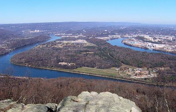
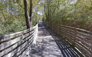
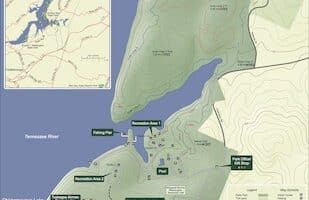
The Moccasin Bend National Archeological District is a part of the Chickamaugua and Chattanooga Military Park system. This area is located only a few miles from downtown, and is worth a ‘running visit’ for its historic trails. Moccasin Bend is one of the most unique units found in the entire National Park Service system, spanning 12,000 years of continuous human habitation.
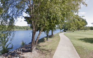
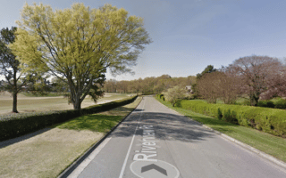
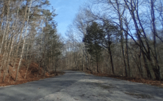
Brown’s Ferry Federal Rd. Google Street View
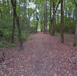
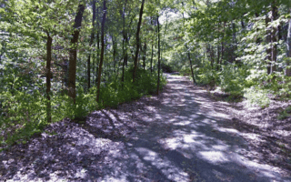
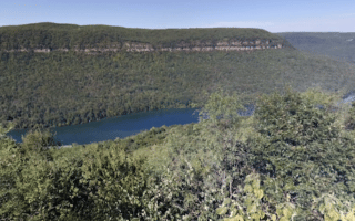
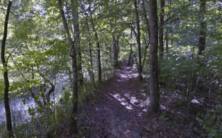
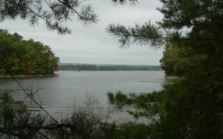
For running, there are two options: Brown’s Ferry Federal Rd. traverses a portion of the road trace emigrating groups of Cherokee walked over during the Trail of Tears in 1838 and Union army supply wagons rumbled over during the Civil War in 1863. It’s 1.2 miles out and back. The Blue Blazes Trail is a 2-mile loop trail, mainly through a quiet forest, featuring a nice overlook of the Tennessee River.
It’s possible to combine the two, using Moccasin Bend Rd. for the 1.3 miles between the two trailheads. Note: no shoulder.
Unfortunately, we can’t recommend running to Moccasion Bend from downtown — unattractive roads with no shoulder/sidewalk.
The Moccasin Bend National Archeological District is a part of the Chickamaugua and Chattanooga Military Park system. This area is located only a few miles from downtown, and is worth a ‘running visit’ for its historic trails. Moccasin Bend is one of the most unique units found in the entire National Park Service system, spanning 12,000 years of continuous human habitation.
Brown’s Ferry Federal Rd. Google Street View
For running, there are two options: Brown’s Ferry Federal Rd. traverses a portion of the road trace emigrating groups of Cherokee walked over during the Trail of Tears in 1838 and Union army supply wagons rumbled over during the Civil War in 1863. It’s 1.2 miles out and back. The Blue Blazes Trail is a 2-mile loop trail, mainly through a quiet forest, featuring a nice overlook of the Tennessee River.
It’s possible to combine the two, using Moccasin Bend Rd. for the 1.3 miles between the two trailheads. Note: no shoulder.
Unfortunately, we can’t recommend running to Moccasion Bend from downtown — unattractive roads with no shoulder/sidewalk.
Scroll Down For Route Maps
Essentials
Brown's Ferry Rd: 1.2 miles RT; Blue Blazes Trail: 2 mile loop; Combine the two for a 5.8 mile run
Fairly flat
Trailhead for Brown's Ferry Federal Road or Blue Blazes Trail
Paved multi-use path is the signature run in Chattanooga. Extends 11 miles from Richmond, through downtown, to the Chickamauga Dam. River views much of the way, numerous sites. Best sections are miles 3-6 and 9-11. Fully lit, markers every 1/2 mile.
A fun and popular run incorporating the Walnut St. pedestrian bridge, Market St. Bridge, and Veteran's bridge, with a loop around Coolidge & Renaissance parks. Add-on with Tennessee River path for a longer run.
Some hill and trail running right near downtown! Hilly trails of 92-acre Stringers Ridge range in difficulty. Enjoy a loop of the trails. To access from downtown, combine with a loop of Coolidge Park and Reservoir Park and the downtown bridges.
Another great option for a longer off-road run in Chattanooga. The multi-use trail and boardwalk runs parallel to the creek through the middle of metropolitan Chattanooga. There are two segments, separated by a 3-mile gap.
The TVA's largest hydroelectric facility is also one of Chattanooga's running gems. For road running, enjoy the scenic 4.6-mile Reservoir Loop. There are also 22 miles of trails, with varying levels of difficulty. Only 15 minutes from downtown.
A memorable running experience. At Chickamauga Battlefield, there are 50 miles of trails, most suitable for running. We've also mapped a 4-mile loop along quiet park roads featuring a bike lane. Great views, historic sites, very scenic!
This route follows the course of the poplar Chattanooga Chase 8k Course through one of Chattanooga's nicest neighborhoods. Attractive homes, great views of the city & river, a section along the Chattanooga Golf Club, and lovely oak trees.
Near downtown, enjoy the trails of Lookout Mountain, which is also the site of historic battlefield trails of Chickamauga and Chattanooga National Military Park. We've outlined some of the best trails for running. Some easier, others more rugged.
Decent spot for some trail running in this 130-acre preserve on South Chickamauga Creek. There are 5 miles of trails, mainly on a loose sandy soil surface. Some easier, flatter sections and some hillier spots.
Nice spot for some trail running located on Chickamaugua Lake and the Tennessee River, 13 miles east of downtown. About 10 miles of mainly wooded trails. Outer Loop Trail is 3.9 miles. Go for a post-run dip in the Olympic-sized pool!
A worth-it destination for trail running. 2,800-acre park is located 17 miles northeast of downtown, featuring 10 miles of wooded trails for those on foot. Trails are at moderately challenging and hilly. Some good road running options too.
One of our preferred spots for a trail run in the Chattanooga area. The 4.1 mile Bay Point Loop Trail is an easy-to-follow loop, mainly wooded with occasional water views. Generally good footing and not too hilly.
Share your feedback on this route and see that of other Great Runs users. Click on the image icon to upload a photo. And please let us know if there are notes or changes we should incorporate!
Subscribe
0 Comments
Oldest
Newest
Inline Feedbacks
View all comments
Essentials
Brown's Ferry Rd: 1.2 miles RT; Blue Blazes Trail: 2 mile loop; Combine the two for a 5.8 mile run
Fairly flat
Trailhead for Brown's Ferry Federal Road or Blue Blazes Trail


Review or Comment on This Route/Share a Photo!
Share your feedback on this route and see that of other Great Runs users. Click on the image icon to upload a photo. And please let us know if there are notes or changes we should incorporate!