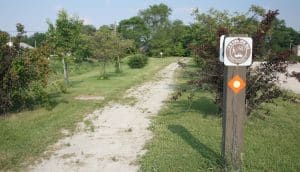
The Chicago area was once an important hub for railways. While many of those train lines are now a thing of the past, Illinois has preserved the legacy of the routes with an extensive network of multi-use paths. We’ve picked out the top paths for running — beloved by locals for their proximity to residential suburbs. Many of the paths also connect the numerous Forest Preserves, which present opportunities for loops and extensions. To see which of these trails are close to where you are, see our overview map. For a full list of Illinois Bike Paths, see this map.
NORTH
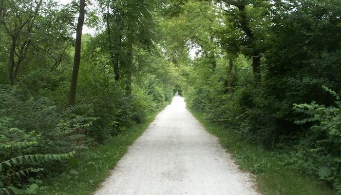
Green Bay Trail: The 9 mile (one-way) Green Bay Trail is a major running destination for those located in the North Shore suburbs. It spans from Wilmette to Highland Park parallel to the Metra North Line and the Lake Michigan Shore. Hop on anywhere near Kenilworth, Winnetka, Highland Park, or Lake Bluff. The section near Lincoln Square is particularly nice. The route is mostly asphalt and crushed limestone, though it does utilize sidewalk at a few transitional locations. MAP
WEST (working way west)
Des Plaines River Trail: This north to south multi-use path runs along its namesake river for 50+ miles, connecting several Forest Preserves in Cook and Lake Counties. Runners can create an out and back of any length along the trail, but a local favorite area to start is Schiller Woods, near Rosemont and O’Hare International Airport. Cook County Section MAPLake County Section MAP
Salt Creek Trail: At nearly 25 miles, the Salt Creek Trail in an important north to south trail which links numerous forest preserves from Busse Forest in Elk Grove to the Brookfield Zoo. The best section for running is heading north from Elmhurst, where the trail stretches along the river banks through Eldridge Park. NEW [2025]: TriTrail Connector, linking it with the Illinois Prairie Path and Great Western Trail.MAP
Great Western Trail: 12 miles of the eastern Great Western Trail fall in the Chicago suburbs of DuPage County, forming a crushed limestone corridor from Wheaton to Elmhurst. 17 more miles stretch west of that. In DuPage County, the trail connects easily with the Illinois Prairie Path and the Salt Creek Trail. All sections are great for running, but the eastern end near Elmhurst has that quintessential suburb feel of nice homes and greenery. MAP
Illinois Prairie Path: One of the first rails-to-trails paths in the U.S., the Illinois Prairie Path is a 61 mile combo of asphalt, concrete, and crushed limestone. Unlike traditional north to south or east to west trails, the IPP has three major branches (and two spurs), which meet near the center of Wheaton. Heading west, it runs to Forest Park. North, it reaches to Elgin, and south to Aurora. The latter two sections meet with the Fox River Trail. A good 3-mile section near Wheaton connects three Forest Preserves: Danada, Herrick Lake, St. James Farm, and Blackwell Forest Preserve. ROUTE MAP (Wheaton to Aurora Spur). TRAIL MAP
SOUTH/EAST
DuPage River Trail: The Y-shaped DuPage River Trail is a work in progress, planned to span 40 miles from Channahon north into DuPage County. Right now, three complete sections of the trail total about 8 miles. Hop on at Hammel Woods in Shorewood (3.8 miles one-way), Whalon Lake in Naperville (3.7 miles one- way). The Naperville River Walk (1.75 miles one-way) is another popular section. MAP
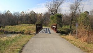
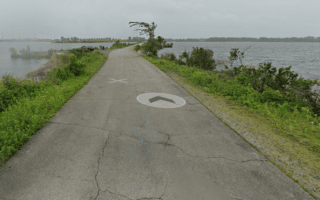
I&M Canal Trail: Part of the Grand Illinois Trail, this 70+ mile path follows the former towpath of the Illinois and Michigan Canal. Some sections are gravel, while others are crushed limestone. Runners can access the path anywhere along the canal, but the most popular point close to the suburbs is Rock Run Preserve. MAP
Palos Trails. Though technically a mountain bike link, runners also love this extensive trail system southwest of Chicago, near Palisades. Opportunities to tack on mileage on the Cal-Sag, I&M, and Centennial multi-use paths
Thorn Creek Trail: South of Chicago, the Thorn Creek Trail stretches 12 miles from Glenwood through Chicago Heights, forming a runnable corridor between Forest Preserves. This section is part of the Grand Illinois Trail, and connects to other multi use paths in the north and south. MAP
Tinley Creek Trail: The 18-mile asphalt Tinley Creek Trail, like many other Chicagoland multi-use paths, is a useful connector between several Forest Preserves. Because the trail is currently divided into two segments, most runners tend toward the northern section of the trail, with access in Oak Forest. MAP
Erie Lackawanna Trail: In Indiana, the Erie Lackawanna Trail traces the Chicago suburbs between Calumet City/Hammond and Crown Point. It’s almost 17 miles of asphalt, beginning in Crown Point near a historic site where bank robber John Dillinger escaped arrest. The north end stops just shy of the Illinois border. There are plenty of interesting trails to connect to along the way. ROUTE MAP
The Chicago area was once an important hub for railways. While many of those train lines are now a thing of the past, Illinois has preserved the legacy of the routes with an extensive network of multi-use paths. We’ve picked out the top paths for running — beloved by locals for their proximity to residential suburbs. Many of the paths also connect the numerous Forest Preserves, which present opportunities for loops and extensions. To see which of these trails are close to where you are, see our overview map. For a full list of Illinois Bike Paths, see this map.
NORTH
Green Bay Trail: The 9 mile (one-way) Green Bay Trail is a major running destination for those located in the North Shore suburbs. It spans from Wilmette to Highland Park parallel to the Metra North Line and the Lake Michigan Shore. Hop on anywhere near Kenilworth, Winnetka, Highland Park, or Lake Bluff. The section near Lincoln Square is particularly nice. The route is mostly asphalt and crushed limestone, though it does utilize sidewalk at a few transitional locations. MAP
WEST (working way west)
Des Plaines River Trail: This north to south multi-use path runs along its namesake river for 50+ miles, connecting several Forest Preserves in Cook and Lake Counties. Runners can create an out and back of any length along the trail, but a local favorite area to start is Schiller Woods, near Rosemont and O’Hare International Airport. Cook County Section MAPLake County Section MAP
Salt Creek Trail: At nearly 25 miles, the Salt Creek Trail in an important north to south trail which links numerous forest preserves from Busse Forest in Elk Grove to the Brookfield Zoo. The best section for running is heading north from Elmhurst, where the trail stretches along the river banks through Eldridge Park. NEW [2025]: TriTrail Connector, linking it with the Illinois Prairie Path and Great Western Trail.MAP
Great Western Trail: 12 miles of the eastern Great Western Trail fall in the Chicago suburbs of DuPage County, forming a crushed limestone corridor from Wheaton to Elmhurst. 17 more miles stretch west of that. In DuPage County, the trail connects easily with the Illinois Prairie Path and the Salt Creek Trail. All sections are great for running, but the eastern end near Elmhurst has that quintessential suburb feel of nice homes and greenery. MAP
Illinois Prairie Path: One of the first rails-to-trails paths in the U.S., the Illinois Prairie Path is a 61 mile combo of asphalt, concrete, and crushed limestone. Unlike traditional north to south or east to west trails, the IPP has three major branches (and two spurs), which meet near the center of Wheaton. Heading west, it runs to Forest Park. North, it reaches to Elgin, and south to Aurora. The latter two sections meet with the Fox River Trail. A good 3-mile section near Wheaton connects three Forest Preserves: Danada, Herrick Lake, St. James Farm, and Blackwell Forest Preserve. ROUTE MAP (Wheaton to Aurora Spur). TRAIL MAP
SOUTH/EAST
DuPage River Trail: The Y-shaped DuPage River Trail is a work in progress, planned to span 40 miles from Channahon north into DuPage County. Right now, three complete sections of the trail total about 8 miles. Hop on at Hammel Woods in Shorewood (3.8 miles one-way), Whalon Lake in Naperville (3.7 miles one- way). The Naperville River Walk (1.75 miles one-way) is another popular section. MAP
I&M Canal Trail: Part of the Grand Illinois Trail, this 70+ mile path follows the former towpath of the Illinois and Michigan Canal. Some sections are gravel, while others are crushed limestone. Runners can access the path anywhere along the canal, but the most popular point close to the suburbs is Rock Run Preserve. MAP
Palos Trails. Though technically a mountain bike link, runners also love this extensive trail system southwest of Chicago, near Palisades. Opportunities to tack on mileage on the Cal-Sag, I&M, and Centennial multi-use paths
Thorn Creek Trail: South of Chicago, the Thorn Creek Trail stretches 12 miles from Glenwood through Chicago Heights, forming a runnable corridor between Forest Preserves. This section is part of the Grand Illinois Trail, and connects to other multi use paths in the north and south. MAP
Tinley Creek Trail: The 18-mile asphalt Tinley Creek Trail, like many other Chicagoland multi-use paths, is a useful connector between several Forest Preserves. Because the trail is currently divided into two segments, most runners tend toward the northern section of the trail, with access in Oak Forest. MAP
Erie Lackawanna Trail: In Indiana, the Erie Lackawanna Trail traces the Chicago suburbs between Calumet City/Hammond and Crown Point. It’s almost 17 miles of asphalt, beginning in Crown Point near a historic site where bank robber John Dillinger escaped arrest. The north end stops just shy of the Illinois border. There are plenty of interesting trails to connect to along the way. ROUTE MAP
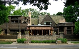
Chicagoland almost has too many neighborhoods to count, but this guide to some of the top residential and corporate areas of the suburbs can help you find a place to run near your home, office, or hotel.
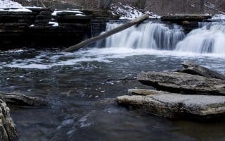
The Forest Preserves in the Chicago suburbs are a unique feature of the Chicago running scene. Here are our favorites of these beautiful green spaces, with route recommendations and trail maps.
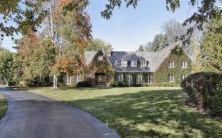
Some gorgeous residential neighborhoods for running, including Oak Park, Fort Sheridian, Clarendon Hills, Buffalo Grove, and the Olmsted-designed Riverside.
Located in Cook County, this Olmsted-designed neighborhood -- one of the first planned communities in the United States -- is a gem for running, with leafy streets and historic homes.
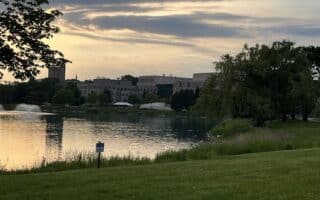
Wonderful running in this upscale suburb on Chicago's north shore. Explore the NWU Campus, including 2 miles of lakeshore path. Also beautiful residential streets, and inland the Channel Trail along the North Branch of the Chicago River.
This run features the wonderful for running streets of Chicago’s North Shore neighborhoods, including a tour of Highland Park following the North Shore Classic Half Marathon course. Glencoe and Winnetka are also great for running.
Some scenic running in Zion at the north end of Chicagoland: nature trails and multi-use trails through dunes & wetlands at Illinois Beach State Park; 2.2 mile Zion Trail; and trails in North Dunes Nature Preserve and around North Point Marina. Can be combined!
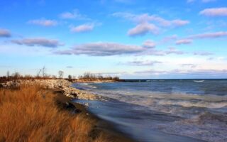
Wonderful running around Wolf Lake and along Lake Michigan in the Chicago East Side/Calumet area on the Illinois/Indiana border. Lake views, savanna, marshland, dunes. We've mapped several terrific loops, which can be combined.
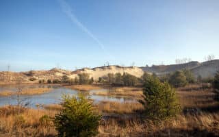
Adjacent parks feature some wonderful running options through a variety of terrain, including spectacular dunescapes, marshlands, forests, and many miles of beachfront along Lake Michigan. Only an hour from Chicago!
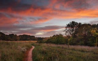
Forest Preserves aren’t the only natural spaces for running in Chicagoland. These other parks have great trail systems for escaping the city to run on dirt or sand.
Share your feedback on this route and see that of other Great Runs users. Click on the image icon to upload a photo. And please let us know if there are notes or changes we should incorporate!


Review or Comment on This Route/Share a Photo!
Share your feedback on this route and see that of other Great Runs users. Click on the image icon to upload a photo. And please let us know if there are notes or changes we should incorporate!