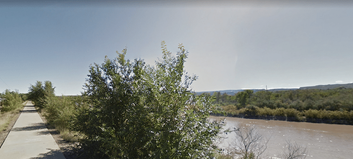
Choosing a section of the paved Riverfront Trail that runs along the Colorado River is one of the best places to run in Grand Junction. Overall, it’s 15 miles from Grand Junction to Fruita. We’ve mapped 8.4 miles from Las Colinas Park west to the Connected Lakes section of Colorado State Park (see our route there). From downtown, the best access is via S 7th St.
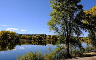
For the eastern section, we’ve included a nice ~1 mile loop around Eagle Rim Park and Las Colonias Park, including a pedestrian bridge that crosses the river. From Las Colonias Park, continue west, for as many miles as you like. There are some sections right along the river, with some water views, and other sections that are a tad inland. The path mainly parallels Riverside Parkway until the Connected Lakes section of James M. Robb Colorado River State Park. Our mapped route ends at 22 3/4 Rd. The path continues west toward Fruita.
Add-Ons. Some sections are part of trails in James M. Robb Colorado River State Park. where there are additional running options.
Choosing a section of the paved Riverfront Trail that runs along the Colorado River is one of the best places to run in Grand Junction. Overall, it’s 15 miles from Grand Junction to Fruita. We’ve mapped 8.4 miles from Las Colinas Park west to the Connected Lakes section of Colorado State Park (see our route there). From downtown, the best access is via S 7th St.
For the eastern section, we’ve included a nice ~1 mile loop around Eagle Rim Park and Las Colonias Park, including a pedestrian bridge that crosses the river. From Las Colonias Park, continue west, for as many miles as you like. There are some sections right along the river, with some water views, and other sections that are a tad inland. The path mainly parallels Riverside Parkway until the Connected Lakes section of James M. Robb Colorado River State Park. Our mapped route ends at 22 3/4 Rd. The path continues west toward Fruita.
Add-Ons. Some sections are part of trails in James M. Robb Colorado River State Park. where there are additional running options.

Review or Comment on This Route/Share a Photo!
Share your feedback on this route and see that of other Great Runs users. Click on the image icon to upload a photo. And please let us know if there are notes or changes we should incorporate!