The best options for running in Aurora, a city of nearly 400,000 east of Denver, are a series of greenways, multi-use paths, and parks.
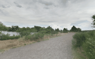
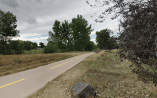
Sand Creek Regional Greenway. This 14-mile public greenway follows Sand Creek between Aurora and Commerce City, running through several parks. Mix of paved and soft surface. Connections with other trails: High Line Canal in Aurora & South Platte River Greenway in Commerce City. NEW: Expanded in 2022. Pro Tip: Sections in Denver & Commerce city are plowed after snowstorms. VIDEO HIGHLIGHTS! TRAIL MAP
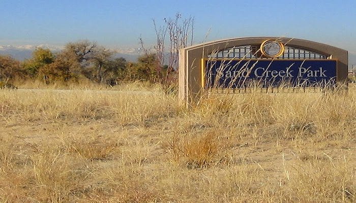
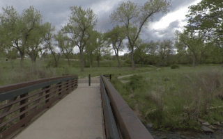
Linear Park Run: Sand Creek Park, Central Park, GreenWay Park. This is basically a series of several parks in Aurora connected by a good network of multi-use trails and paths. It’s a lovely green oasis! We’ve put together a route of up to 6.5 miles one-way, starting in Sand Creek Park, then a section along Bluff Lake, ~2 mile loop of Central Park (which has a good hill!), and then continuing into Westerly Creek Park, GreenWay Park, and Fred Thomas Park. A section of the Sand Creek Greenway/Colorado Front Range trails are part of this route, and there are other trails/multi-use paths in the parks. ROUTE MAP
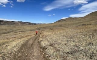
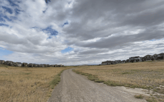
High Line Canal Trail. A section of this 71-mile multi-use trail runs through Aurora. There are nice prairie views, though not much of the way in water views along a mostly dry canal in this area. We’ve mapped 11 miles between Expo Park and a trailhead off E 14th Dr. just south of E Colfax Ave. Part of the High Line overlaps with the Colorado Front Range multi-use trail. TRAIL MAP ROUTE MAP
The best options for running in Aurora, a city of nearly 400,000 east of Denver, are a series of greenways, multi-use paths, and parks.
Sand Creek Regional Greenway. This 14-mile public greenway follows Sand Creek between Aurora and Commerce City, running through several parks. Mix of paved and soft surface. Connections with other trails: High Line Canal in Aurora & South Platte River Greenway in Commerce City. NEW: Expanded in 2022. Pro Tip: Sections in Denver & Commerce city are plowed after snowstorms. VIDEO HIGHLIGHTS! TRAIL MAP
Linear Park Run: Sand Creek Park, Central Park, GreenWay Park. This is basically a series of several parks in Aurora connected by a good network of multi-use trails and paths. It’s a lovely green oasis! We’ve put together a route of up to 6.5 miles one-way, starting in Sand Creek Park, then a section along Bluff Lake, ~2 mile loop of Central Park (which has a good hill!), and then continuing into Westerly Creek Park, GreenWay Park, and Fred Thomas Park. A section of the Sand Creek Greenway/Colorado Front Range trails are part of this route, and there are other trails/multi-use paths in the parks. ROUTE MAP
High Line Canal Trail. A section of this 71-mile multi-use trail runs through Aurora. There are nice prairie views, though not much of the way in water views along a mostly dry canal in this area. We’ve mapped 11 miles between Expo Park and a trailhead off E 14th Dr. just south of E Colfax Ave. Part of the High Line overlaps with the Colorado Front Range multi-use trail. TRAIL MAP ROUTE MAP

Review or Comment on This Route/Share a Photo!
Share your feedback on this route and see that of other Great Runs users. Click on the image icon to upload a photo. And please let us know if there are notes or changes we should incorporate!