There are some excellent trail running options in the greater Fayetteville area. Here’s a brief description of each, with links for additional information. Note these spots are also popular for mountain biking, so use caution!
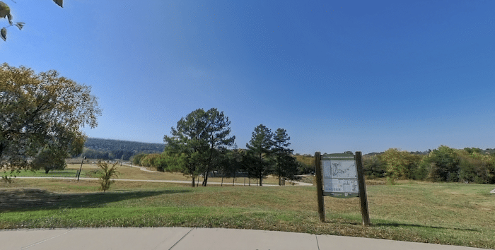
Mt. Sequoyah Woods. Google Street View.
Mt. Sequoyah Woods. 97-acre wooded park in the eastern part of Fayetteville, with 4.5 miles of multi-purpose, natural-surface trail that meanders through occasionally rugged, undisturbed forest on the east side of Mt. Sequoyah. Add-on with road section at the western end that climbs to Mt. Sequoyah Cross, which features great views. TRAIL MAP
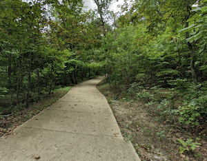
Markham Hill Park. Located between the University of Arkansas campus and Centennial Park, these are nature trails popular for trail running. You might run into the University of Arkansas cross-country team! Off Halsell. NOTE: Registration might be required, see info. TRAIL MAP
Centennial Park. This park is more of a mountain biking destination for northwest Arkansas. There are sidewalks being built and other improvements that will make it more amenable for other activities such as trail running.
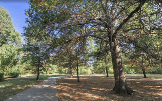
Kessler Mountain Regional Park. A 620-acre multi-purpose park on and around Kessler Mountain. There are numerous sports & recreation facilities, and 10 miles of mainly wooded trails that are popular for mountain biking and trail running. This TRAIL MAP has good information on the trails and level of difficulty. There are kiosks with maps at key areas. Also, “mile zero” of the Razorback Greenway is located at the eastern end of the park!
There are some excellent trail running options in the greater Fayetteville area. Here’s a brief description of each, with links for additional information. Note these spots are also popular for mountain biking, so use caution!
Mt. Sequoyah Woods. Google Street View.
Mt. Sequoyah Woods. 97-acre wooded park in the eastern part of Fayetteville, with 4.5 miles of multi-purpose, natural-surface trail that meanders through occasionally rugged, undisturbed forest on the east side of Mt. Sequoyah. Add-on with road section at the western end that climbs to Mt. Sequoyah Cross, which features great views. TRAIL MAP
Markham Hill Park. Located between the University of Arkansas campus and Centennial Park, these are nature trails popular for trail running. You might run into the University of Arkansas cross-country team! Off Halsell. NOTE: Registration might be required, see info. TRAIL MAP
Centennial Park. This park is more of a mountain biking destination for northwest Arkansas. There are sidewalks being built and other improvements that will make it more amenable for other activities such as trail running.
Kessler Mountain Regional Park. A 620-acre multi-purpose park on and around Kessler Mountain. There are numerous sports & recreation facilities, and 10 miles of mainly wooded trails that are popular for mountain biking and trail running. This TRAIL MAP has good information on the trails and level of difficulty. There are kiosks with maps at key areas. Also, “mile zero” of the Razorback Greenway is located at the eastern end of the park!
A 6-mile 'grand tour' of Fayetteville that includes the centrally located trails, several parks, and a part of the University of Arkansas campus. Lots of excellent add-on options on Fayetteville's extensive trail system!
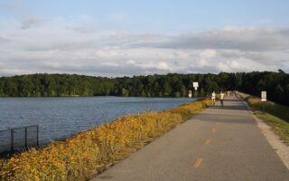
This lake and recreation area in northeast Fayetteville is a popular running spot. Loop the lake on a 5.3 mile paved multi-use trail or the pedestrian-only Nature Trail. Mainly wooded, with some open/lake views.
Share your feedback on this route and see that of other Great Runs users. Click on the image icon to upload a photo. And please let us know if there are notes or changes we should incorporate!

Review or Comment on This Route/Share a Photo!
Share your feedback on this route and see that of other Great Runs users. Click on the image icon to upload a photo. And please let us know if there are notes or changes we should incorporate!