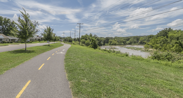
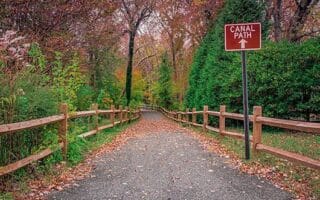
In the central part of Fredericksburg, there’s some nice running along the Rappahannock River, incorporating a few different trails with a few different options for length & loops. The heart of the route is the Rappahannock River Heritage Trail — a paved multi-use path that runs for 1.5 miles between Old Mill Park and Mary Washington Blvd. It’s not right along the river, so there aren’t really water views. For a nice 5k loop, at Mary Washington Blvd., turn LEFT onto the paved Rappahannock Canal Path, which follows the canal back to the river.
Embrey Dam Trail. Google Street View
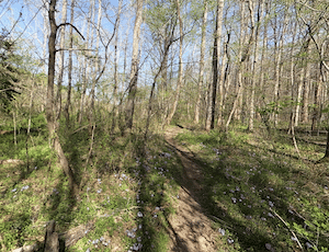
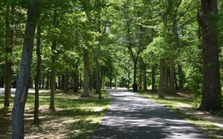
Longer Run Option: At the Mary Washington Blvd. end of the Rappahannock River Heritage Trail, the Embrey Dam Trail continues for another 3 miles west along the Rappahannock River. This is a fairly narrow dirt path — more of a trail run. Mainly wooded, with some water views. A full run incorporating the Rappahannock River Heritage Trail, Embrey Dam Trail, and canal loop is 9.4 miles.
In the central part of Fredericksburg, there’s some nice running along the Rappahannock River, incorporating a few different trails with a few different options for length & loops. The heart of the route is the Rappahannock River Heritage Trail — a paved multi-use path that runs for 1.5 miles between Old Mill Park and Mary Washington Blvd. It’s not right along the river, so there aren’t really water views. For a nice 5k loop, at Mary Washington Blvd., turn LEFT onto the paved Rappahannock Canal Path, which follows the canal back to the river.
Embrey Dam Trail. Google Street View
Longer Run Option: At the Mary Washington Blvd. end of the Rappahannock River Heritage Trail, the Embrey Dam Trail continues for another 3 miles west along the Rappahannock River. This is a fairly narrow dirt path — more of a trail run. Mainly wooded, with some water views. A full run incorporating the Rappahannock River Heritage Trail, Embrey Dam Trail, and canal loop is 9.4 miles.
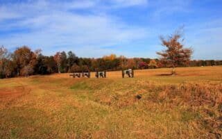
Wonderful running in this national military park commemorating one of the bloodiest battles of the Civil War. 35+ miles of interpretive trails spread out over Fredericksburg, Chancellorsville, Wilderness, and Spotsylvania. Scenic, rolling hill terrain.
A nice 5-miler combining the Rappahannock Canal Trail with a loop of the University of Mary Washington Campus. Add with the running track just south of campus, and/or combine with the the Rappahannock River Heritage Trail or Sunken Road Trail.
For an easy 4.5 mile out and back run, enjoy the Belmont Ferry Farm Trail. Located on the east bank of the Rappahannock River, the trail runs through Saint Clair Brooks Park & John Lee Pratt Park. Partially wooded and part passing by athletic fields.
A 3-mile paved multi-use path, combination of open & wooded. There are some scenic views of Hazel Run and the historic Virginia Central Railway trail bed. Part of a longer planned trail.
Share your feedback on this route and see that of other Great Runs users. Click on the image icon to upload a photo. And please let us know if there are notes or changes we should incorporate!
Subscribe
0 Comments
Oldest
Newest
Inline Feedbacks
View all comments
Essentials
Rappahannock River Heritage Trail & Canal Loop: 3.3 miles; Long Run Incorporating Embrey Dam Trail: Up to 9.4 miles (15 km)
Rolling Hills: Long run has total gain of 621 feet (189m)

Review or Comment on This Route/Share a Photo!
Share your feedback on this route and see that of other Great Runs users. Click on the image icon to upload a photo. And please let us know if there are notes or changes we should incorporate!