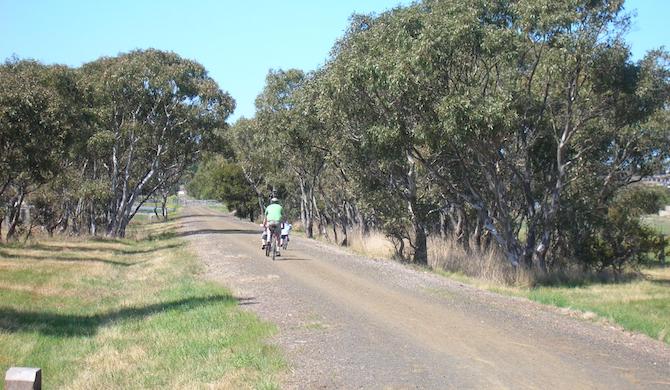
Following the former train line from South Geelong to Queenscliff, this 32 km trail provides great scenery and a tranquil environment no matter where you pick it up. The trail is paved in high traffic sections and there are plenty of amenities throughout the journey.
Go as far as you wish. The final 16 km (10 miles) from Drysdale to Queenscliff is the most popular, due largely that it follows a working tourist steam train line. However, for those wanting something convenient from Geelong, we’ve mapped a 9 km (5.6 miles) out and back route from near South Geelong station to the Bellarine Hwy, providing a glimpse of what the rest of the trail offers. There are road crossings, so it won’t be an uninterrupted route.
To get to the start: Starting at South Geelong station, head south and follow Strong St., and then the paved pedestrian path. Cross the large roundabout and continue following the path. At the next smaller roundabout you can join the start of the Bellarine Rail Trail. From there the path is well signposted.


Review or Comment on This Route/Share a Photo!
Share your feedback on this route and see that of other Great Runs users. Click on the image icon to upload a photo. And please let us know if there are notes or changes we should incorporate!