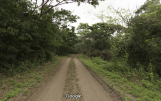
The large island of Santay sits at the center of the Rio Guaya, just offshore from Guayaquil. This National Recreation Area does have a population of about 210 people who live in eco-villages, but it mostly consists of protected forest and waterfront encircled by multi-use trails. Visitors can access the island either by the Puente (Bridge) Isla Santay (off Calle del Oro in Guayaquil), or by the Puente Duran-Santay from Malecón Abel Gilbert 3 in Duran. Once on the island, runners can enjoy a 6 km “ciclovia” that spans from the administrative area to the Duran Bridge. Runners can also explore the Sendero Huaquillas and the Camino a la Cocodrila paths near the administrative area. While there are some dirt paths, most of the routes consist of a bouncy plastic-wood composite that will energize your run!
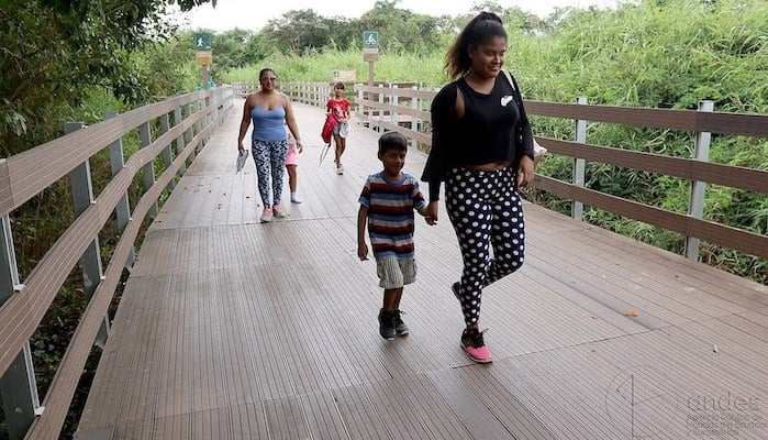
Guayaquil, viernes 29 de junio del 2018 (Andes).-Turistas recorren uno de los tramos de la Isla Santay..Foto:César Muñoz/Andes
Features:
Scroll Down For Route Maps
Essentials
- Up to 6 km (one-way)
- 10 meters (33 feet)
- Puente Isla Santay or Puente Duran-Santay
- Barrio Centenario Norte-Sur Bus Stop
Current Weather & Forecast

Guayaquil, EC
10:33 pm,
Jul 13, 2026
L: 26°
H: 26°
Daily ForecastHourly Forecast
Tomorrow
4:00 pm
25° / 28°°C
0 mm
0%
15 mph
79 %
1018 mb
0 mm/h
Wednesday
4:00 pm
25° / 28°°C
0 mm
0%
15 mph
75 %
1018 mb
0 mm/h
Thursday
4:00 pm
24° / 28°°C
0.2 mm
20%
14 mph
79 %
1018 mb
0 mm/h
Friday
4:00 pm
25° / 28°°C
0.2 mm
20%
15 mph
75 %
1019 mb
0 mm/h
Saturday
4:00 pm
25° / 28°°C
0.6 mm
60%
18 mph
78 %
1019 mb
0 mm/h
Tomorrow
1:00 am
25° / 25°°C
0 mm
0%
13 mph
79 %
1018 mb
0 mm/h
Tomorrow
4:00 am
25° / 25°°C
0 mm
0%
13 mph
78 %
1017 mb
0 mm/h
Tomorrow
7:00 am
27° / 27°°C
0 mm
0%
15 mph
70 %
1018 mb
0 mm/h
Tomorrow
10:00 am
28° / 28°°C
0 mm
0%
15 mph
64 %
1018 mb
0 mm/h
Tomorrow
1:00 pm
28° / 28°°C
0 mm
0%
14 mph
63 %
1017 mb
0 mm/h
Tomorrow
4:00 pm
27° / 27°°C
0 mm
0%
14 mph
68 %
1016 mb
0 mm/h
Tomorrow
7:00 pm
25° / 25°°C
0 mm
0%
13 mph
75 %
1017 mb
0 mm/h
Other Routes in Guayaquil, Ecuador
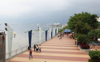
Malecón 2000
Guayaquil, Ecuador
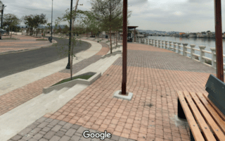
The most popular running option in Guayaquil. The Malecón 2000 is a delightful brick waterfront promenade along 2.4 km of the city’s coast. Includes monuments and other top sites.

Enjoy some hill work on the steps of Cerro Santa Ana, then extend your route on the waterfront of the Las Penas neighborhood, where you can look back on the colorful rows of houses and shops.
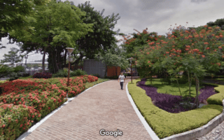
This large park in north Guayaquil has over 4 km of lovely brick paths around the perimeter. Runners can also cross the street into Reserva Senderos and run along the dirt bike path.
There are great routes on the west side of Guayaquil, where runners can seek out the waterfront paths of the Parque Lineal del Estero Salado. We’ve mapped an 8 km loop starting from the university.
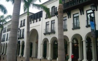
Plaza Lagos is a shopping center in north Guayaquil, but it’s also a community of nicely developed promenades and residential streets. We’ve mapped a 3 km loop.
This forest area on the western outskirts of Guayaquil features numerous trails, including a wide, flat, dirt bike path around the park perimeter. It’s a 2.5 km loop. The terrain is mainly wooded.
The Parque Lineal Kennedy Norte is a great option in north-central Guayaquil, especially for those located near the airport. There is a 1 km promenade along the estuary, with runnable residential street options nearby.
There are some more waterfront paths in the Cisne/Ximena/Isla Trinitaria area of southwest Guayaquil. Not the most scenic, but they can be combined for a run in the southwest of Guayaquil.
User Ratings
Leave A Review or Comment
Review or Comment on This Route/Share a Photo!
Share your feedback on this route and see that of other Great Runs users. Click on the image icon to upload a photo. And please let us know if there are notes or changes we should incorporate!