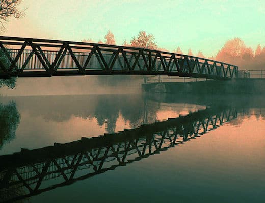
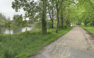
A pleasant run on a gravel path along the Speed River, as far as Guelph Lake. The gravel path starts at Riverside Park at the intersection of Speedvale Ave./Riverside Dr. It’s a pleasant park, with sandy beach area, an amphitheater, and sports fields.
Riverside Park. Wikimedia. Patty O’Hearn Kickham
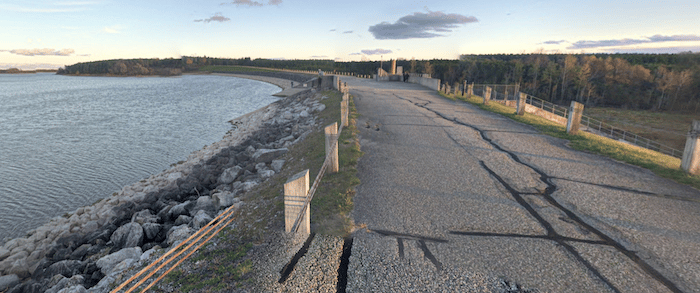
Head north on the Speed River Trail/ Royal Recreation Trail on the east side of the river, through the park. At 1.4 km, cross Woodlawn Rd. and continue north through a pine & cedar forest, to Victoria Rd (3.6 km). Here, you can continue for another 1 km to the Guelph Lake Dam. From there, our route adds a scenic section along Guelph Lake, which adds up to 2.8 km. Retrace your steps, with an option to run on the west side of the river south of Woodlawn Rd.
Add-Ons: At Guelph Lake, there are 10 km of mainly wooded hiking trails that are good for trail running. From Riverside Park, the Downtown Trail goes south of Speedvale Ave. for nearly 2 km.
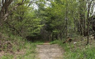
A pleasant run on a gravel path along the Speed River, as far as Guelph Lake. The gravel path starts at Riverside Park at the intersection of Speedvale Ave./Riverside Dr. It’s a pleasant park, with sandy beach area, an amphitheater, and sports fields.
Riverside Park. Wikimedia. Patty O’Hearn Kickham
Head north on the Speed River Trail/ Royal Recreation Trail on the east side of the river, through the park. At 1.4 km, cross Woodlawn Rd. and continue north through a pine & cedar forest, to Victoria Rd (3.6 km). Here, you can continue for another 1 km to the Guelph Lake Dam. From there, our route adds a scenic section along Guelph Lake, which adds up to 2.8 km. Retrace your steps, with an option to run on the west side of the river south of Woodlawn Rd.
Add-Ons: At Guelph Lake, there are 10 km of mainly wooded hiking trails that are good for trail running. From Riverside Park, the Downtown Trail goes south of Speedvale Ave. for nearly 2 km.
Scroll Down For Route Maps
Essentials
Up to 12.4 km (7.7 mile) loop, with options for longer/shorter
62m (206 feet) over full loop
Riverside Park at the intersection of Speedvale Ave./Riverside Dr.
A lovely run through several parks along the Speed and Eramosa rivers, which merge in downtown Guelph. Gravel surface, featuring a nice combination of woods, water views, parks, and fields. Numerous options for loops, add-ons, or combinations with adjacent trails.
An interesting and scenic run combining the paths around the University of Guelph campus, running track, fields, and adjacent Arboretum. Located just south of downtown. The 400-acre Arboretum has 12.5 km of trails that are great for running.
In the southwestern part of Guelph, there's a series of several parks, bound together by a section of the Royal Recreation Trail. We've created a 10k route to use as a guide, but there are lots of options here to create your own route too.
Share your feedback on this route and see that of other Great Runs users. Click on the image icon to upload a photo. And please let us know if there are notes or changes we should incorporate!
Subscribe
0 Comments
Oldest
Newest
Inline Feedbacks
View all comments
Essentials
Up to 12.4 km (7.7 mile) loop, with options for longer/shorter
62m (206 feet) over full loop
Riverside Park at the intersection of Speedvale Ave./Riverside Dr.

Review or Comment on This Route/Share a Photo!
Share your feedback on this route and see that of other Great Runs users. Click on the image icon to upload a photo. And please let us know if there are notes or changes we should incorporate!