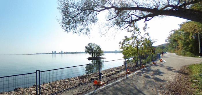
The Waterfront Trail is the signature run trail in Hamilton. A gorgeous, paved multi-use path runs right along Lake Ontario, with unimpeded views of the water and incorporating multiple waterfront parks. From downtown/central Hamilton, the best bet is to access the trail at Bayfront Park. BONUS: Much of the trail is lit! A couple of options:
6.4 km (4-mile) Eastern Route: Do a loop around Bayfront Park and then head east, doing a loop of Pier 4 Park and then the Pier 7 Boardwalk, enjoying the water views and the boats at the Hamilton Yacht Club. Return to Bayfront Park.
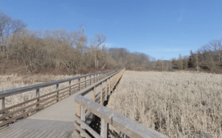
Western Route. From Bayfront Park, head west on the Waterfront Trail for 2.2 km to the lookout McQuesten High Level Bridge, where you can continue on the path for another 1 km under the bridge to Princess Point. These two routes combined are 12.8 km.
Add-Ons: Contuinue west on our Princess Point route.
The Waterfront Trail is the signature run trail in Hamilton. A gorgeous, paved multi-use path runs right along Lake Ontario, with unimpeded views of the water and incorporating multiple waterfront parks. From downtown/central Hamilton, the best bet is to access the trail at Bayfront Park. BONUS: Much of the trail is lit! A couple of options:
6.4 km (4-mile) Eastern Route: Do a loop around Bayfront Park and then head east, doing a loop of Pier 4 Park and then the Pier 7 Boardwalk, enjoying the water views and the boats at the Hamilton Yacht Club. Return to Bayfront Park.
Western Route. From Bayfront Park, head west on the Waterfront Trail for 2.2 km to the lookout McQuesten High Level Bridge, where you can continue on the path for another 1 km under the bridge to Princess Point. These two routes combined are 12.8 km.
Add-Ons: Contuinue west on our Princess Point route.


Review or Comment on This Route/Share a Photo!
Share your feedback on this route and see that of other Great Runs users. Click on the image icon to upload a photo. And please let us know if there are notes or changes we should incorporate!