There’s some pleasant running along the Qiantang River, on both the north and south banks. We generally prefer the paths on the south side, though both are pleasant and runnable! If you want to do a run incorporating both banks, the only real crossing bridge for pedestrians is the Fuxing Bridge (Zhonghe Viad).
South Bank Paths (Binjiang District)
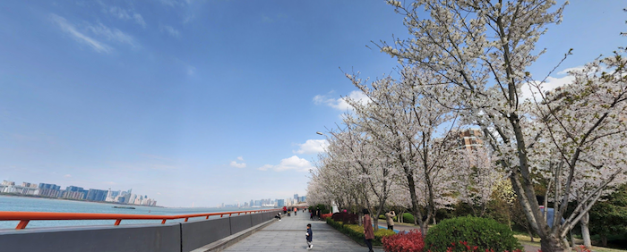
Paths, mostly paved, run along the water for ~16+ km between the Pengbu Bridge (S2) and the Quiantangjiang Bridge. Enjoy nice views of the water, and some green spaces in the riverfront parks. We’ve mapped the whole route from north to south. The path is not 100% continuous, so here are the two main sections:
KM 1-KM 7: This runs from the Pengbu Bridge (s2) to the Wangjiang Tunnel. There are nice paths along the river, and in a couple of sections, separate bicycle and pedestrian paths. There’s a running track at the Olympic Sports Complex, just north of the Xixing Bridge (~km 4).
KM 7-KM 9: On-Road Section.
KM 9-KM 16.6. From just north of the Zhonghe Viad (bridge) to the Quiantangjiang Bridge. Nice waterfront path, good for pedestrians, with nice water views. Parallels Wentao Rd.
North Bank Path. Google Street View
North Bank Paths (Jianggan & Shangcheng District)
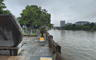
There are ~8.4 km of paths along the north bank, between the Xixing Bridge and the Quiantangjiang Bridge, paralleling Zhijiang Rd. The path is popular with pedestrians and cyclists. Most of the path is right alongside the river, with good water and skyline views. Toward the south end, pass Bai Ta (White Pagoda Park),
Both Banks
If you want to do a run incorporating both banks, the only real crossing bridge for pedestrians is the Fuxing Bridge (Zhonghe Viad). There aren’t good ‘loop’ options, as there isn’t a good bridge for crossing further north. But using this bridge would add a nice variety, choosing parts of both banks!
There’s some pleasant running along the Qiantang River, on both the north and south banks. We generally prefer the paths on the south side, though both are pleasant and runnable! If you want to do a run incorporating both banks, the only real crossing bridge for pedestrians is the Fuxing Bridge (Zhonghe Viad).
South Bank Paths (Binjiang District)
Paths, mostly paved, run along the water for ~16+ km between the Pengbu Bridge (S2) and the Quiantangjiang Bridge. Enjoy nice views of the water, and some green spaces in the riverfront parks. We’ve mapped the whole route from north to south. The path is not 100% continuous, so here are the two main sections:
KM 1-KM 7: This runs from the Pengbu Bridge (s2) to the Wangjiang Tunnel. There are nice paths along the river, and in a couple of sections, separate bicycle and pedestrian paths. There’s a running track at the Olympic Sports Complex, just north of the Xixing Bridge (~km 4).
KM 7-KM 9: On-Road Section.
KM 9-KM 16.6. From just north of the Zhonghe Viad (bridge) to the Quiantangjiang Bridge. Nice waterfront path, good for pedestrians, with nice water views. Parallels Wentao Rd.
North Bank Path. Google Street View
North Bank Paths (Jianggan & Shangcheng District)
There are ~8.4 km of paths along the north bank, between the Xixing Bridge and the Quiantangjiang Bridge, paralleling Zhijiang Rd. The path is popular with pedestrians and cyclists. Most of the path is right alongside the river, with good water and skyline views. Toward the south end, pass Bai Ta (White Pagoda Park),
Both Banks
If you want to do a run incorporating both banks, the only real crossing bridge for pedestrians is the Fuxing Bridge (Zhonghe Viad). There aren’t good ‘loop’ options, as there isn’t a good bridge for crossing further north. But using this bridge would add a nice variety, choosing parts of both banks!
Scroll Down For Route Maps
Essentials
North Bank: Up to 16.6 km (10.3 miles); South Bank: up to 8.4 km (5.2 miles) one-way
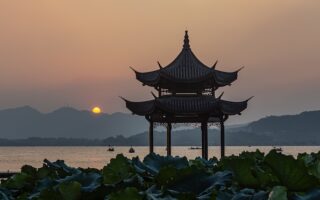
The signature run in Hangzhou. Extensive network of paths around the lake and across dramatic causeways. Fabulous water views, lovely waterfront parks historical pagodas, cultural sites, tea fields, & scenic hills. Full lake loop is 12.5 km, and numerous other options.
Some 10 km of tree-shaded paths along the historic Grand Canal in Hangzhou, a UNESCO heritage site. A favorite route is from the Gongchen Bridge in the charming Xiaohe Historic Cultural District to Wulin Square. Add-on spur possible along the Yuhangtang River.
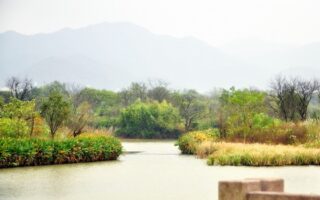
Beautiful natural site that's lovely for running. There are extensive trails around waterways, causeways, aquatic grasslands, botanical gardens, and fishing villages. Best runs are a 3.7 km east-west path and three scenic causeways: Fudi, Green, & Longevity.
Share your feedback on this route and see that of other Great Runs users. Click on the image icon to upload a photo. And please let us know if there are notes or changes we should incorporate!
Subscribe
0 Comments
Oldest
Newest
Inline Feedbacks
View all comments
Essentials
North Bank: Up to 16.6 km (10.3 miles); South Bank: up to 8.4 km (5.2 miles) one-way


Review or Comment on This Route/Share a Photo!
Share your feedback on this route and see that of other Great Runs users. Click on the image icon to upload a photo. And please let us know if there are notes or changes we should incorporate!