The 20-mile Capital Area Greenbelt Trail is the anchor of running in Harrisburg. We’ve created two ‘routes’: a 6-mile section along the Susquehanna River, including a loop around City Island, and this 13.5 mile section, which we’ve divided into a couple of options.
Phoenix Park to Paxton St. This 3.5 mile section runs along Spring Creek, from Phoenix Park to Paxton St. It’s all dedicated, paved path, somewhat wooded and mostly through parks, including Five Senses Park.
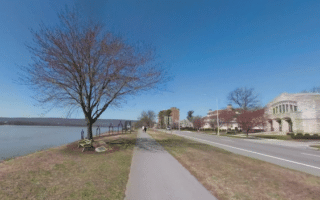
Wildwood Lake. Google Street View
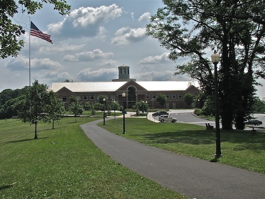
Paxton St. to Wildwood Lake. This is a 10-mile one-way route, so we recommend you choose a section! From Paxton Rd., there’s an 0.5 mile on-road section. Then, the trail picks up and goes for a rather nondescript 1.5 miles to the National Civil War Museum, which features a green campus and trails. Then, a 1.4 mile section mainly along Stanley Rd., where the trail picks up again. It gets nicer here, on paths through the Patton Arboretum & Former State Hospital Grounds, and then a section through Harrisburg Community College. The final 3 miles is a lovely loop around Wildwood Lake.
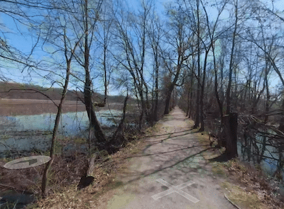
Wildwood Park Nature Trails/Wildwood Lake. There are 5 miles of trails in this park. A loop of the lake is 3 miles. The west bank (Towpath Trail) has some nice water views. On the east bank, the East Shore Trail is right along the lake but is more rugged, while the Wildwood Way Trail is more of a multi-use trail and is more wooded. TRAIL INFOTRAIL MAP
Add-Ons: The waterfront section of the Capital Area Greenbelt Trail runs along Front St. from Phoenix Park west for 4.5 miles, through Downtown, to Uptown.
The 20-mile Capital Area Greenbelt Trail is the anchor of running in Harrisburg. We’ve created two ‘routes’: a 6-mile section along the Susquehanna River, including a loop around City Island, and this 13.5 mile section, which we’ve divided into a couple of options.
Phoenix Park to Paxton St. This 3.5 mile section runs along Spring Creek, from Phoenix Park to Paxton St. It’s all dedicated, paved path, somewhat wooded and mostly through parks, including Five Senses Park.
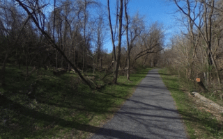
Wildwood Lake. Google Street View
Paxton St. to Wildwood Lake. This is a 10-mile one-way route, so we recommend you choose a section! From Paxton Rd., there’s an 0.5 mile on-road section. Then, the trail picks up and goes for a rather nondescript 1.5 miles to the National Civil War Museum, which features a green campus and trails. Then, a 1.4 mile section mainly along Stanley Rd., where the trail picks up again. It gets nicer here, on paths through the Patton Arboretum & Former State Hospital Grounds, and then a section through Harrisburg Community College. The final 3 miles is a lovely loop around Wildwood Lake.
Wildwood Park Nature Trails/Wildwood Lake. There are 5 miles of trails in this park. A loop of the lake is 3 miles. The west bank (Towpath Trail) has some nice water views. On the east bank, the East Shore Trail is right along the lake but is more rugged, while the Wildwood Way Trail is more of a multi-use trail and is more wooded. TRAIL INFOTRAIL MAP
Add-Ons: The waterfront section of the Capital Area Greenbelt Trail runs along Front St. from Phoenix Park west for 4.5 miles, through Downtown, to Uptown.
Scroll Down For Route Maps
Essentials
Up to 13.5 miles one-way, including 3-mile loop of Wildwood Lake. Choose a section!
Flat
Mapped route starts at Phoenix Park. But there are numerous other landmarks & access points
See trail map link for parking areas & access points
One of the most scenic runs in Harrisburg. Up to 4.5 miles along the Susquehanna River on a dedicated path with water views, lovely older homes, & downtown Harrisburg. Optional 1.5 mile loop of City Island. Part of the Capital Area Greenbelt Trail.
Lovely nature preserve with 5 miles of trails, including a 3-mile loop around Wildwood Lake. Combination of woods and water views. Can continue north or south on the Capital Area Greenbelt for a longer run.
1,025 acre conservation area located 13 miles north of Harrisburg features 12 miles of trails, ranging from easier to more challenging. Mainly wooded, with some serious hill options. Known for its large trees of numerous species.
A nice 4-mile out and back in the western part of Harrisburg. The trail starts in the Creekview Park area. Part paved and part grass/dirt. Combination of woods and fields.
Share your feedback on this route and see that of other Great Runs users. Click on the image icon to upload a photo. And please let us know if there are notes or changes we should incorporate!
Subscribe
0 Comments
Oldest
Newest
Inline Feedbacks
View all comments
Essentials
Up to 13.5 miles one-way, including 3-mile loop of Wildwood Lake. Choose a section!
Flat
Mapped route starts at Phoenix Park. But there are numerous other landmarks & access points
See trail map link for parking areas & access points


Review or Comment on This Route/Share a Photo!
Share your feedback on this route and see that of other Great Runs users. Click on the image icon to upload a photo. And please let us know if there are notes or changes we should incorporate!