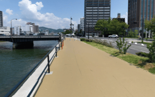
Ujina Island is a pleasant seaside escape just 5 km south of central Hiroshima. It’s a popular excursion for locals, who enjoy the island’s perimeter path along Hiroshima Bay. It’s also a treat for running — the concrete path is right along the beach, and loops for 3.5 km around the island. There are a couple of short, not very scenic on-road sections on both the east and west sides in order to do the full perimeter. Note: the path is literally along the water, with no barrier in some sections– be cautious in rainy/windy conditions!
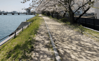
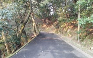
Additional Options: There are a couple of options to make this a longer run. From the Hiroshimako tram stop, a pleasant loop around Hiroshima Minato Park and the pier-side path to Ujinahatoba Park is a 3 km out and back, then taking the small bridge to Ujina Island. On Ujina Island, the interior, wooded road cutting through Motoujina Park for ~1.5 km is a leafy alternative to the waterfront path. The road has no shoulder or sidewalk, but not too much car traffic, either.
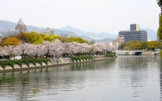
For a super long run, you can run south from central Hiroshima to Ujina Island using paths along the Kyobasji River or Motoyasu River.
Ujina Island is a pleasant seaside escape just 5 km south of central Hiroshima. It’s a popular excursion for locals, who enjoy the island’s perimeter path along Hiroshima Bay. It’s also a treat for running — the concrete path is right along the beach, and loops for 3.5 km around the island. There are a couple of short, not very scenic on-road sections on both the east and west sides in order to do the full perimeter. Note: the path is literally along the water, with no barrier in some sections– be cautious in rainy/windy conditions!
Additional Options: There are a couple of options to make this a longer run. From the Hiroshimako tram stop, a pleasant loop around Hiroshima Minato Park and the pier-side path to Ujinahatoba Park is a 3 km out and back, then taking the small bridge to Ujina Island. On Ujina Island, the interior, wooded road cutting through Motoujina Park for ~1.5 km is a leafy alternative to the waterfront path. The road has no shoulder or sidewalk, but not too much car traffic, either.
For a super long run, you can run south from central Hiroshima to Ujina Island using paths along the Kyobasji River or Motoyasu River.


Review or Comment on This Route/Share a Photo!
Share your feedback on this route and see that of other Great Runs users. Click on the image icon to upload a photo. And please let us know if there are notes or changes we should incorporate!