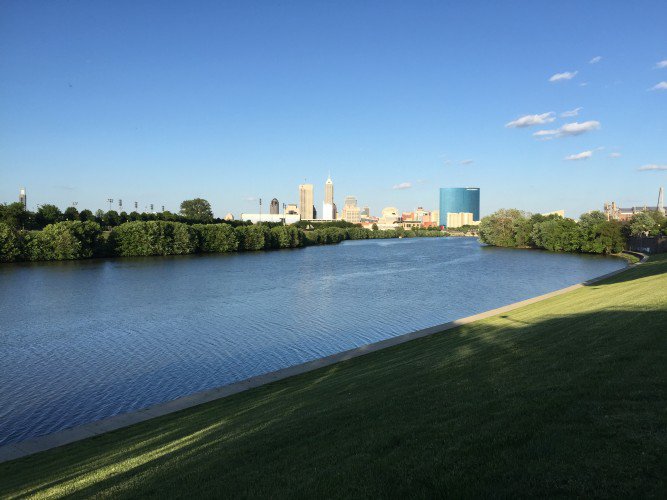
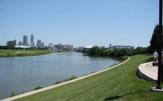
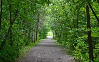
The Central White River Trail is a terrific option for running in the heart of Indianapolis. The paved multi-use path runs for up to 7 miles along the White River from Raymond St. south of downtown, through downtown, and then north to Riverside Park. There are great views of the Indy skyline, and good glimpses of the water. It’s also known as the Wapahani Trail, from the Delaware Indiana’s tribe’s word for White River.
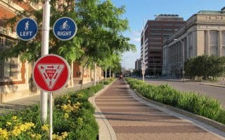
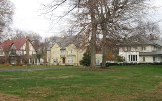
From the south end at Raymond St. (Eli Lily Recreation Park), the trail runs along the west side of the river for 2.2 miles north to downtown. Good downtown access is via a pedestrian bridge linking the Indiana Museum and the Zoo. In the downtown section, you’ll pass the Indianapolis Museum of Art, the Lake Sullivan Sports Center, IUPUI, the Downtown Canal Walk, White River State Park, and the Indianapolis Zoo. At the 3.3 mile mark, cross Michigan St. to the east side. The trail continues north for another 3.5 miles, with a nice 2-mile section through Riverside Park.
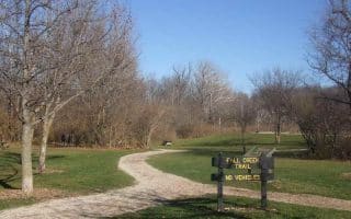
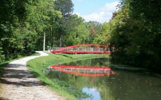
Add-Ons: At Riverside Park, continue north on the Central Canal Connector Trail for 2 miles through the Virginia B. Fairbanks Art & Nature Park, which features contemporary art installations showcased amid 100 acres with woodlands, meadows & a lake. The canal trail continues for many miles from there. At the south end @ Raymond St., connect to the Eagle Creek Greenway, which travels for 3.2 miles along Eagle Creek through West Indianapolis.
The Central White River Trail is a terrific option for running in the heart of Indianapolis. The paved multi-use path runs for up to 7 miles along the White River from Raymond St. south of downtown, through downtown, and then north to Riverside Park. There are great views of the Indy skyline, and good glimpses of the water. It’s also known as the Wapahani Trail, from the Delaware Indiana’s tribe’s word for White River.
From the south end at Raymond St. (Eli Lily Recreation Park), the trail runs along the west side of the river for 2.2 miles north to downtown. Good downtown access is via a pedestrian bridge linking the Indiana Museum and the Zoo. In the downtown section, you’ll pass the Indianapolis Museum of Art, the Lake Sullivan Sports Center, IUPUI, the Downtown Canal Walk, White River State Park, and the Indianapolis Zoo. At the 3.3 mile mark, cross Michigan St. to the east side. The trail continues north for another 3.5 miles, with a nice 2-mile section through Riverside Park.
Add-Ons: At Riverside Park, continue north on the Central Canal Connector Trail for 2 miles through the Virginia B. Fairbanks Art & Nature Park, which features contemporary art installations showcased amid 100 acres with woodlands, meadows & a lake. The canal trail continues for many miles from there. At the south end @ Raymond St., connect to the Eagle Creek Greenway, which travels for 3.2 miles along Eagle Creek through West Indianapolis.


Review or Comment on This Route/Share a Photo!
Share your feedback on this route and see that of other Great Runs users. Click on the image icon to upload a photo. And please let us know if there are notes or changes we should incorporate!