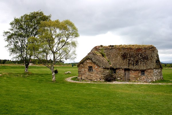
This is a nice run just east of Inverness, combining trails in the Culloden Woods with paths around the Culloden Battlefield — site of the 1745 Jacobite uprising and a brutal battle. There’s a wondrfully curated interpretive center that’s worth a visit. We’ve created a mapped route of 8+ miles to use as a guideline — there are options for shorter/longer. See the attached trail maps for additional info. Note: There’s a fee for entering/touring the battlefield site itself.
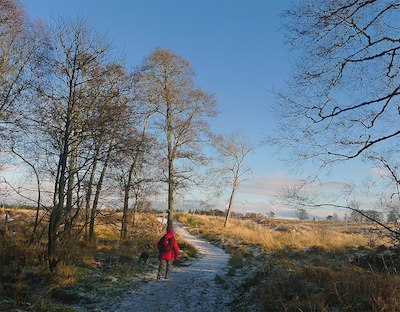
Culloden Wood. Photo: Julian Paren
Start at the Culloden Woods car park. It’s ~2.5 miles around the mostly wide, uneven gravel and earth surface, with some steep slopes. The paths pass battlefield landmarks and pagan traditions at the infamous Prisoner’s Stone and St Mary’s Well. You can then continue onto some of the battlefield paths, which includes a section along Culloden Rd., which has a decent footpath alongside. Note that the battlefield paths are hilly.
This is a nice run just east of Inverness, combining trails in the Culloden Woods with paths around the Culloden Battlefield — site of the 1745 Jacobite uprising and a brutal battle. There’s a wondrfully curated interpretive center that’s worth a visit. We’ve created a mapped route of 8+ miles to use as a guideline — there are options for shorter/longer. See the attached trail maps for additional info. Note: There’s a fee for entering/touring the battlefield site itself.
Culloden Wood. Photo: Julian Paren
Start at the Culloden Woods car park. It’s ~2.5 miles around the mostly wide, uneven gravel and earth surface, with some steep slopes. The paths pass battlefield landmarks and pagan traditions at the infamous Prisoner’s Stone and St Mary’s Well. You can then continue onto some of the battlefield paths, which includes a section along Culloden Rd., which has a decent footpath alongside. Note that the battlefield paths are hilly.
Scroll Down For Route Maps
Essentials
Mapped Route is 8.3 miles (13.2 km). Culloden Woods paths are ~2.5 miles;
Mapped route is 591 feet (180m)
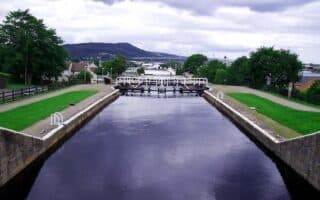
Canal Lock
Car parks at Culloden Woods & Culloden Battlefield
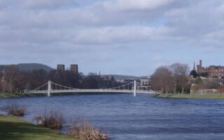
This route in central Inverness that has it all: River Ness & Caledonian Canal paths, Ness Islands, parks, gardens, a castle, fields, woods, bridges, and a running track.
A lovely run along paths on both sides of the River Ness, including a loop around the Ness Islands. Good water views & several Inverness sites. Main loop is 4 miles, with good add-on options.
Several miles of pleasant gravel paths for running alongside the Caledonian Canal. Particularly scenic is the direction south to Moray Firth. The path also goes for several miles north to Dochgarroch Locks.
Share your feedback on this route and see that of other Great Runs users. Click on the image icon to upload a photo. And please let us know if there are notes or changes we should incorporate!
Subscribe
0 Comments
Oldest
Newest
Inline Feedbacks
View all comments
Essentials
Mapped Route is 8.3 miles (13.2 km). Culloden Woods paths are ~2.5 miles;
Mapped route is 591 feet (180m)
Canal Lock
Car parks at Culloden Woods & Culloden Battlefield


Review or Comment on This Route/Share a Photo!
Share your feedback on this route and see that of other Great Runs users. Click on the image icon to upload a photo. And please let us know if there are notes or changes we should incorporate!