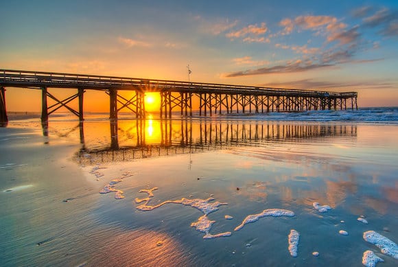
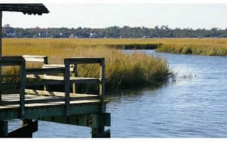
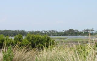
A worth-it destination run is to explore Sullivan’s Island and Isle of Palms, for its waterfront roads, attractive homes, and great beaches for running. The area is just a 15-minute drive from downtown and is a particular treat at sunset! There are a few different ways to do this run, depending on the preferred length. One running highlight in this area is the Ben Sawyer Bridge — it’s 2.5 miles from the mainland to Sullivan’s Island Beach, with nice marsh and water views, and a good pedestrian path. So that alone would be a 5-mile out and back. Best to park on Sullivan’s Island and start from there. Note: See comments section for more details
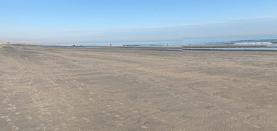
Sullivan’s Island Beach. Google Street View
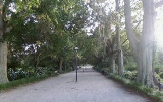
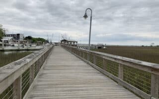
One on the island, there’s more to explore on foot. From the beach, head west to Sullivan’s Island Lighthouse (1 mile out and back), or east for nearly 4 miles to Isle of Palms Beach, using waterfront roads and Rt. 703. There are nice palm trees, attractive homes, occasional water views, and at Isle of Palms beach a nice pier to run out. You can also run more miles on Palm Blvd. all the way to the end of Isle of Palms, but there are no water views and it’s a bit nondescript.
This is also a great area for beach running, with several miles of very runnable beach featuring firm, compact sand. On Sullivan’s Island, the beach is ~2.5 miles, and on Isle of Palms, up to 6 miles.
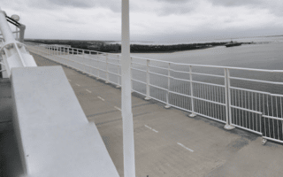
You can also run over the Isle of Palms Connector Bridge (Highway 517, ~3.5 miles one-way). It’s daunting looking, but there is a bike/pedestrian path (not protected).
A worth-it destination run is to explore Sullivan’s Island and Isle of Palms, for its waterfront roads, attractive homes, and great beaches for running. The area is just a 15-minute drive from downtown and is a particular treat at sunset! There are a few different ways to do this run, depending on the preferred length. One running highlight in this area is the Ben Sawyer Bridge — it’s 2.5 miles from the mainland to Sullivan’s Island Beach, with nice marsh and water views, and a good pedestrian path. So that alone would be a 5-mile out and back. Best to park on Sullivan’s Island and start from there. Note: See comments section for more details
Sullivan’s Island Beach. Google Street View
One on the island, there’s more to explore on foot. From the beach, head west to Sullivan’s Island Lighthouse (1 mile out and back), or east for nearly 4 miles to Isle of Palms Beach, using waterfront roads and Rt. 703. There are nice palm trees, attractive homes, occasional water views, and at Isle of Palms beach a nice pier to run out. You can also run more miles on Palm Blvd. all the way to the end of Isle of Palms, but there are no water views and it’s a bit nondescript.
This is also a great area for beach running, with several miles of very runnable beach featuring firm, compact sand. On Sullivan’s Island, the beach is ~2.5 miles, and on Isle of Palms, up to 6 miles.
You can also run over the Isle of Palms Connector Bridge (Highway 517, ~3.5 miles one-way). It’s daunting looking, but there is a bike/pedestrian path (not protected).
Scroll Down For Route Maps
Essentials
Many miles of options, see description
Flat
Depends on route/section chosing
There's parking available on the island for the beaches
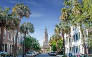
Lots of ways to explore Charleston's spectacular historic district. Get up early and create your own route before the crowds hit. We've mapped an outline route and also a lovely 2.6-miler 'straight shot' on pretty streets to Colonial Lake. Many options to vary.
A lovely run in the northern section of Charleston, combining the campus of The Citadel military college, historic Hampton Park, and the surrounding neighborhood. Good add-on options.
A must-do running experience on Charleston is the run from downtown over the Arthur Ravenel Bridge. It looks daunting, but there's a wide, well-protected multi-use path that's popular with pedestrians and cyclists. Additional options to explore Patriots Point.
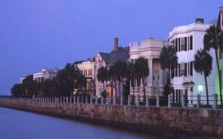
One of the hidden gems for running in Charleston. There are waterfront boardwalks, gorgeous homes, and a pedestrian ocean walk at the end of Pitt St. Some nice additional running options in the northeastern part of Mount Pleasant, as well.
This popular beach and golf resort is a barrier island 24 miles southwest of Charleston. It's a treat for running, with 10 miles of beach with packed sand, and 30 miles of bike trails. Private island but public can enter by foot.
Just across the Ashley River from Charleston, runners can explore the West Ashley Greenway. The multi-use trail roughly parallels US 17 through a combination of residential neighborhoods, schools, parks, and a marsh. 8.2 miles one-way.
10+ miles of paved multi-use paths along the residential streets of the Crowfield Plantation housing development in the Goose Creek suburb north of Charleston, plus 15 miles of trails in Wannamaker North County Park.
Share your feedback on this route and see that of other Great Runs users. Click on the image icon to upload a photo. And please let us know if there are notes or changes we should incorporate!
Subscribe
0 Comments
Oldest
Newest
Inline Feedbacks
View all comments
Essentials
Many miles of options, see description
Flat
Depends on route/section chosing
There's parking available on the island for the beaches


Review or Comment on This Route/Share a Photo!
Share your feedback on this route and see that of other Great Runs users. Click on the image icon to upload a photo. And please let us know if there are notes or changes we should incorporate!