Features:
Jávea is an increasingly popular coastal town on the northern end of the Costa Blanca, just south of Dénia. We have two recommended routes in this area:

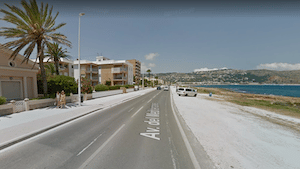
Coastal Run. A pretty run along the coast from Xàbia Port, south for 3.5 km to Platja de l’Arenal. There isn’t a dedicated seafront path, but there’s a gravel area on the coast side and a wide sidewalk on the inland side of the v. del Mediterráneo road.
‘Mirador’ Run. Run the 4 km between the Molins De La Plana and Cap de Sant Antoni along the Ctra. del Cap de Sant Antoni road (CV-7362). This is a popular walk, taking in the historic windmills and then heading toward toward Cape San Antonio, with great views of the Mediterranean and Ibiza in the distance. No shoulder, but not too much traffic. If you’d like to run there from Jávea port, it’s a 2.4 km steep climb, using Calle Salem (see map). The full out and back from Jávea port is 13 km.
- Coastal Route: Up to 7 km (4.4 miles) out and back; Mirador Route: Several distance options
- Coastal route is flat; Mirador Route is flat, unless you run from Jávea port, which is very hilly
- Depends on route chosen


Comment on this Route/Share a Photo!
Share your feedback on this route and see that of other Great Runs users. Click on the image icon to upload a photo. And please let us know if there are notes or changes we should incorporate!