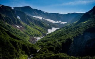
Here’s an opportunity to run in the area of a glacier! Located a 15-minute drive from Juneau, this important visitor destination features fantastic views of Mendenhall Lake, surrounding mountains, and the glacier. There are numerous trails for running in this area, with various degrees of difficulty.
Trails from the Visitor Center. Combine some of the trails around the Visitor Center for a gorgeous 3-4 mile run: the 1/3 mile to ‘Photo Point‘, then the 1 mile Trail of Time loop, and the 2 mile Nugget Falls loop. For those seeking a trail running challenge, there’s the 3.5 mile East Glacier loop. MAP & INFORMATION
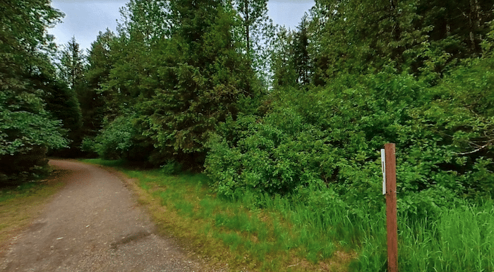
Glacier Spur Rd. Multi-Use Path & Powerline Trail. A paved multi-use path runs alongside Glacier Spur Rd. from the Visitor Center headed south. It’s 1.5 miles to when the road turns into Mendenhall Loop Rd. You can also run on the Powerline Trail, which is just east of Glacier Spur Rd. south to Gladstone St. From there, it’s more of a sidewalk alongside the road, continuing onto Glacier Highway all the way to Lemon Creek (8 miles total, fairly flat). ROUTE MAP
Moose Lake Trail. Google Street View
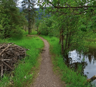
Lake Area Trails. There are several trails in the Tongass National Forest, an area of woods and lakes just west of Glacier Spur Rd. The trails are accessed from the US Forest Ranger Station off Mendenhall Loop Rd. Most of the trails are wooded, though there are some open spots and lake views. The surface is a combination of narrow dirt and glacial gravel. Create your own route, combining the Dredge Lake Trail, Moose Lake Trail, & Moraine Ecology Trail. Note: trail conditions vary in season & weather.
Here’s an opportunity to run in the area of a glacier! Located a 15-minute drive from Juneau, this important visitor destination features fantastic views of Mendenhall Lake, surrounding mountains, and the glacier. There are numerous trails for running in this area, with various degrees of difficulty.
Trails from the Visitor Center. Combine some of the trails around the Visitor Center for a gorgeous 3-4 mile run: the 1/3 mile to ‘Photo Point‘, then the 1 mile Trail of Time loop, and the 2 mile Nugget Falls loop. For those seeking a trail running challenge, there’s the 3.5 mile East Glacier loop. MAP & INFORMATION
Glacier Spur Rd. Multi-Use Path & Powerline Trail. A paved multi-use path runs alongside Glacier Spur Rd. from the Visitor Center headed south. It’s 1.5 miles to when the road turns into Mendenhall Loop Rd. You can also run on the Powerline Trail, which is just east of Glacier Spur Rd. south to Gladstone St. From there, it’s more of a sidewalk alongside the road, continuing onto Glacier Highway all the way to Lemon Creek (8 miles total, fairly flat). ROUTE MAP
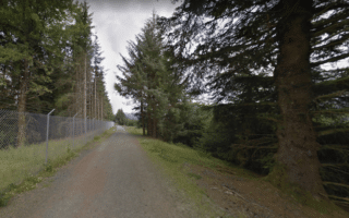
Moose Lake Trail. Google Street View
Lake Area Trails. There are several trails in the Tongass National Forest, an area of woods and lakes just west of Glacier Spur Rd. The trails are accessed from the US Forest Ranger Station off Mendenhall Loop Rd. Most of the trails are wooded, though there are some open spots and lake views. The surface is a combination of narrow dirt and glacial gravel. Create your own route, combining the Dredge Lake Trail, Moose Lake Trail, & Moraine Ecology Trail. Note: trail conditions vary in season & weather.
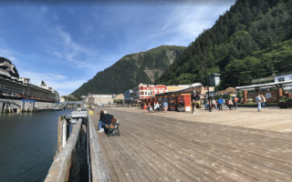
Scenic waterfront path with great views of the channel, Mount Juneau, and surrounding mountains. Combine Aurora Harbor Way & Seawalk for 2.5 miles. Can add Douglas Bridge & Egan Dr. for more.
Our recommendation of some of the easier trails for running in Juneau: Mendenhall Refuge Trail, Kaxdigoowu Heen Dei Trail, Trails Around Mendenhall Glacier, & trails in the Dredge Lakes Area.
The 3,819-ft Mount Roberts is one of the signature features of Juneau. There are some moderate to very challenging trail running options here. Can also take a tram to the summit and run/hike along the ridge.
Share your feedback on this route and see that of other Great Runs users. Click on the image icon to upload a photo. And please let us know if there are notes or changes we should incorporate!

Review or Comment on This Route/Share a Photo!
Share your feedback on this route and see that of other Great Runs users. Click on the image icon to upload a photo. And please let us know if there are notes or changes we should incorporate!