Features:
Categories:
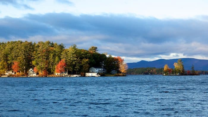
This 71 square mile lake massive lake, situated in the center of New Hampshire, is a favorite vacation spot, popular in summer for water activities, in fall for foliage viewing, and in winter for nordic skiing.
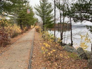
Wolfeboro Area. Two of our favorite spots for running in Lake Winnipesaukee are in the Wolfeboro area, on the eastern side of the lake. We love the Cotton Valley Rail Trail, which runs for 11 miles between Wolfeboro and Rt. 16 in Wakefield. The most ‘runnable’ part is 6.2 miles from downtown Wolfeboro to East Wolfeboro. A good 4 mile out and back is from Wolfeboro to Albee Beach, which has some water views on causeways along Lake Wentworth and Crescent Lake.
We also like the ‘Sewall Loop’ in Wolfeboro. It’s a nice 4-mile route on quiet roads, incorporating Sewall Rd., Forest St., and N.Main St. (Rt 109). There are nice views of the village, beaches, boats bobbing in Wolfeboro Harbor, and some grand homes bordering the lake. Some lake views. ROUTE MAP
Weirs Beach. On the western side of the lake, there’s some nice running at Weirs Beach. A short lakeside path leads to Endicott Rock State Historic Site. Then run along Scenic Rd. (note: no shoulder), and for a challenge, run up Soleil Mountain for some nice views (and a 400-foot climb!).
Gilford/Glendale. Just south of Weirs Beach. Using Gilford Beach as an anchor, run along Belknap Point Rd. to Lincoln Park, then do a jaunt out to Varney Point and then along Dockham Shore Rd., passing the Winnipesaukee Yacht Club.
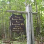
Laconia: WOW Trail & Winnisquam Scenic Trail. The WOW Trail is a favorite in the Winnepesaukee region. The paved rail-trail follows the active corridor of the Winnepesaukee Railroad through the towns of Laconia and Lakeport. It’s a nice tour of downtown with a few good water views. You can then connect to the Winnisquam Scenic Trail in Belmont, which goes along Lake Winnisquam, which is New Hampshire’s fourth largest lake. TRAIL INFORMATION. TRAIL MAP
Winnipesaukee River Trail. Here’s a rail-trail that makes for a nice run just off I-93 between Tilton and Franklin. The trail runs along the Winnipesaukee River, mainly wooded, surface a combination of paved and crushed stone/dirt/gravel. It’s 4.8 miles one-way, and fairly flat. TRAIL INORMATION ROUTE MAP


Comment on this Route/Share a Photo!
Share your feedback on this route and see that of other Great Runs users. Click on the image icon to upload a photo. And please let us know if there are notes or changes we should incorporate!