Google Street View
Features:
Categories:
This route follows the section of the Lansing River Trail headed south. Starting south of I-496 (just south of downtown) at the confluence of the Grand River and Red Cedar River, this paved multi-use path runs for 4.7 miles south to E Jolly Rd.
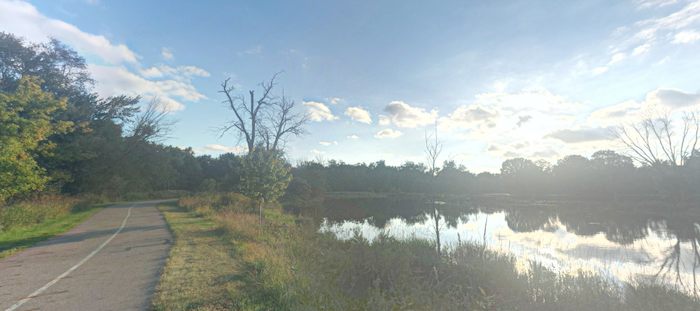
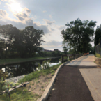
Starting at River Point Park, the first 1.7 miles follows the Red Cedar River east, overlapping with our east-west route. At N Aurelius Rd., the trail turns south, following Sycamore Creek, passing through Scott Woods Park. This section is mainly wooded. At 3.2 miles, you’ll enter Hawk Island Park, with Lansing River Trail paths on both sides of the lake (a lake loop is 1.5 miles). The final section is 0.7 miles south of Hawk Island Park to E Jolly Rd.
- At the northern end, can add with our 5-mile Lansing River Trail route between Moores Park & MSU
- BIG LOOP: Just south of E Jolly R., the S Lansing Pathway heads is a paved multi-use path that runs for 4.5 miles west to S Waverly Rd. Ambitious runners can do a 15.5 mile loop combining these sections of the Lansing River Trail, with a few road sections.
- Can also access the Fenner Nature Ctr. off E Mt Hope Ave., for 4 miles of nice trail running.
Essentials
- Up to 4.7 miles (7.5 km) one-way, between River Point Park and E Jolly Rd.
- Fairly flat
- North End: River Point Park. Or, a N Aurelius Rd.
- See trail map for parking information

Comment on this Route/Share a Photo!
Share your feedback on this route and see that of other Great Runs users. Click on the image icon to upload a photo. And please let us know if there are notes or changes we should incorporate!