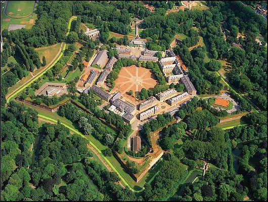
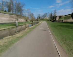
The Citadelle de Lille, is the fortified city wall designed by Sébastien Vauban between 1667 and 1670. Now a city park, it’s a centerpiece of Lille and a great place for a run. It’s fun to at least do a loop of the three main perimeter paths — sort of an inner, middle, and outer loop, which added together are nearly 10k! They’re almost like long running tracks. The terrain is mainly open, and there are great views from the higher paths. The inner path around the moat is the Voie des Combatants, and clocks in at nearly 2 km. The middle loop is the 2.6 km Allée du Train de Loos. The outer perimeter is ~4 km, and follows the Deûle River and a smaller canal on the east side. At the eastern end of the Citadelle, the Esplanade Champ de Mars, a major gathering spot for events in Lille.
From the outer loop, we also recommend adding in the ~1 km of paths around the gorgeously landscaped Jardin Vauban, a classic English garden created in 1863.
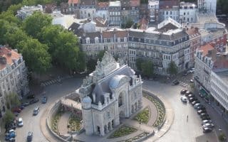
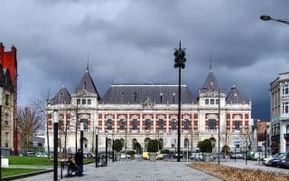
A great way to explore the city's highlights on a run. Our mapped route covers many of the main sites of the city center and the historic old city. Spectacular buildings, impressive squares, Botanic Gardens, Parc Henri Matisse. Options for shorter and longer.
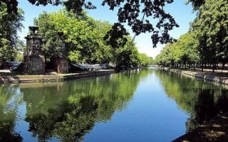
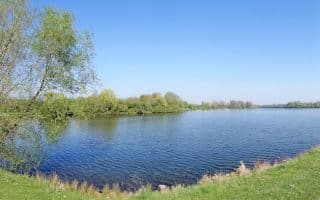
Lovely paths along the Deûle river and canals in central Lille. Our 8.5 km loop showcases the paths south of the Citadelle around the Quai de l'Ouest, with great views of the water and Vieux Lille. Can extend for 2.5 km north of the Citadelle to the D48.
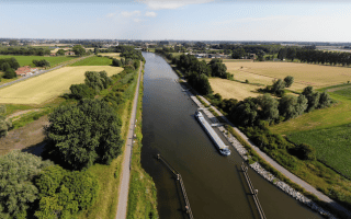
A pleasant run along the Deûle River headed north from Lille. A gravel path along the east side of the river goes for many, many km, as far as the Belgian border and beyond. We've mapped up to 10.2 km. Some nice water views, and an increasingly pastoral landscape.
A terrific route a few km east of Lille, combining the city's largest park, path to a 17th century Château, and the fields and running track at the Stadium Lille Métropole complex.
Roubaix is part of the greater Lille area and has some nice running routes. Best bets fir running are the linear Parc Barbieux, paths along the Quai that continue for many km east along the Canal de l‘Espierres, and long-distance paths along the Leie River.
Share your feedback on this route and see that of other Great Runs users. Click on the image icon to upload a photo. And please let us know if there are notes or changes we should incorporate!
Subscribe
0 Comments
Oldest
Newest
Inline Feedbacks
View all comments
Essentials
Doing the inner/middle/outer loops adds up to 9.4 km (5.8 miles) with options for more
31m (102 feet)
Anywhere one enters the Citadelle
Rue Léonard Danel is a good access street to the Citadelle from central Lille

Review or Comment on This Route/Share a Photo!
Share your feedback on this route and see that of other Great Runs users. Click on the image icon to upload a photo. And please let us know if there are notes or changes we should incorporate!