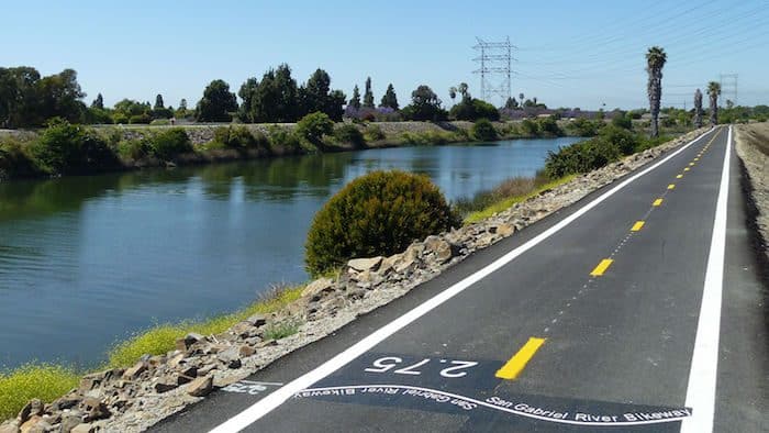
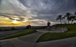
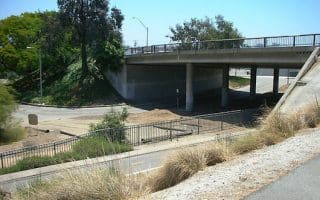
This is an opportunity to put together a long, straightforward run through a series of parks that form a linear park, connected by the San Gabriel River Trail. Our map serves as a guideline for a route that stretches for 8+ miles, from El Dorado East Regional Park, and heading north to Bellflower. Use the river trail as the base to explore this series of parks. Along the way, there are numerous sports & fitness facilities. The River Trail itself is a popular, paved multi-use trail runs for 28 miles from Seal Beach to Azusa, just south of the San Gabriel Mountains/Angeles National Forest. There are mile markers.
Flickr: Jennifer Arrow
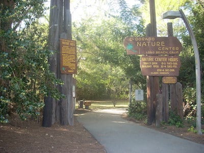
Start at El Dorado East Regional Park, which is ~5 miles north of the trail’s southern terminus at Seal Beach. There are numerous trails, bike paths, and fields that you can explore. It’s about 4 miles from the south to north end of the parks — so this can be its own self-contained route! To extend, use the River Trail to cross E. Carson St., into Rynerson Park/Monte Verde Park (40 acres of open space). Here, you can continue through the park for ~1 mile north to Del Almo Blvd. [Option here: head west along 2+ miles of trails through Heartwell Park to Veterans Stadium.] At Del Almo, continue into Liberty Park and Fitness Center for another ~1 mile to South St. This would be a good spot to stop or turn around, but you can continue along the River Trail for another 1.5+ miles to Bellflower City Park, and even further along the River Trail. Note, the terrain starts gaining elevation north of Liberty Park.
This is an opportunity to put together a long, straightforward run through a series of parks that form a linear park, connected by the San Gabriel River Trail. Our map serves as a guideline for a route that stretches for 8+ miles, from El Dorado East Regional Park, and heading north to Bellflower. Use the river trail as the base to explore this series of parks. Along the way, there are numerous sports & fitness facilities. The River Trail itself is a popular, paved multi-use trail runs for 28 miles from Seal Beach to Azusa, just south of the San Gabriel Mountains/Angeles National Forest. There are mile markers.
Flickr: Jennifer Arrow
Start at El Dorado East Regional Park, which is ~5 miles north of the trail’s southern terminus at Seal Beach. There are numerous trails, bike paths, and fields that you can explore. It’s about 4 miles from the south to north end of the parks — so this can be its own self-contained route! To extend, use the River Trail to cross E. Carson St., into Rynerson Park/Monte Verde Park (40 acres of open space). Here, you can continue through the park for ~1 mile north to Del Almo Blvd. [Option here: head west along 2+ miles of trails through Heartwell Park to Veterans Stadium.] At Del Almo, continue into Liberty Park and Fitness Center for another ~1 mile to South St. This would be a good spot to stop or turn around, but you can continue along the River Trail for another 1.5+ miles to Bellflower City Park, and even further along the River Trail. Note, the terrain starts gaining elevation north of Liberty Park.
Scroll Down For Route Maps
Essentials
Up to 8.6 miles one-way, but many options to vary/add on to the route. Use map as anchor
Fairly flat
Closest to Long Beach is El Dorado Park
The numerous parks are good access points and have parking
A wonderful series of paved paths along the water, running from the Aquarium in Long Beach for 7+ miles south to the Peninsula in Belmont Shore. Great water views, passing Shoreline Village, Marina Green, Junipero Beach, & more. Beach also runnable.
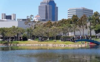
A pleasant 5-mile loop around downtown Long Beach. Includes a couple of nice parks, a lagoon, and a loop around the marina. Nearly all off-road. Highlights: Rainbow Lagoon Park, Promenade Square, Shoreline Aquatic Park. Easy add-ons.
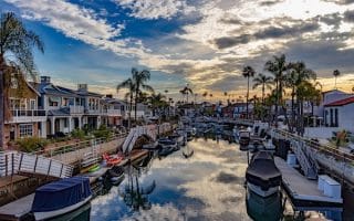
A very scenic run in the Seal Beach and and Naples areas, consisting of numerous paths along Alamitos Bay and around the Marina. If you like boats, this is an especially nice run! Full loop is nearly 10 miles, but good options to shorten/lengthen.
A couple of miles inland in the Signal Hill area, there's a series of small parks with hilly trails leading to panoramas with great views. We recommend doing this run near sunset! Includes the adjacent Signal Hill Park, Hilltop Park, Discovery Well Park, Sunset Park.
A wonderful series of paved paths along the water, running from the Aquarium in Long Beach for 7+ miles south to the Peninsula in Belmont Shore. Great water views, passing Shoreline Village, Marina Green, Junipero Beach, & more. Beach also runnable.
Share your feedback on this route and see that of other Great Runs users. Click on the image icon to upload a photo. And please let us know if there are notes or changes we should incorporate!
Subscribe
0 Comments
Oldest
Newest
Inline Feedbacks
View all comments
Essentials
Up to 8.6 miles one-way, but many options to vary/add on to the route. Use map as anchor
Fairly flat
Closest to Long Beach is El Dorado Park
The numerous parks are good access points and have parking


Review or Comment on This Route/Share a Photo!
Share your feedback on this route and see that of other Great Runs users. Click on the image icon to upload a photo. And please let us know if there are notes or changes we should incorporate!