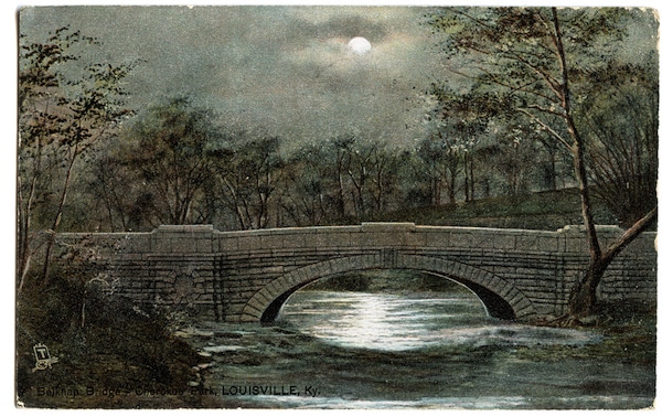
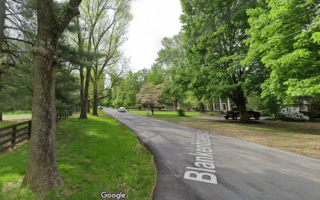
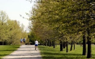
These are two adjoining parks, among the five in Louisville designed by Frederick Law Olmsted. The running highlight of popular Cherokee Park is the ‘Scenic Route’, a 2.4 mile long path through the center of the park. This loop shows off Cherokee Park’s scenic rolling hills, open meadows, and woodlands. The path features separate lanes for vehicle traffic and recreational users. Those looking to lengthen this loop can add in Baringer Path (0.6 miles) or Willow Pond Path (1/3 mile).
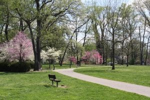
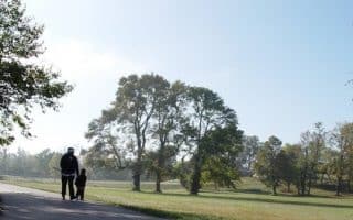
For a longer run, combine with 520 acre Seneca Park, which has a 1.2 mile walking path (called ‘Scenic Loop’) and a 3.1 mile cross country path. There’s also a golf course, and facilities for many other activities. Also nearby is Rock Creek, where you can run another few km on grass.
The area connecting Seneca park to Cherokee Park is also nice for running. From Seneca Park, it’s 1.5 miles, along the parklike Seneca Park Rd. and Beargrass Rd.
Add-On: Beargrass Creek Greenway, just east of Cherokee Park, runs for 1.5 miles east of Cherokee Park, paralleling I-64.
These are two adjoining parks, among the five in Louisville designed by Frederick Law Olmsted. The running highlight of popular Cherokee Park is the ‘Scenic Route’, a 2.4 mile long path through the center of the park. This loop shows off Cherokee Park’s scenic rolling hills, open meadows, and woodlands. The path features separate lanes for vehicle traffic and recreational users. Those looking to lengthen this loop can add in Baringer Path (0.6 miles) or Willow Pond Path (1/3 mile).
For a longer run, combine with 520 acre Seneca Park, which has a 1.2 mile walking path (called ‘Scenic Loop’) and a 3.1 mile cross country path. There’s also a golf course, and facilities for many other activities. Also nearby is Rock Creek, where you can run another few km on grass.
The area connecting Seneca park to Cherokee Park is also nice for running. From Seneca Park, it’s 1.5 miles, along the parklike Seneca Park Rd. and Beargrass Rd.
Add-On: Beargrass Creek Greenway, just east of Cherokee Park, runs for 1.5 miles east of Cherokee Park, paralleling I-64.
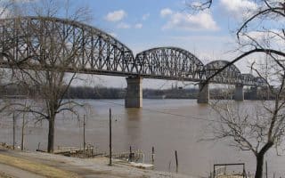
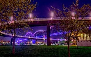
There's 10+ miles of running along the Ohio River! Mostly on pleasant dedicated paths through parks, with great views. Paths on the Kentucky Side are ~7 miles, and 1.7 miles on the Indiana. The 2-mile Big Four Bridge is a spectacular run in and of itself.
From Louisville to Jeffersonville and back over Big Four Bridge, this run offers 2 miles of amazing city and river views and a display of Louisville’s more entertaining side.
For some attractive residential neighborhood running in Louisville, we recommend the Indian Hills neighborhood. This area of tree-lined streets graced by attractive homes is south of the Ohio River, adjacent to the Louisville Country Club.
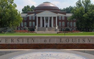
This 2.4 mile loop tours the country’s first city-owned public university. The University of Louisville is a university of many medical firsts, and a great place for some run-seeing. Or you can do a DIY running tour.
This park has more to offer than just tennis courts! There are 3.1 miles of trails Beargrass Creek State Nature. popular with cross country runners, and a 1.5 mile paved multi-used path.
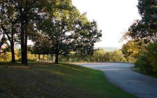
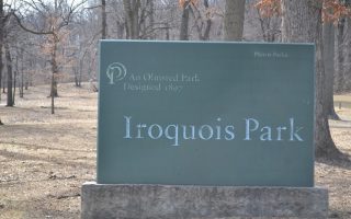
Designed by Frederick Law Olmsted as “Louisville’s Yellowstone”, Iriquois Park was planned to be a scenic reservation of forested hillside and vista views. There are several miles of trails and wonderful views of the city from the summit.
A 3.6 mile loop through a quiet Louisville neighborhood. This loop begins at Iroquois Park and explores a surrounding neighborhood for a peaceful long run. For a longer run, or as part of this, enjoy Iroquois Park.
Activity-filled, 550-acre urban park 14 miles east of downtown with trails, birding, a pool, an archery range & more. The 1.25 mile Goose Creek Trail is the most scenic of the park's three trails. A signed 5k loop is also popular with runners.
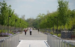
A 19-mile greenway connecting four parks, part of the 'Louisville Loop'. The area is 20 miles west of downtown. Great combination of woods, meadows, lawns, parks. The Humana Grand Allee is among the best sections for running.
Share your feedback on this route and see that of other Great Runs users. Click on the image icon to upload a photo. And please let us know if there are notes or changes we should incorporate!
 For a longer run, combine with 520 acre Seneca Park, which has a 1.2 mile walking path (called ‘Scenic Loop’) and a 3.1 mile cross country path. There’s also a golf course, and facilities for many other activities. Also nearby is Rock Creek, where you can run another few km on grass.
Review or Comment on This Route/Share a Photo!
Share your feedback on this route and see that of other Great Runs users. Click on the image icon to upload a photo. And please let us know if there are notes or changes we should incorporate!