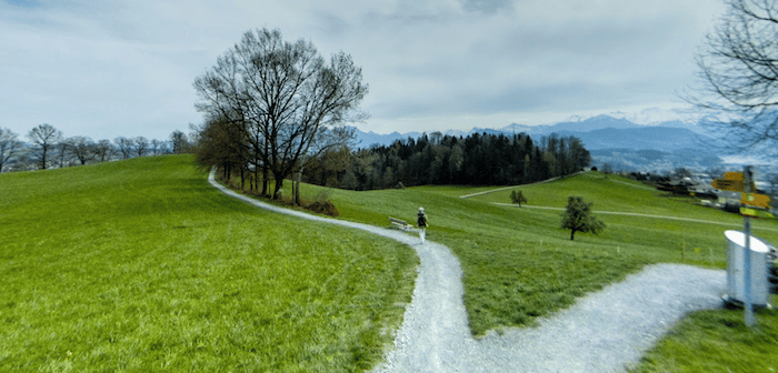
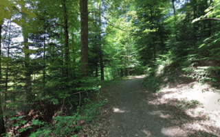
The Kriens paths are a wonderful opportunity to do some scenic and hilly running through farm fields, just west of Lucerne. There are several paths and runnable roads in this area, part of it in the Wolfsschlucht nature preserve. The main, ‘yellow’ path (Helsana Trail) is a well-marked 9 km loop, There are shorter loops (‘green’ path), with many options to create your own distance. The area’s small roads are also generally quiet and very pleasant for running. Use the incline railway stations between Sonnenberg and Kriends as an anchor. Note: very hilly!
Note that the main route is very hilly. If you’d prefer less elevation, just run on some of the more ‘diagonal’ paths or along some of the (relatively) flatter roads in the area.
Add-On: Combine with the hilly, wooded paths of the Gütschwald, just to the east. See our route there. A lovely, “woods farms, and fields’ route combining the Kriens and Gütschwald paths would be a running pleasure of 10-15 hilly km!


Review or Comment on This Route/Share a Photo!
Share your feedback on this route and see that of other Great Runs users. Click on the image icon to upload a photo. And please let us know if there are notes or changes we should incorporate!