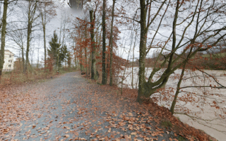
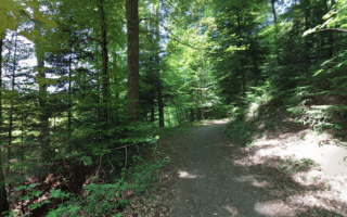
Just west of Lucerne, there’s some lovely, hilly running on paths through the Gütschwald (woods). There are numerous paths through these woods. We’ve mapped the main one a nearly 5 km out and back, but you can also create your own preferred route. The surface is gravel/dirt surface with generally good footing. Note: very hilly — 150m elevation gain, with steep grades!
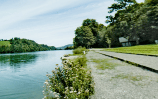
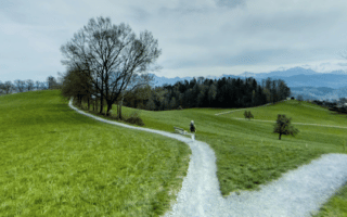
Add-On: We highly recommend combining the Gütschwald with the Kriens Path just to the west. This pastoral path is more open, winding around farm fields, with nice views of the valley below. The main, ‘yellow’ path is a well-marked 9 km loop, part of it in the Wolfsschlucht nature preserve. There are shorter loops (‘green’ path), with many options to create your own distance. Use the incline railway stations between Sonnenberg and Kriends as an anchor.
Just west of Lucerne, there’s some lovely, hilly running on paths through the Gütschwald (woods). There are numerous paths through these woods. We’ve mapped the main one a nearly 5 km out and back, but you can also create your own preferred route. The surface is gravel/dirt surface with generally good footing. Note: very hilly — 150m elevation gain, with steep grades!
Add-On: We highly recommend combining the Gütschwald with the Kriens Path just to the west. This pastoral path is more open, winding around farm fields, with nice views of the valley below. The main, ‘yellow’ path is a well-marked 9 km loop, part of it in the Wolfsschlucht nature preserve. There are shorter loops (‘green’ path), with many options to create your own distance. Use the incline railway stations between Sonnenberg and Kriends as an anchor.


Review or Comment on This Route/Share a Photo!
Share your feedback on this route and see that of other Great Runs users. Click on the image icon to upload a photo. And please let us know if there are notes or changes we should incorporate!