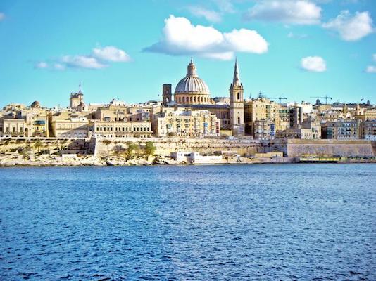
This is a ‘runseeing’ tour of Valletta, the capital of Malta — a small walled city established on a peninsula in the 1500s. There are a few ways of seeing Valletta on foot, which can be combined in various ways. The heart of the city is inside Great Siege Rd. Inside the old city walls it’s largely pedestrianized. Note: the old city has narrow streets and can get crowded — good to go early!
Waterfront. Creative Commons
Waterfront Route Outside The City Walls. There’s a~5 km of waterfront running in Valletta, below the city walls on the west and east sides of the peninsula. Basically, stay on the combination road/waterfront path: on the east side, it’s along Quarry Wharf to the St. Elmo’s Bridge path, out to the Breakwater Pier, and then loop around to the west side, following Boat St., as far as the Sliema Ferry terminal.
Creative Commons: Mstyslav Chernov
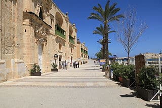
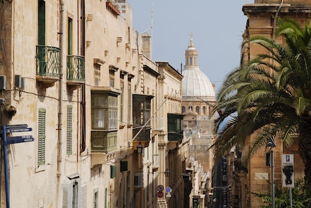
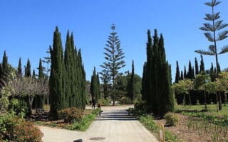
Inside the City Walls. Start at Triton Fountain, and run through the City Gate. Then, do the short section along the Hastings Garden, a park on top of the city walls, and then create your own route through the Old City. Use Republic St. as the anchor, which will take you by the important sites of Saint-John’s Cathedral, St. George’s Square, Grandmaster Palace, Republic Square, and the Casa Rocca Piccola palace, ending at St. Elmo Heritage building. It’s 1.6 km from Triton Fountain through the old city to St. Elmo. Here, you can run on additional streets in the old city or join the waterfront paths.
Combo Route: Our mapped 9.2 km route does a straight shot through the Old City, then the east side waterfront (lower Quarry Wharh and upper Gardens), then looping around to the west side along Boat St.
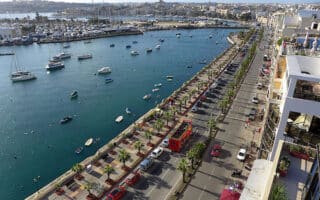
Add-Ons: Enjoy the waterfront promenade, which starts at Sa Maison Ferry Terminal and heads north for up to 13 km through Sliema, Pieta, Gazira, and St. Julian’s
This is a ‘runseeing’ tour of Valletta, the capital of Malta — a small walled city established on a peninsula in the 1500s. There are a few ways of seeing Valletta on foot, which can be combined in various ways. The heart of the city is inside Great Siege Rd. Inside the old city walls it’s largely pedestrianized. Note: the old city has narrow streets and can get crowded — good to go early!
Waterfront. Creative Commons
Waterfront Route Outside The City Walls. There’s a~5 km of waterfront running in Valletta, below the city walls on the west and east sides of the peninsula. Basically, stay on the combination road/waterfront path: on the east side, it’s along Quarry Wharf to the St. Elmo’s Bridge path, out to the Breakwater Pier, and then loop around to the west side, following Boat St., as far as the Sliema Ferry terminal.
Creative Commons: Mstyslav Chernov
Inside the City Walls. Start at Triton Fountain, and run through the City Gate. Then, do the short section along the Hastings Garden, a park on top of the city walls, and then create your own route through the Old City. Use Republic St. as the anchor, which will take you by the important sites of Saint-John’s Cathedral, St. George’s Square, Grandmaster Palace, Republic Square, and the Casa Rocca Piccola palace, ending at St. Elmo Heritage building. It’s 1.6 km from Triton Fountain through the old city to St. Elmo. Here, you can run on additional streets in the old city or join the waterfront paths.
Combo Route: Our mapped 9.2 km route does a straight shot through the Old City, then the east side waterfront (lower Quarry Wharh and upper Gardens), then looping around to the west side along Boat St.
Add-Ons: Enjoy the waterfront promenade, which starts at Sa Maison Ferry Terminal and heads north for up to 13 km through Sliema, Pieta, Gazira, and St. Julian’s
Scroll Down For Route Maps
Essentials
Combo Tour: 9.2 km (5.7 miles). Waterfront route of up to 7 km.
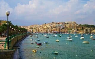
Scenic waterfront running between the capital of Valetta and Paceville on a combination of sidewalk and dedicated seafront promenade, winding its way for nearly around bays and marinas for 13 km through Sliema and St. Julian's.
Nice waterfront running between Xemxija Bay and Pembroke, including St. Paul's Bay, Qawra, and Salina Bay. Up to 12 km, part on dedicated promenade and part on sidewalk alongside the coast road.
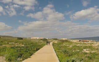
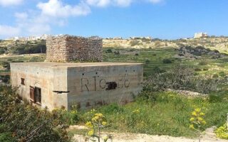
A unique running experience: run on an old Roman Road, passing by numerous archaeological sites. Part of a longer trail run that's up an 11.5 km loop across the island, passing numerous additional historical spots.
Toward the southeast end of the island, there's a nice waterfront run between Marsascala and St. Thomas Bay. The route is on a a dedicated, palm-lined waterfront path. A neat 5-miler out and back, with great views!
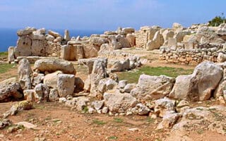
A terrific 'runseeing' tour of several historical sites at the southern end of Malta, including the Blue Grotto and Haġar Qim. Also some great coastal views. It's nearly all on roads with good sidewalks.
In central Malta, enjoy 2-3 km of paths in Ta' Qali National Park. For a longer run, head for 2 km west to see historical sites in Mdina, which include the Mdina Cathedral, Palazzo Falson, and St Paul’s Catacombs.
Share your feedback on this route and see that of other Great Runs users. Click on the image icon to upload a photo. And please let us know if there are notes or changes we should incorporate!
Subscribe
0 Comments
Oldest
Newest
Inline Feedbacks
View all comments
Essentials
Combo Tour: 9.2 km (5.7 miles). Waterfront route of up to 7 km.

Review or Comment on This Route/Share a Photo!
Share your feedback on this route and see that of other Great Runs users. Click on the image icon to upload a photo. And please let us know if there are notes or changes we should incorporate!