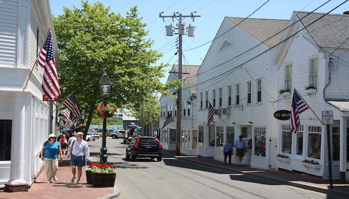
Edgartown is the largest village on Martha’s Vineyard and is its historic and tony center. Historic captains’ homes along the water, tree-lined side streets with quaint homes and inns, a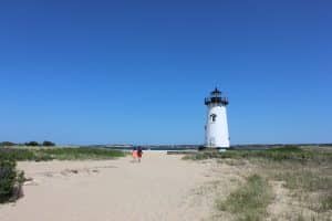 nd a vibrant commercial center make for an enjoyable run. This is a quick running tour of Edgartown.
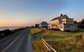
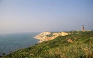
 Rather than proscribe a particular route, we suggest starting at any point in Edgartown and develop your own. A highlight is the ~1 mile along N. Water St. to the end of Starbuck Neck Rd., including the sandy path to the Lighthouse, with water views and homes built by whaling captains. Then, enjoy some of the leafy side-streets, such as Summer St., School St., (about 0.6 miles each), Morse St., and Cooke St., staying inside Peases Point Way. Main St. is enjoyable for running if you go early to beat the crowds. Doing N. Water St, and then a bunch of the side streets can easily add up to ~5 miles without much overlap.
Add-ons: Katama Road, toward South Beach, has a good bike path. Not hugely scenic but wide-open.
Review or Comment on This Route/Share a Photo!
Share your feedback on this route and see that of other Great Runs users. Click on the image icon to upload a photo. And please let us know if there are notes or changes we should incorporate!