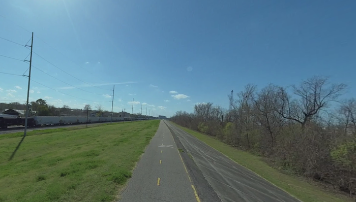
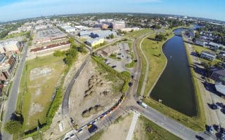
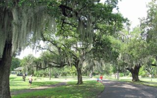
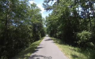
The Mississippi River Trail, also known as The Levee Path, is a pavedmulti-use path atop the Mississippi River levee. It’s a good opportunity for those looking for a flat, easy, uninterrupted off-road run. There are two sections, not contiguous. The trail can be somewhat monotonous. While it runs along the Mississippi River, one cannot see the water along most of the trail. NOTE: This trail is open and exposed, and it can be windy. There’s little in the way of facilities.
Audubon Park to St. Charles Parish
This sections runs along the east bank of the river from near Audubon Park in western New Orleans west to the Bonnet Carré Spillway in St. Charles Parish, where the Mississippi and Lake Ponchartrain intersect. At Audubon Park, access to the Levee is via The Fly — a strip of frontage behind the Audubon Zoo that comes off West Drive/River Drive. Run west for as many miles as you like. Kenner is at about the half-way point.
Algiers Point Area
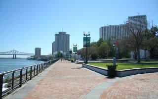
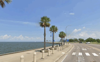
This section of the Levee path runs along the west bank of the Mississippi in the Algiers Point area. It’s directly across from the Audubon Aquarium, and reachable via a short ferry ride from Canal St. station. The Algiers Point neighborhood is a fun mix of homey pubs, small art galleries, and quaint Creole cottages. At Algiers Point itself, there are great views of the river, Jackson Square, and the New Orleans skyline. There’s also the Jazz Walk of Fame.
This section of the Mississippi River Trail runs is up to 9 miles. From the Algiers Point ferry, it’s 2.7 miles south to Huey Long Ave. in Gretna, or 6.3 miles northeast to the US Army Corps of Engineers Algiers Lock.
The Mississippi River Trail, also known as The Levee Path, is a pavedmulti-use path atop the Mississippi River levee. It’s a good opportunity for those looking for a flat, easy, uninterrupted off-road run. There are two sections, not contiguous. The trail can be somewhat monotonous. While it runs along the Mississippi River, one cannot see the water along most of the trail. NOTE: This trail is open and exposed, and it can be windy. There’s little in the way of facilities.
Audubon Park to St. Charles Parish
This sections runs along the east bank of the river from near Audubon Park in western New Orleans west to the Bonnet Carré Spillway in St. Charles Parish, where the Mississippi and Lake Ponchartrain intersect. At Audubon Park, access to the Levee is via The Fly — a strip of frontage behind the Audubon Zoo that comes off West Drive/River Drive. Run west for as many miles as you like. Kenner is at about the half-way point.
Algiers Point Area
This section of the Levee path runs along the west bank of the Mississippi in the Algiers Point area. It’s directly across from the Audubon Aquarium, and reachable via a short ferry ride from Canal St. station. The Algiers Point neighborhood is a fun mix of homey pubs, small art galleries, and quaint Creole cottages. At Algiers Point itself, there are great views of the river, Jackson Square, and the New Orleans skyline. There’s also the Jazz Walk of Fame.
This section of the Mississippi River Trail runs is up to 9 miles. From the Algiers Point ferry, it’s 2.7 miles south to Huey Long Ave. in Gretna, or 6.3 miles northeast to the US Army Corps of Engineers Algiers Lock.


Review or Comment on This Route/Share a Photo!
Share your feedback on this route and see that of other Great Runs users. Click on the image icon to upload a photo. And please let us know if there are notes or changes we should incorporate!