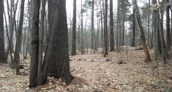
Whitaker Woods is a great low-key trail run for anyone stationed near downtown North Conway who doesn’t want to venture too far into the forest. The area is a 300+ acre former farm with a network of some 45 kilometers of criss-crossing trails. The trail is scenic, well maintained, the terrain is varied, and it’s not overly strenuous. As far as trail goes it’s well maintained. This relatively flat three mile loop is a prime location to spot wildflowers in the warmer months, and home of the “Snowshoe Scramble” race every January. Because of their location down in the valley, these shady trails can be prone to mud in spring, but stay tuned — in 2014, town officials began discussions to pave this locally popular route. Park on either side of the park, about 5 minutes outside of North Conway village. Head out the Powerline Trail until you hit the Gradual Trail, head South on the Bancroft Loop, and return via the Fuller Trail. For a longer route, there are several cross trails that will extend your run in any direction. We’ve included a map of their X-C skiing trails.
Features:
Categories:
Scroll Down For Route Maps
Essentials
- 3 miles, with longer & shorter options - 40 km of trails
- 143 feet
- Kearsarge Road Trailhead or White Mountain Highway Trailhead
- Park on either side of the park, at one of the trailheads
Current Weather & Forecast
Location Weather
Please set your valid city name and country code.
Other Routes in North Conway Area, NH
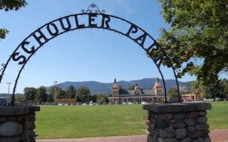
A pleasant tour of the North Conway area, with a section along Main St., and then some of the perimeter, out Kearsarge Road to the village of Intervale, then looping back. Good opportunity to get an overview of area.
A favorite of the local running club The White Mountain Milers, the Pudding Pond trail is a quick and easy loop just outside of town which can be paired with a jaunt up Peaked Mountain for a longer run with views and elevation.
One of the best running spots in the White Mountains. The paved trail is 8.8 miles from Flume Gorge in the south to Skookumchuck & Rt. US 3 in the north, with an 800 foot elevation gain. Many sites & views along the way. Seasonal shuttle allows for one-way run!
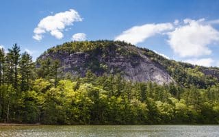
Echo Lake State Park – White Horse Ledge & West Side Rd.
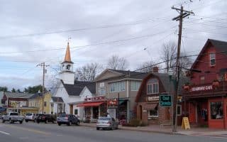
North Conway Area, NH
Good running options around Echo Lake Park. There's a pleasant perimeter path around a lake and a 1-mile auto road. White Horse Ledge is one of the signature trail runs in the North Conway area. West Side Rd. is another option.
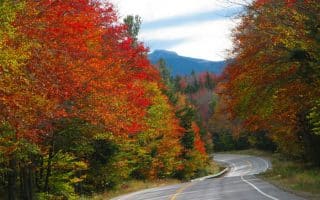
The “Kanc” spans 32 miles between Lincoln and Conway. The most spectacular views on the road itself are around the CL Graham/Wangan Grounds Scenic Overlook. We have a 5.6 mile out and back route, and a 2.8 mile loop. Hilly!

A gravel trail that runs 18 miles between Gorham and Whitefield. Great wildlife viewing, historic ruins, and panoramic views of Mts. Jefferson and Adams. Run any section! Or, we've mapped a 5.6 mile out and back taking in our favorite section.
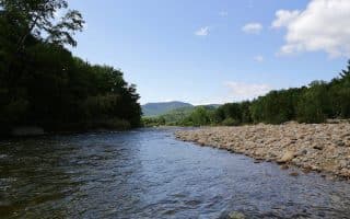
A flat and friendly pavement run with river views and a pleasant soundscape of bubbling brooks. We've mapped a 3 mile loop around the paved perimeter road of the campground.
For a longer tour de North Conway, the White Mountain Half Marathon has already mapped a challenging run through the well maintained paved highways that connects town to the scenic West Side Road.
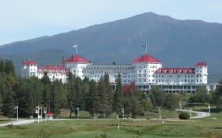
Running up the long driveway of this historic resort, with its red roof, wrap around porch, and extensive grounds, is a special treat. There are also more than 100 km of trails that are part of the resort, with lots of variety and great for running.
User Ratings
Leave A Review or Comment
Review or Comment on This Route/Share a Photo!
Share your feedback on this route and see that of other Great Runs users. Click on the image icon to upload a photo. And please let us know if there are notes or changes we should incorporate!