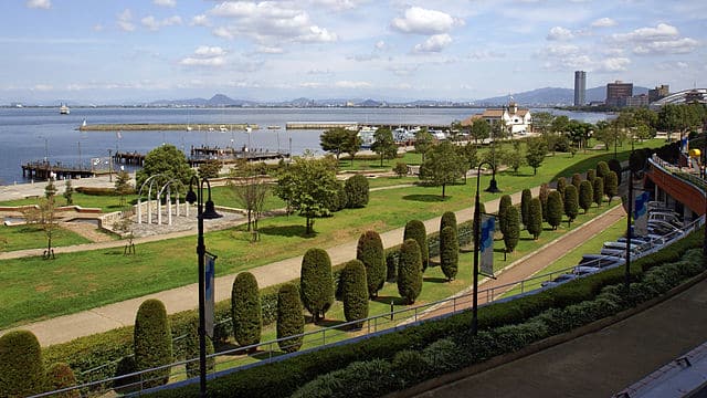
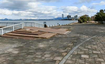
It’s a worth-it destination run to head to Otsu for a run along Lake Biwa — Japan’s largest lake! The capital of Shiga Prefecture, Otsu is a city of 500,000 located a 30-minute drive or train ride from Kyoto. The signature run is nearly 7 km along the western shore of Lake Biwa. It’s mainly on dedicated paths, with nice water views and passing through several parks.
Otsu Waterfront Path. Google Street View
Start centrally near the ferry terminal and head south, on wide, stone-surfaced boardwalk path. The first 2 km are through Hamaotsunagisa Park. You’ll then pass a waterfront museum, Biwako Hall performance center, continuing through a park, with open water views. Between kms 3.4-4.5 is Mizusaisei Center Okujo Park & Sunshine Beach. Continue past the bridge, with the final 2 km passing through Zeze Castle Site Park, through to the southern end of Ōtsu Kogan Nagisa Park.
Add-On: From the northern terminus of the run, you can run for 1 km northwest to the Ojiyama Sports Park, which features a terrific running track. Just north of there is Ojigaoka Park, a hilly city park with ~2 km of paths.
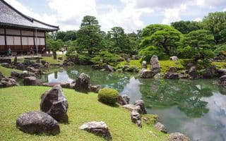
The National Garden grounds of the Imperial Palace are among the running highlights of Kyoto. Important sites and lovely paths around extensive gardens. 1.3 km from north-south and 0.7 km east-west.
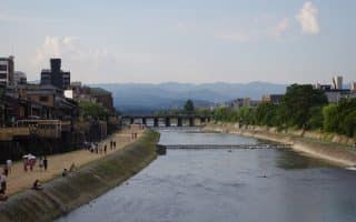
The signature running route in Kyoto, with many km of paths, both below the street at river grade and above the river. Several parks & landmarks along then way, & numerous bridges. We've mapped 11.7 km, pointing out the most pleasant sections.
Castle built in 1603 is one of the more popular visitor sites in Kyoto. It's also popular with runners. A loop around the perimeter is 1.8 km. For a longer run, our Imperial Palace and Kamo River path routes are ~1 km away.
Pleasant urban park tucked up against the base of the Higashiyama Mountain. A couple of km of paths going by numerous shrines. Some nice green spaces, small ponds, and very popular during cherry blossom season!
A great opportunity to get in some green space and hill running, fairly centrally located. There are numerous paths and stairs in this green space. There are two temples and the picturesque Yoshida Shrine.
One of the most important sites in Kyoto and a unique run. The shrine sits at the base of Mt. Inari, which has a 4 km hike to the top, through thousands of gates. This challenging trail run is a combination of path and stairs.
A large temple complex in northwestern Kyoto, which includes about 50 subtemples. The area has pleasant grounds that are usually quiet, making for pleasant running. Can also run to Ryoanji and Kinkakuji temples.
Share your feedback on this route and see that of other Great Runs users. Click on the image icon to upload a photo. And please let us know if there are notes or changes we should incorporate!


Review or Comment on This Route/Share a Photo!
Share your feedback on this route and see that of other Great Runs users. Click on the image icon to upload a photo. And please let us know if there are notes or changes we should incorporate!