The historic university city of Oxford is an idyllic place to explore on foot. There is a historic landmark or fascinating architectural site around almost every corner. We’ve mapped a 9 km “runseeing” tour around Oxford — it explores the grounds of the University, ventures into some of the city’s most opulent residential streets, and highlights the top tourist destinations downtown.
Directions:
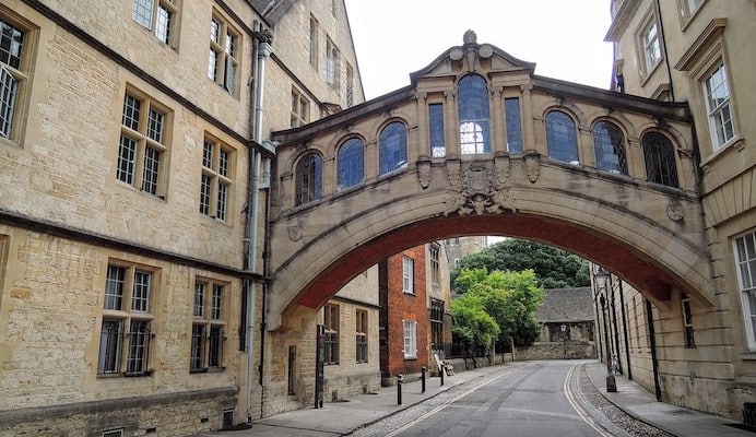
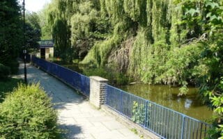
Our route starts near the Carfax Tower on High Street, then follows the Queen Street walkway west to the Oxford Castle and Prison. It meets the Castle Mill Street Path, then heads south to the River Thames. Follow the river paths east to Christ Church Meadow, to see Christ Church and the Tom Tower. Use Broad Walk to meet the Oxford Botanical Gardens, and cut through to see the Magdalene Bridge. Then, head back west on High Street until it meets Catte Street, which turns right into the Oxford University campus. Pass the Church of St. Mary the Virgin, the Radcliffe Camera, and the Bodleian Library. Take a quick right after the library to see the Bridge of Sighs, then exit the campus on Parks Road. Parks Road leads past the Museum of Natural History and the University Parks before reaching the scenic Park Town and North Oxford neighborhoods. Our tour explores some of the best residential streets, including Bradmore, Crick, Chadlington, Linton, and Northmoor (site of JRR Tolkien’s house). Finally, head south along A4144 past Martyrs Memorial and back to the center of the city.
The historic university city of Oxford is an idyllic place to explore on foot. There is a historic landmark or fascinating architectural site around almost every corner. We’ve mapped a 9 km “runseeing” tour around Oxford — it explores the grounds of the University, ventures into some of the city’s most opulent residential streets, and highlights the top tourist destinations downtown.
Directions:
Our route starts near the Carfax Tower on High Street, then follows the Queen Street walkway west to the Oxford Castle and Prison. It meets the Castle Mill Street Path, then heads south to the River Thames. Follow the river paths east to Christ Church Meadow, to see Christ Church and the Tom Tower. Use Broad Walk to meet the Oxford Botanical Gardens, and cut through to see the Magdalene Bridge. Then, head back west on High Street until it meets Catte Street, which turns right into the Oxford University campus. Pass the Church of St. Mary the Virgin, the Radcliffe Camera, and the Bodleian Library. Take a quick right after the library to see the Bridge of Sighs, then exit the campus on Parks Road. Parks Road leads past the Museum of Natural History and the University Parks before reaching the scenic Park Town and North Oxford neighborhoods. Our tour explores some of the best residential streets, including Bradmore, Crick, Chadlington, Linton, and Northmoor (site of JRR Tolkien’s house). Finally, head south along A4144 past Martyrs Memorial and back to the center of the city.


Review or Comment on This Route/Share a Photo!
Share your feedback on this route and see that of other Great Runs users. Click on the image icon to upload a photo. And please let us know if there are notes or changes we should incorporate!