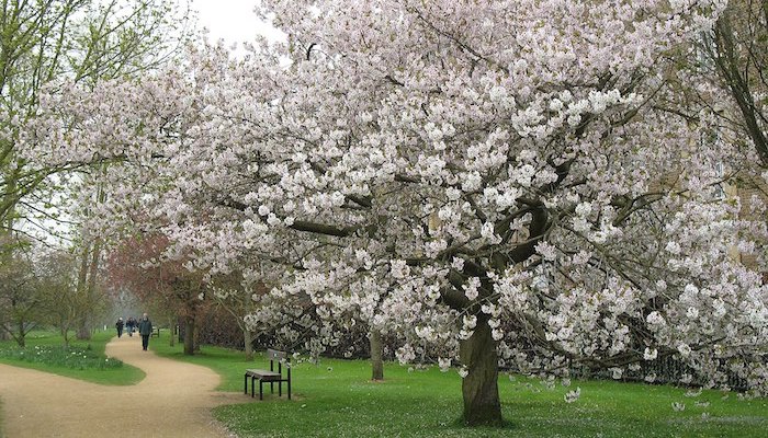
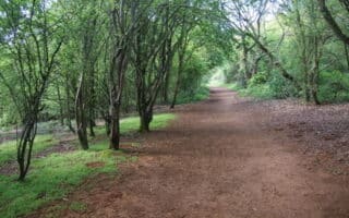
A rich selection of paths winds through the parks just east of Oxford University, in the green space surrounding the River Cherwell. These areas, though commonly referred to as the “University Parks,” also include The Oxford Botanical Gardens, The Water Meadow, and The Grove. We’ve mapped a 6.1 km loop around the area, but there are plenty options to vary, add on, or create your own route. Runners can easily add on a loop of Christ Church Meadow, or use Iffley Road, Jackdaw Lane, then Meadow Lane to connect to Aston’s Eyot, and The Kidneys.
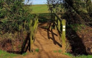
Another great asset in this area is the Marston Ferry Cycling Path, a pleasant paved lane beginning at the intersection of Oxford Road and Cherwell Drive. The path winds northwest along B4495, then crosses the Cherwell River before ending near The Cherwell School. All the sidewalks in this area are wide and runnable, so it’s possible to continue in almost any direction. We’ve mapped a 6.4 km loop that connects Marston Ferry with the University Parks. Runners could also turn LEFT at the River Cherwell Bridge and follow the towpath back to High Bridge. Note: the Cycling path is prone to flooding. Check for condition updates here.
A rich selection of paths winds through the parks just east of Oxford University, in the green space surrounding the River Cherwell. These areas, though commonly referred to as the “University Parks,” also include The Oxford Botanical Gardens, The Water Meadow, and The Grove. We’ve mapped a 6.1 km loop around the area, but there are plenty options to vary, add on, or create your own route. Runners can easily add on a loop of Christ Church Meadow, or use Iffley Road, Jackdaw Lane, then Meadow Lane to connect to Aston’s Eyot, and The Kidneys.
Another great asset in this area is the Marston Ferry Cycling Path, a pleasant paved lane beginning at the intersection of Oxford Road and Cherwell Drive. The path winds northwest along B4495, then crosses the Cherwell River before ending near The Cherwell School. All the sidewalks in this area are wide and runnable, so it’s possible to continue in almost any direction. We’ve mapped a 6.4 km loop that connects Marston Ferry with the University Parks. Runners could also turn LEFT at the River Cherwell Bridge and follow the towpath back to High Bridge. Note: the Cycling path is prone to flooding. Check for condition updates here.

Review or Comment on This Route/Share a Photo!
Share your feedback on this route and see that of other Great Runs users. Click on the image icon to upload a photo. And please let us know if there are notes or changes we should incorporate!