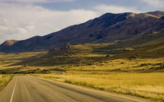
The Parley’s Creek Route is a scenic 6.1 mile run that winds along the famous Parley Creek. About 5 miles south of downtown and attracting lots of bicyclists, walkers, and runners, the route is mostly paved and fairly hilly. You’ll pass several of Salt Lake City’s famous landmarks, including Tanner Park, Parleys Historic Nature Park, and Parley’s Canyon. For a real challenge run in Parleys Canyon to the top of Grandeur Peak — a 3,000 foot elevation gain.
It is 6.1 miles one-way, from Sugar House Park to the top of Grandeur Peak. It is 3.5 miles one-way from Sugar House Park to the end of Parleys Historic Nature Park.
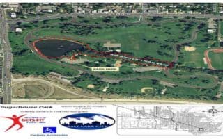
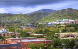
Tanner Park: A 9.75 acre, regional park located in East Salt Lake City. Tanner Park offers several amenities, and serves as a great place to stop for a quick restroom or water break. Tanner Park is also an option for parking, if you plan on taking a car.
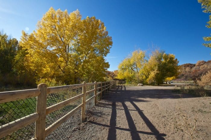
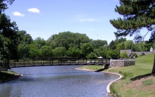
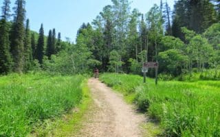
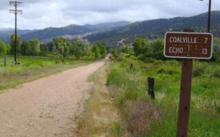
Parleys Historic Nature Park: Parleys Historic Nature Park is a 68-acre public, open space, bisected by Parley’s Creek. Known as an extraordinarily scenic area, the historic nature park is one of the best spots for running, biking, walking, and bird-watching in the Salt Lake City area. The park is open from 5:00a.m. through 11:00p.m. seven days a week, and allows dogs in certain areas.
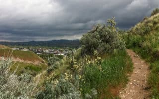
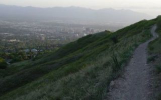
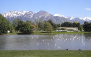
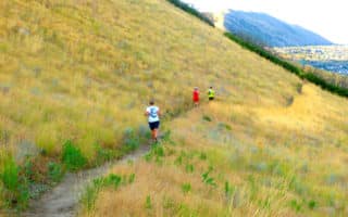
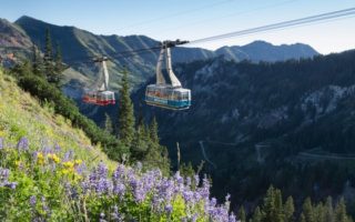
Parley’s Canyon/Grandeur Peak: If you can make it to the top, the summit of Parley’s Canyon is arguably the most beautiful view, and tranquil spot for a picnic, in all of Salt Lake City. With an elevation of 7,120 feet, the summit of Parley’s Canyon is the highest point along I-80 in the state of Utah. Not only the Summit, but also the popular park known as “Washington Park,” located within the Canyon, are perfect places to get away from the busy City, and enjoy the mountains. Grandeur Peak, one of the City’s most well-known hiking spots.
The Parley’s Creek Route is a scenic 6.1 mile run that winds along the famous Parley Creek. About 5 miles south of downtown and attracting lots of bicyclists, walkers, and runners, the route is mostly paved and fairly hilly. You’ll pass several of Salt Lake City’s famous landmarks, including Tanner Park, Parleys Historic Nature Park, and Parley’s Canyon. For a real challenge run in Parleys Canyon to the top of Grandeur Peak — a 3,000 foot elevation gain.
It is 6.1 miles one-way, from Sugar House Park to the top of Grandeur Peak. It is 3.5 miles one-way from Sugar House Park to the end of Parleys Historic Nature Park.
Tanner Park: A 9.75 acre, regional park located in East Salt Lake City. Tanner Park offers several amenities, and serves as a great place to stop for a quick restroom or water break. Tanner Park is also an option for parking, if you plan on taking a car.
Parleys Historic Nature Park: Parleys Historic Nature Park is a 68-acre public, open space, bisected by Parley’s Creek. Known as an extraordinarily scenic area, the historic nature park is one of the best spots for running, biking, walking, and bird-watching in the Salt Lake City area. The park is open from 5:00a.m. through 11:00p.m. seven days a week, and allows dogs in certain areas.
Parley’s Canyon/Grandeur Peak: If you can make it to the top, the summit of Parley’s Canyon is arguably the most beautiful view, and tranquil spot for a picnic, in all of Salt Lake City. With an elevation of 7,120 feet, the summit of Parley’s Canyon is the highest point along I-80 in the state of Utah. Not only the Summit, but also the popular park known as “Washington Park,” located within the Canyon, are perfect places to get away from the busy City, and enjoy the mountains. Grandeur Peak, one of the City’s most well-known hiking spots.


Review or Comment on This Route/Share a Photo!
Share your feedback on this route and see that of other Great Runs users. Click on the image icon to upload a photo. And please let us know if there are notes or changes we should incorporate!