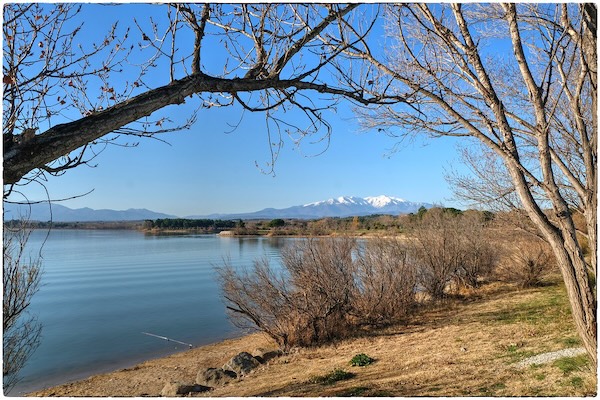
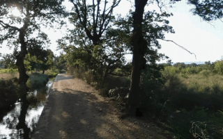
One of our favorite runs in the Perpignan area is the loop around Lac de Villeneuve-de-la-Raho. The lake is located in the town of Villeneuve-de-la-Raho, about a 15-minute drive south of Perpignan. It’s a popular recreation destination, with a beach, bird preserve, and other water activities. A firm, gravel-surfaced path encircles the lake, with nice water views and mountains in the distance. (Lac=Lake).
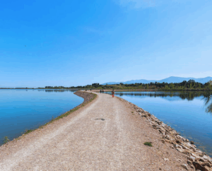
Path across lake. Google Street View
There are actually two ‘sections’ of the lake. A smaller lake, Petit Lac, at the north end is 1.5 km around. The larger lake is a 6.7 km loop, which requires doing all but ~0.5 km of the small lake because of the narrow isthmus at the northeast end. Our route starts at the parking area near the north end. At the southwest end, a scenic section of the path crosses the lake, passing a Bird Preserve (Réserve ornithologique de Villeneuve de la Raho).
Longer Option: Note to ambitious runners! A bike path runs alongside Av. Albert Einstein/Mas Pelegri, for ~9 km between Perpignan and the lake.
One of our favorite runs in the Perpignan area is the loop around Lac de Villeneuve-de-la-Raho. The lake is located in the town of Villeneuve-de-la-Raho, about a 15-minute drive south of Perpignan. It’s a popular recreation destination, with a beach, bird preserve, and other water activities. A firm, gravel-surfaced path encircles the lake, with nice water views and mountains in the distance. (Lac=Lake).
Path across lake. Google Street View
There are actually two ‘sections’ of the lake. A smaller lake, Petit Lac, at the north end is 1.5 km around. The larger lake is a 6.7 km loop, which requires doing all but ~0.5 km of the small lake because of the narrow isthmus at the northeast end. Our route starts at the parking area near the north end. At the southwest end, a scenic section of the path crosses the lake, passing a Bird Preserve (Réserve ornithologique de Villeneuve de la Raho).
Longer Option: Note to ambitious runners! A bike path runs alongside Av. Albert Einstein/Mas Pelegri, for ~9 km between Perpignan and the lake.
Scroll Down For Route Maps
Essentials
6.7 km (4.2 miles) loop
Fairly flat
Parking area at north end
Ample parking. There is bus service from Perpignan to the lake
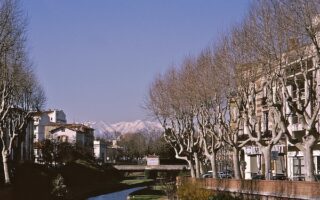
A lovely run combining a loop around Square Bir Hakeim, Perpignan's 'green lung' and the tree-lined quai paths along the Basse River, which is a tributary of the Têt River. It's an easy ~6 km loop, with an option to add the historic center (Ciudadela), or nearby Têt River paths for a longer run.
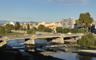
There's ~6 km of decent running along the Têt River in Perpignan. The paths are a combination of pedestrian promenade above the river, and some sections at grade that are also cycle paths. There are nice views of the river, the historic sections of Perpignan, and the snowy Pyrénées. Can add w/Basse River paths.
South of Perpignan, a dirt path runs along the narrow Canal de Perpignan for 25+ km between the Catalunya district and Canohès, Thuir and Ille-sur-Têt. Combination of open & wooded terrain, passing by farm fields. Good shade option on a hot day!
Share your feedback on this route and see that of other Great Runs users. Click on the image icon to upload a photo. And please let us know if there are notes or changes we should incorporate!
Subscribe
0 Comments
Oldest
Newest
Inline Feedbacks
View all comments
Essentials
6.7 km (4.2 miles) loop
Fairly flat
Parking area at north end
Ample parking. There is bus service from Perpignan to the lake

Review or Comment on This Route/Share a Photo!
Share your feedback on this route and see that of other Great Runs users. Click on the image icon to upload a photo. And please let us know if there are notes or changes we should incorporate!