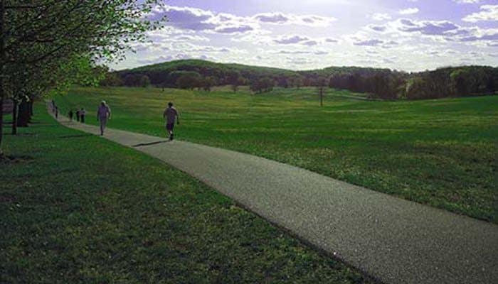
Known to locals as “Montco,” this wealthy, family-friendly community borders Philadelphia to the north. It’s the third most populous county in the state, encompassing residential areas including Norristown, Pottstown, King of Prussia, Lansdale, and Willow Grove. There are lots of great options for running in Montgomery County, with numerous rail trail, and nature paths scenic university campuses in the area. Here are some of our favorites: AREA TRAIL MAP
Cynwyd Heritage Trail
A roughly 2-mile multi-use path, the Cynwyd Heritage Trail in Lower Marion reaches from Cynwyd Station to the Manayunk Bridge, where it intersects with the Schuylkill River Trail. The running surface is primarily asphalt and crushed stone, as it stretches through residential areas, parks, and cemeteries. If the asphalt becomes too much for you, a softer dirt trail parallels much of the route.
The pristine grounds of Haverford College are a great place to run, with a Nature Trail circling the airy campus. This 2.2 mile path, originally established to view the school’s arboretum, quickly became a favorite training ground for collegiate athletes. Locals caught on, and the public is encouraged to visit the dirt/gravel trail, which starts at the visitors center and wraps around the arboretum, athletic fields, and duck pond.
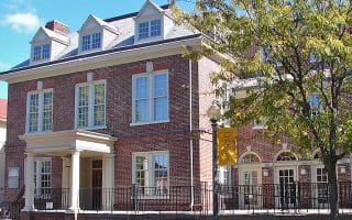
In addition to the attractive grounds of Haveford College, enjoy the equally Villanova University 2.5 miles to the north and Bryn Mawr College 2 miles to the south. We’ve mapped a 5.5 mile route incorporating all three campuses, with the prettiest roads connecting them. The 135-acre, Olmsted-designed Bryn Mawr campus is a gem, with its Collegiate Gotic style architecture.
One GREAT option is to run one-way and take the train back (Paoli/Thorndale Line) or, even better, the NHSL Light Rail, which runs even more frequently.
Though primarily in Chester County, the Chester Valley Trail extends into Montgomery County for about 1.2 miles. The asphalt multi-use rail trail can be accessed at South Gulph Road in King of Prussia. Plans are in order to expand the trail north into Norristown.
One of the best longer-distance running options on the area. This crushed stone rail-trail follows Perkiomen Creek for 21 miles from just north of Valley Forge National Park north to Green Lane. It’s mainly wooded. At the south end near Valley Forge, the Perkiomen Trail intersects with the Schuylkill River Trail (23.6). ROUTE MAPTRAIL MAP
Upper Schuylkill River Trail
About 16 miles of the Schuylkill River Trail runs through Montgomery County. Just north of Manayunk, the Montgomery section runs from Spring Hill (mile 11.9) to Pottstown (mile 27.8), passing through Norristown, Valley Forge NP, King of Prussia, & Phoenixville. At mile 23.6, intersect with the south end of the Perkiomen Trail. TRAIL MAP
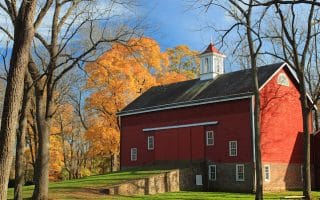
Norristown Farm Park
A lovely spot for running, with farm buildings, fields, woods, and streams. There are 7 miles of paved trails and some wooded nature trails. Good map with trail loop/length options.
Known to locals as “Montco,” this wealthy, family-friendly community borders Philadelphia to the north. It’s the third most populous county in the state, encompassing residential areas including Norristown, Pottstown, King of Prussia, Lansdale, and Willow Grove. There are lots of great options for running in Montgomery County, with numerous rail trail, and nature paths scenic university campuses in the area. Here are some of our favorites: AREA TRAIL MAP
Cynwyd Heritage Trail
A roughly 2-mile multi-use path, the Cynwyd Heritage Trail in Lower Marion reaches from Cynwyd Station to the Manayunk Bridge, where it intersects with the Schuylkill River Trail. The running surface is primarily asphalt and crushed stone, as it stretches through residential areas, parks, and cemeteries. If the asphalt becomes too much for you, a softer dirt trail parallels much of the route.
The pristine grounds of Haverford College are a great place to run, with a Nature Trail circling the airy campus. This 2.2 mile path, originally established to view the school’s arboretum, quickly became a favorite training ground for collegiate athletes. Locals caught on, and the public is encouraged to visit the dirt/gravel trail, which starts at the visitors center and wraps around the arboretum, athletic fields, and duck pond.
In addition to the attractive grounds of Haveford College, enjoy the equally Villanova University 2.5 miles to the north and Bryn Mawr College 2 miles to the south. We’ve mapped a 5.5 mile route incorporating all three campuses, with the prettiest roads connecting them. The 135-acre, Olmsted-designed Bryn Mawr campus is a gem, with its Collegiate Gotic style architecture.
One GREAT option is to run one-way and take the train back (Paoli/Thorndale Line) or, even better, the NHSL Light Rail, which runs even more frequently.
Though primarily in Chester County, the Chester Valley Trail extends into Montgomery County for about 1.2 miles. The asphalt multi-use rail trail can be accessed at South Gulph Road in King of Prussia. Plans are in order to expand the trail north into Norristown.
One of the best longer-distance running options on the area. This crushed stone rail-trail follows Perkiomen Creek for 21 miles from just north of Valley Forge National Park north to Green Lane. It’s mainly wooded. At the south end near Valley Forge, the Perkiomen Trail intersects with the Schuylkill River Trail (23.6). ROUTE MAPTRAIL MAP
Upper Schuylkill River Trail
About 16 miles of the Schuylkill River Trail runs through Montgomery County. Just north of Manayunk, the Montgomery section runs from Spring Hill (mile 11.9) to Pottstown (mile 27.8), passing through Norristown, Valley Forge NP, King of Prussia, & Phoenixville. At mile 23.6, intersect with the south end of the Perkiomen Trail. TRAIL MAP
Norristown Farm Park
A lovely spot for running, with farm buildings, fields, woods, and streams. There are 7 miles of paved trails and some wooded nature trails. Good map with trail loop/length options.
Delco, the small county to the south of Philadelphia, sits along the Delaware River. Highlights include the John Heinz National Wildlife Refuge, Ridley Creek Park, and the course of the Media 5 Mile Race. There is also loads of trail running here.
Chester County, one of the original three Pennsylvania counties, is a tony area west of Philadelphia and Delaware counties. This historic spot is marked by rail trails, beautiful parks, and high-end residential neighborhoods.
This northeastern border to Philadelphia is another of Pennsylvania’s original counties. Includes running along the Delaware Canal Towpath, around Lake Galena, and scenic Tyler State Park.
Share your feedback on this route and see that of other Great Runs users. Click on the image icon to upload a photo. And please let us know if there are notes or changes we should incorporate!
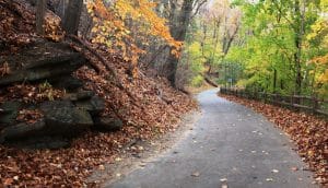 A roughly 2-mile multi-use path, the Cynwyd Heritage Trail in Lower Marion reaches from Cynwyd Station to the Manayunk Bridge, where it intersects with the Schuylkill River Trail. The running surface is primarily asphalt and crushed stone, as it stretches through residential areas, parks, and cemeteries. If the asphalt becomes too much for you, a softer dirt trail parallels much of the route.
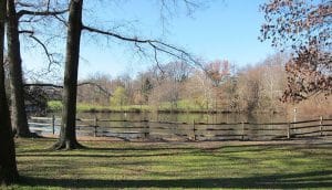 The pristine grounds of Haverford College are a great place to run, with a Nature Trail circling the airy campus. This 2.2 mile path, originally established to view the school’s arboretum, quickly became a favorite training ground for collegiate athletes. Locals caught on, and the public is encouraged to visit the dirt/gravel trail, which starts at the visitors center and wraps around the arboretum, athletic fields, and duck pond.
 Though primarily in Chester County, the Chester Valley Trail extends into Montgomery County for about 1.2 miles. The asphalt multi-use rail trail can be accessed at South Gulph Road in King of Prussia. Plans are in order to expand the trail north into Norristown.
 For flat, scenic running in a historic and educational location, see our post on running in Valley Forge.
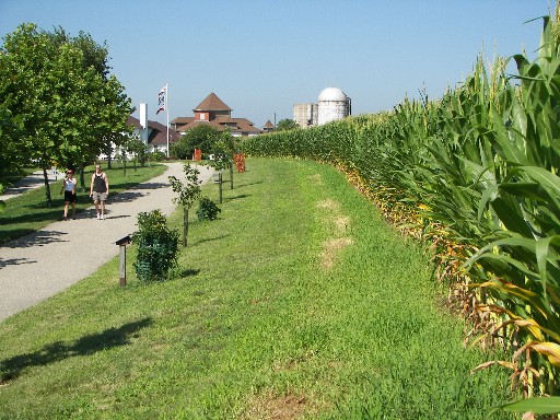 A lovely spot for running, with farm buildings, fields, woods, and streams. There are 7 miles of paved trails and some wooded nature trails. Good map with trail loop/length options.
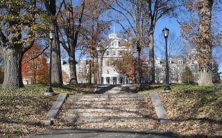
Review or Comment on This Route/Share a Photo!
Share your feedback on this route and see that of other Great Runs users. Click on the image icon to upload a photo. And please let us know if there are notes or changes we should incorporate!