Runners should make a pilgrimage to the Nike headquarters located in Beaverton — a small city that borders on western Portland. There’s a terrific network of easy, flat multi-use paths in Beaverton, many of which can be combined for routes of various lengths. The best places to run in Beaverton are:
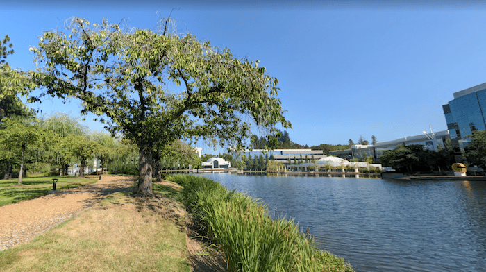
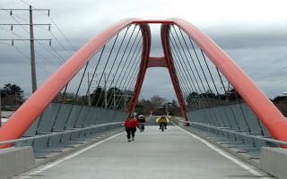
Nike Jogging Trail. This should be on any runner’s bucket list! Start at the symbolic Steve Prefontaine Hall [Prefontaine was an Oregon track legend who died tragically in an auto accident in 1975 — see Pre’s Trail in Eugene]. This trail with a wood chip surface in parts loops around an artificial lake and then around the perimeter of the Nike campus, passing numerous buildings named after famous athletes. A loop is ~3 miles, with an option to add the 1.4 mile Hollister Trail loop, just across SW Jenkins Rd. Be sure to take a lap around the Michael Johnson Track! For a longer run, connect to the Tualatin Hills Nature Park (below).
Note from a recent runner: Nike Jogging Trail is on private property, as the security guard reminded us June 2024. If you want to run this (as we did) you’ll have to park to the south on the streets on Nike campus/around the rail stop and sneak onto the main campus and avoid the security cars.ROUTE MAP
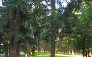
Tualatin Hills Nature Park. Just across from Nike HQ and accessible from the Merlo Rd./SW 158th Ave light rail station, there are 3-4 miles of easy, wide gravel trails through the woods. At the east end is the paved Westside Trail. Longer run: combine with Nike trails or Waterhouse Trail.
Waterhouse Trail. Google Street View
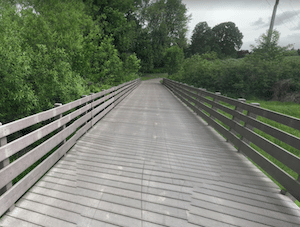
Waterhouse Trail. This is a paved, ~5 mile linear park trail in Beaverton. The southern end starts at the Merlo Rd./SW 158th light rail station (northern end of Tualatin Hills Nature Park). Run for 2 miles north through Waterhouse Powerline Park. The trail continues north of Highway 26 (use NW Bethany to connect & cross), through John Marty Park & Pirate Park, ending at NW Springville Rd. ROUTE MAP Along the way, there are some other short trails that make for some nice add-ons. From south to north:
Schlottman Creek Greenway. 1 mile
Willow Creek Greenway. 0.8 miles
Stoller Creek Greenway: 0.7 miles
Rock Creek Trail 8 miles (see below)
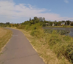
Rock Creek Trail at Bethany Lake. Google Street View
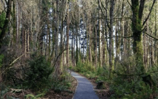
Rock Creek Trail. This is a wonderful, 8-mile linear park trail that heads west toward Hillsboro. The eastern end is at Pirate Park (connections to the Waterhouse Trail, above). Head west on this paved path through Pirate Park, Emerald Estates Park, Allenbach Acres Park, and Bethany Lake Park [At the west end of Bethany Lake, there’s an 0.7 mile extension to NW Rock Creek Blvd.). Here, there’s an 0.7 mile section on NW Malhuer, where the trail picks up again at NW Rock Creek Blvd., crossing Highway 26. Continue south for another 2.8 miles through several connected parks, to the end of the trail at the west end of Orenco Woods Nature Park. ROUTE MAP
Runners should make a pilgrimage to the Nike headquarters located in Beaverton — a small city that borders on western Portland. There’s a terrific network of easy, flat multi-use paths in Beaverton, many of which can be combined for routes of various lengths. The best places to run in Beaverton are:
Nike Jogging Trail. This should be on any runner’s bucket list! Start at the symbolic Steve Prefontaine Hall [Prefontaine was an Oregon track legend who died tragically in an auto accident in 1975 — see Pre’s Trail in Eugene]. This trail with a wood chip surface in parts loops around an artificial lake and then around the perimeter of the Nike campus, passing numerous buildings named after famous athletes. A loop is ~3 miles, with an option to add the 1.4 mile Hollister Trail loop, just across SW Jenkins Rd. Be sure to take a lap around the Michael Johnson Track! For a longer run, connect to the Tualatin Hills Nature Park (below).
Note from a recent runner: Nike Jogging Trail is on private property, as the security guard reminded us June 2024. If you want to run this (as we did) you’ll have to park to the south on the streets on Nike campus/around the rail stop and sneak onto the main campus and avoid the security cars.ROUTE MAP
Tualatin Hills Nature Park. Just across from Nike HQ and accessible from the Merlo Rd./SW 158th Ave light rail station, there are 3-4 miles of easy, wide gravel trails through the woods. At the east end is the paved Westside Trail. Longer run: combine with Nike trails or Waterhouse Trail.
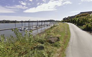
Waterhouse Trail. Google Street View
Waterhouse Trail. This is a paved, ~5 mile linear park trail in Beaverton. The southern end starts at the Merlo Rd./SW 158th light rail station (northern end of Tualatin Hills Nature Park). Run for 2 miles north through Waterhouse Powerline Park. The trail continues north of Highway 26 (use NW Bethany to connect & cross), through John Marty Park & Pirate Park, ending at NW Springville Rd. ROUTE MAP Along the way, there are some other short trails that make for some nice add-ons. From south to north:
Schlottman Creek Greenway. 1 mile
Willow Creek Greenway. 0.8 miles
Stoller Creek Greenway: 0.7 miles
Rock Creek Trail 8 miles (see below)
Rock Creek Trail at Bethany Lake. Google Street View
Rock Creek Trail. This is a wonderful, 8-mile linear park trail that heads west toward Hillsboro. The eastern end is at Pirate Park (connections to the Waterhouse Trail, above). Head west on this paved path through Pirate Park, Emerald Estates Park, Allenbach Acres Park, and Bethany Lake Park [At the west end of Bethany Lake, there’s an 0.7 mile extension to NW Rock Creek Blvd.). Here, there’s an 0.7 mile section on NW Malhuer, where the trail picks up again at NW Rock Creek Blvd., crossing Highway 26. Continue south for another 2.8 miles through several connected parks, to the end of the trail at the west end of Orenco Woods Nature Park. ROUTE MAP
The signature run along the Willamette River in Portland. Includes the longest floating pedestrian bridge in the world! Numerous landmarks, bridges for loops, and great water views. Cherry blossoms in spring!
An exploration of the south section of the Willamette River trails, between the Tilikum Crossing and Sellwood bridges. Nice water views, and pleasant sections in Willamette Park and Oaks Bottom Wildlife Refuge.
2+ mile linear park is a great running option close to downtown. It's a winding road with a separate running/walking path along the boulevard, running up a wooded hillside. Popular with runners. A bonus is it's well lit at night. Hilly!
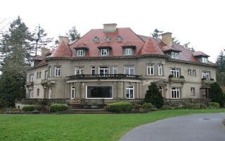
This 700 foot climb starts at the Lower Macleay Trail and the Kings Heights neighborhood, and follows that into the Wildwood Trail and up to the Mansion, which has been used in a number of motion pictures, and in The Amazing Race.
A variation on the Terwilliger Boulevard trail detailed earlier, this run culminates at Council Crest, the highest peak of the Tualatin Mountain range at 1,071 feet.
Another way to run to the Council Crest Peak is through Washington Park, home to some of the more scenic landmarks in Portland including the Portland Japanese Garden, the Portland Children’s Museum, and the Washington Park Ampitheater.
The Springwater on the Willamette Trail runs through downtown Portland and south to Sellwood Riverfront Park, along the east side of the Willamette River. Numerous bridges, river islands, and more park-like at the southern end.
Part of the extensive Springwater Corridor trail system. This paved multi-use trail stretches for 17 miles from south Portland east to Boring. Scenery includes woods, wetlands, buttes, agricultural fields and pastures, residential & some industrial.
Some nice residential streets and parks for running in East Portland. A highlight is Mt. Tabor Park, with ~3 miles of trails and nice views. In the northern section of E. Portland, nice paths at Laurelhurst Park and residential streets just south of there.
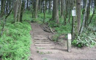
The largest urban forest in the United States. 80+ miles of soft-surface trails, fire lanes and forest roads, stretching for 7 miles along the eastern slope of the Tualatin Mountains. Tons of options here. We've mapped the first 3 miles of Lief Erickson Rd.
This National Recreation Trail meanders for 30.2 breathtaking miles, from the southern end of the trail at the Vietnam Veterans Memorial in Washington Park to the Northwest terminus of the trail at Newberry Road.
Good options near the airport are along Marine Drive, a 12-mile long bike path; and Blue Lake, with 100 acres of trails, wetlands, and the titular lake, which is formed from underground springs.
The best places to run in Hillsboro are the 8-mile Rock Creek Trail, a linear park trail that heads toward Beaverton; the scenic trails around the Jackson Bottom Wetlands; and the Jackson School Woods Trail, where there's a nice running track at Hare Field.
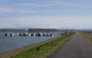
Great destination run, 35 miles west of Portland/Vancouver. This 23-mile paved multi-use path features wonderful views of the Coastal Range, 13 bridges, & two long railroad trestles. South end more open farmland, north end more wooded. Hilly!
Nice run in southern Portland combining the small, nicely manicured campus of Lewis & Clark College with good trail running options at Tryon Creek State Natural Area south of campus & less developed River View north of campus.
A guide to running options in Vancouver, Washington, directly across the Columbia River from Portland. Several wonderful waterfront routes, multi-use trails, Lacamas Lake, & more!
Share your feedback on this route and see that of other Great Runs users. Click on the image icon to upload a photo. And please let us know if there are notes or changes we should incorporate!


Review or Comment on This Route/Share a Photo!
Share your feedback on this route and see that of other Great Runs users. Click on the image icon to upload a photo. And please let us know if there are notes or changes we should incorporate!