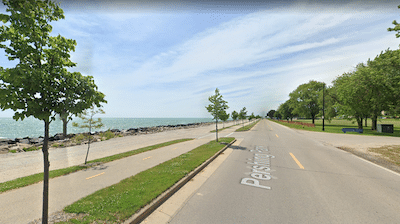
In Racine, the Lake Michigan Pathway offers a scenic run along the lake. Overall, the paved multi-use trail goes for nearly 10 miles — we’ve mapped the 5-mile part along the lake. Our route is actually 6 miles, as include the 0.5 mile jaunts out two causeways/piers.
Google Street ViewRacine Harbor. Google Street View
The southern end starts at 17th St. Run north, passing Gateway Technical College (1 mile), and then the heart of downtown. The next section is around the scenic marina, with jaunts out the Christopher Columbus Causeway to the Racine Overlook and the Racine Breakwater to the Lighthouse. The final 1.5 miles are along North Beach, passing the Zoo and ending at Melvin Ave. A there and back would be anywhere from 8 miles to 10 miles, depending on whether the causeways are included.
Note: It’s possible to run along the 1-mile North Beach, but the sand tends to be soft.
Add-Ons: Connect to the Root River Pathway, just inland from the Marina. Also, at the residential area at the north end of the trail is pleasant for running.
Scroll Down For Route Maps
Essentials
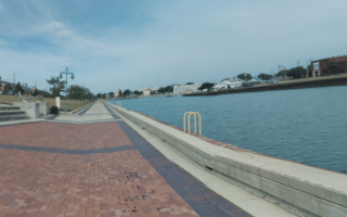
Up to 6.1 miles (9.8 km) one-way, including the two causeways, which are each 1 mile out and back.
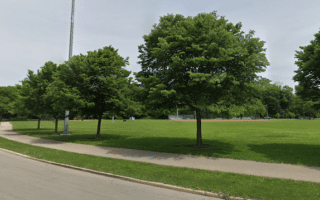
A pleasant linear park run along the Root River in Racine. Lots of green, with occasional water views. Winds through Cedar Bend Park, Horlick Park, Lincoln Park, and Colonial Park.
In Kenosha, a scenic run of up to 5 miles along Lake Michigan. Most of the route is on the Pike Bike Trail, a paved multi-use path. Good views of the lake most of the way and numerous parks.
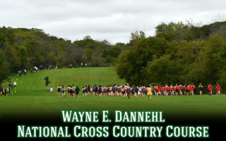
Run on a nationally renowned cross-country course at UW - Parkside. Grass and natural paths over rolling hills with marked 3K, 4K, 5K, 6K, 8K and 10K courses. Add with running track and pedestrian paths at UW - Parkside campus.
A good way to rack up some miles, with 23 miles of paved multi-use path, divided into two non-contiguous sections: 7.5 miles between Kenosha and Racine, and 15.6 miles from southern Kenosha south to North Chicago. Open, with some nice shade trees.
Some scenic running in Zion at the north end of Chicagoland: nature trails and multi-use trails through dunes & wetlands at Illinois Beach State Park; 2.2 mile Zion Trail; and trails in North Dunes Nature Preserve and around North Point Marina. Can be combined!
Share your feedback on this route and see that of other Great Runs users. Click on the image icon to upload a photo. And please let us know if there are notes or changes we should incorporate!
Subscribe
0 Comments
Oldest
Newest
Inline Feedbacks
View all comments
Essentials
Up to 6.1 miles (9.8 km) one-way, including the two causeways, which are each 1 mile out and back.


Review or Comment on This Route/Share a Photo!
Share your feedback on this route and see that of other Great Runs users. Click on the image icon to upload a photo. And please let us know if there are notes or changes we should incorporate!