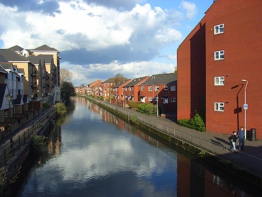
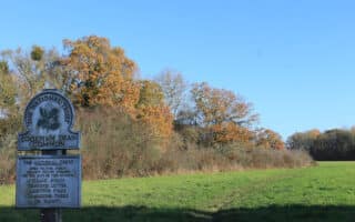
There’s pleasant running along the River Kennet, which flows into the Thames in Reading. A path called Kennetside starts right where the Kennet & Thames meet (1 mile north of central Reading), and runs for nearly 3 miles to Fobney Island. There, one can continue along the River Kennet and on paths around Fobney Island and area lakes.
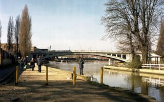
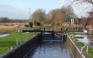
The 1-2 miles of the path from the mouth are paved. There are nice views of the narrow river — which looks more like a canal. South of central Reading, the path becomes narrower and eventually turns to dirt, following the west bank south of County Lock. A good add-on is Waterloo Meadows, which is across the rover (access from Rose Kiln Ln. at the 2.4 mile mark of the Kennet path). Our route ends at the Fobney Island Nature Reserve at Island Rd., but there are options to continue on additional paths in this area.
Add-Ons: Fobney Island/Lakes route. River Thames paths.
There’s pleasant running along the River Kennet, which flows into the Thames in Reading. A path called Kennetside starts right where the Kennet & Thames meet (1 mile north of central Reading), and runs for nearly 3 miles to Fobney Island. There, one can continue along the River Kennet and on paths around Fobney Island and area lakes.
The 1-2 miles of the path from the mouth are paved. There are nice views of the narrow river — which looks more like a canal. South of central Reading, the path becomes narrower and eventually turns to dirt, following the west bank south of County Lock. A good add-on is Waterloo Meadows, which is across the rover (access from Rose Kiln Ln. at the 2.4 mile mark of the Kennet path). Our route ends at the Fobney Island Nature Reserve at Island Rd., but there are options to continue on additional paths in this area.
Add-Ons: Fobney Island/Lakes route. River Thames paths.


Review or Comment on This Route/Share a Photo!
Share your feedback on this route and see that of other Great Runs users. Click on the image icon to upload a photo. And please let us know if there are notes or changes we should incorporate!