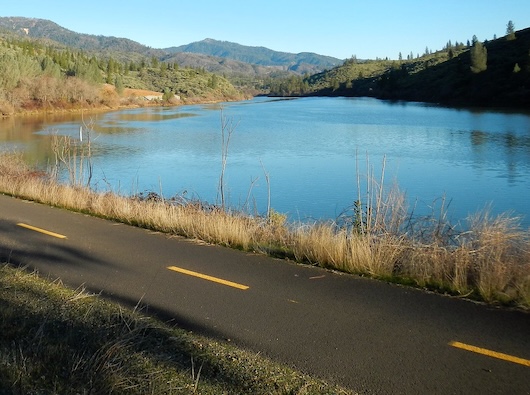
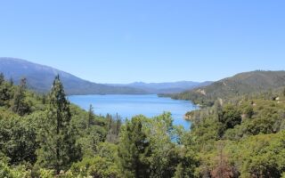
The Sacramento River Trail is the signature run in Redding. The winding, paved Rail-Trail travels from the Sundial Bridge — a running destination itself — west as far as the Shasta Bridge, a total distance of 15.6 miles. The are great views of the Sacramento River, Keswick Reservoir and Shasta Lake. There are numerous additional trails and spur options off the SRT.
One-Way Option
Start in Redding at the Sundial Bridge — an iconic bridge over the Sacramento River in the shape of a sundial, with a glass path lit at night. Head west along the northern bank of the river. Key distances & landmarks:
1.4 miles: Redding Park & Diestelhorst Bridge (pedestrian bridge)
4 miles: Sacramento River Trail Bridge — cross over to south bank. NOTE: From here it’s a 250 foot gain over 1 mile to Keswick Dam
5 miles: Keswick Dam
7 miles: Keswick, West St. access @Spring Creek. From here west, trail is more remote
12 miles: Matheson
15.6 miles: End of trail @Shasta Dam in Coram. Can continue west for 1 mile along the road to access the bridge crossing over to the Shasta Dam Visitor Center & Additional Trails
Loop Options
The trail runs along both banks of the river for 2.5 between the Sundial Bridge and the Sacramento River Trail Bridge. So this would be a good 5-mile loop. For a 9 mile loop, run along the north bank from the Sundial Bridge to the Sacramento River Trail Bridge, then cross to the south bank, returning east for 2.5 miles. crossing the Diestelhorst Bridge back to the north bank.
Add-Ons
Sundial Bridge. Flickr: Jasperdo
Additional trails at the east end in the Turtle Bay area in central Redding. At Keswick Dam, there are extensive trails on the north side of the Keswick Reservoir. And, scenic trails at Shasta Dam.
Scroll Down For Route Maps
Essentials
Up to 15.6 miles (25 km) one-way. Loop options of 5 miles & 9 miles
Mainly flat, except hill between Sacramento River Trail Bridge & Keswick Dam
Redding: Sundial Bridge
Parking: Turtle Bay, south side of Sundial Br. There are other parking areas & access points
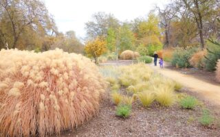
Scenic run in central Redding, with paved paths anchored by Turtle Bay Exploration Park, an area along the river showcasing the Sundial Bridge, botanical gardens, & Arboretum. Fairly open terrain. 7.5 mile loop, with shorter & longer options.
Some trail running options we love in Redding: Clear Creek Greenway, the Lema Ranch Trails, and some more challenging trails around Shasta Dam. See separate post for Whiskeytown NRA.
Scenic area overlooking Whiskeytown Lake, 15 miles west of Redding. ~80 miles of mainly forested trails (easy to challenging) featuring rugged canyons and waterfalls, historic mining features, and post-fire ecology. Some road running options too.
Share your feedback on this route and see that of other Great Runs users. Click on the image icon to upload a photo. And please let us know if there are notes or changes we should incorporate!
Subscribe
0 Comments
Oldest
Newest
Inline Feedbacks
View all comments
Essentials
Up to 15.6 miles (25 km) one-way. Loop options of 5 miles & 9 miles
Mainly flat, except hill between Sacramento River Trail Bridge & Keswick Dam
Redding: Sundial Bridge
Parking: Turtle Bay, south side of Sundial Br. There are other parking areas & access points


Review or Comment on This Route/Share a Photo!
Share your feedback on this route and see that of other Great Runs users. Click on the image icon to upload a photo. And please let us know if there are notes or changes we should incorporate!