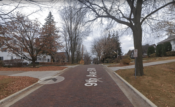
This is a pleasant run in central Rochester, combining a couple of parks with nice residential streets in the Historic Southwest, Pill Hill, and Kutzky Park neighborhoods. We’ve mapped a 5-mile route, but you can also add on or create your own in this area. This is also an opportunity to get in some elevation in this otherwise flat area!
Kutsky Park. Google Street View
A good starting point is the Soldiers Field Veterans Memorial, at the north end of the Soldiers Field Golf Course. There’s a pleasant ~0.7 mile loop path, as well as a running track. Exit onto 9th St. SW, heading briefly west and then north for 3/4 mile on this pretty residential street with set back homes. Some of the streets in this neighborhood are actually brick surfaced.
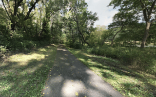
Turn LEFT on 2nd St. SW briefly, then RIGHT on 11th St., into Kutzky Park. Run the ~0.8 mile paved path through the park, following Cascade Creek. For the return, head south on 13th St., LEFT on Center St., and then RIGHT on 7th St. SW.
This is a pleasant run in central Rochester, combining a couple of parks with nice residential streets in the Historic Southwest, Pill Hill, and Kutzky Park neighborhoods. We’ve mapped a 5-mile route, but you can also add on or create your own in this area. This is also an opportunity to get in some elevation in this otherwise flat area!
Kutsky Park. Google Street View
A good starting point is the Soldiers Field Veterans Memorial, at the north end of the Soldiers Field Golf Course. There’s a pleasant ~0.7 mile loop path, as well as a running track. Exit onto 9th St. SW, heading briefly west and then north for 3/4 mile on this pretty residential street with set back homes. Some of the streets in this neighborhood are actually brick surfaced.
Turn LEFT on 2nd St. SW briefly, then RIGHT on 11th St., into Kutzky Park. Run the ~0.8 mile paved path through the park, following Cascade Creek. For the return, head south on 13th St., LEFT on Center St., and then RIGHT on 7th St. SW.
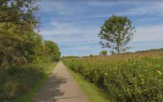
Among the three river routes accessible from downtown Rochester, this paved multi-use trail follows the Bear Creek River south for 3.4 miles. Mix of open & wooded terrain, with some nice water views.
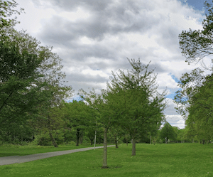
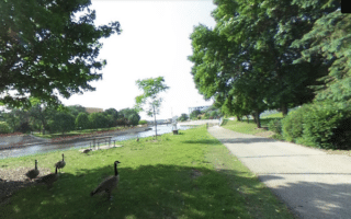
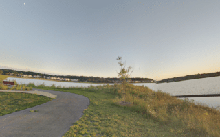
Paved multi-use trail follows Silver Lake for 2.3 miles from downtown north to the Rochester-Olmsted County Recreation Area. Pleasant and scenic, especially around Silver Lake Park. Side trail option along Cascade Creek to Kutzky Park.
Paved multi-use trail follows the South Fork River southwest from downtown Rochester for up to 5.5 miles, also passing by several lakes. Combination of open & wooded terrain. The 2.5 miles east of Highway 63 are especially pretty.
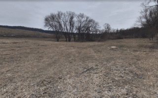
A great spot for easy to moderate trail running, close to downtown. This 320-acre park area has 8+ miles of trails covering woodlands, meadows, prairies and oak savannas. Nice variety in terms of terrain and ability.
Cascade Lake is just west of downtown and steps away from the Mayo Clinic. There's a nice 2.2 loop around the lake with nice water views. Can add on with adjacent trails north and south of Cascade Lake.
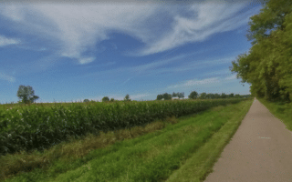
Paved multi-use trail follows an old rail line between Rochester and Pine Island. The landscape is a combination of farmland, fields, and forest. Up to 15 miles. At southern end, can add Cascade Lake Loop.
A 'rails to trails' multi-use trail that runs for 13 miles from just north of Eyota (12 miles east of Rochester) to Plainview. Combination of paved and crushed stone. Mainly agricultural landscape.
Share your feedback on this route and see that of other Great Runs users. Click on the image icon to upload a photo. And please let us know if there are notes or changes we should incorporate!

Review or Comment on This Route/Share a Photo!
Share your feedback on this route and see that of other Great Runs users. Click on the image icon to upload a photo. And please let us know if there are notes or changes we should incorporate!