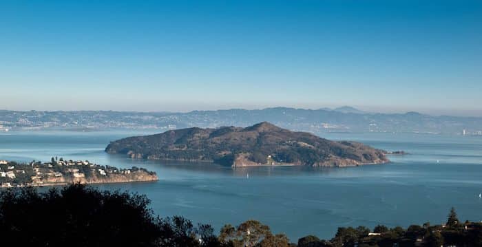
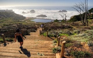
Take the ferry from San Francisco or Tiburon to enjoy a gorgeous, traffic-free run with views and hills. Angel Island is in the middle of the Bay. There are great views of the Bay, GG bridge, and the city. This is a state park that has had many roles in the past, including as a fort and an immigration processing center. There’s a paved, 5-mile loop around the island, or a longer run that include the hill to the top. There are lots of other trails for variety. The interior of the island is more wooded.
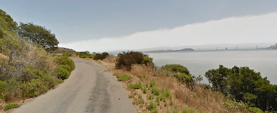
Perimeter Road. Google Street View.
The ferry runs regularly from Pier 41 and takes 1/2 hour. Can also access from Tiburon. Frequency varies by season.
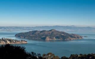
Take the ferry from San Francisco or Tiburon to enjoy a gorgeous, traffic-free run with views and hills. Angel Island is in the middle of the Bay. There are great views of the Bay, GG bridge, and the city. This is a state park that has had many roles in the past, including as a fort and an immigration processing center. There’s a paved, 5-mile loop around the island, or a longer run that include the hill to the top. There are lots of other trails for variety. The interior of the island is more wooded.
Perimeter Road. Google Street View.
The ferry runs regularly from Pier 41 and takes 1/2 hour. Can also access from Tiburon. Frequency varies by season.
Our favorite residential neighborhood for running in San Francisco is Pacific Heights. Lovely streets and attractive homes just east of the Presidio. We also love running in the Nob Hill, Sea Cliff and Noe Valley neighborhoods.
Some great options in South San Francisco, just north of SFO: waterfront paths at Candlestick Point and a Bay Trail section at Sierra Point; some nice hills & trails at McLaren Park; and some serious but rewarding climbing at San Bruno Mountain.
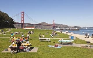
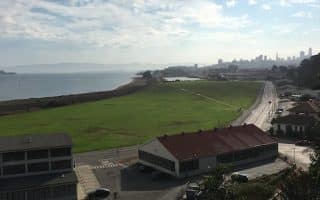
The run along Chrissy Field from Fort Mason to Fort Point is one of the great urban runs of the world. Water views the whole way. Heading north, views of the Golden Gate Bridge and the Marin Headlands, and south, the SF skyline.
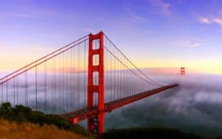
Running across the Bridge is not only encouraged…it’s a tourist attraction. There is a dedicated path for runners/walkers. It's 1.7 miles across the bridge. Spectacular views. Lots of add-on potential. VIDEO HIGHLIGHTS!
The iconic, memorable San Francisco run includes the Embarcadero, Fisherman's Wharf, Crissy Field to Fort Point, and then over the Golden Gate Bridge. Fantastic views! Choose a section or do the entire 9.6 miles!
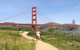
The run between the Golden Gate Bridge and Land’s End is unique: spectacular ocean views, hills, wooded sections, and some beautiful homes. We've mapped several options. VIDEO HIGHLIGHTS!
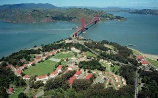
A former military installation, now a gorgeous park with miles of trails for walking and running. There are hills, wooded trails, and scenic vistas out to the Golden Gate Bridge and the Pacific Ocean. Also some great loop options involving Crissy Field.
Another great loop option involving the Presidio, the Golden Gate Bridge, and the Golden Gate Promenade. Take the Presidio Promenade Path through the Presidio, then return along Crissy Field. Great views and variety.
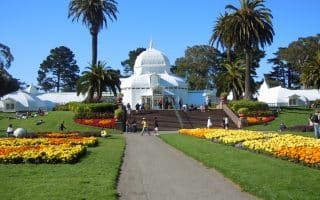
Golden Gate Park is the left coast version of New York’s Central Park. The Park runs from Highway 1 at the ocean to the west, to the Haight-Ashbury area to the east.
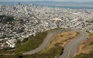
San Francisco is famous for its hilly streets. We've created a route in the Bernal Heights neighborhood, which features four of the city's hilliest streets (all w/grades >35%!) and two scenic hilltop parks.
The Great Highway runs for 3.8 miles from the Cliff House to Lake Merced in the Sunset/Ocean Beach area. A 2-mile stretch is closed to cars. Run on the road, beach, or interior bike path. Scenic & festive!
Some good running options just south of Great Highway/Ocean Beach. There's a 4.5 mile loop around Lake Merced, some nice trail running in Fort Funston including a 2-mile bike path, and pedestrian paths around the campus of SFSU.
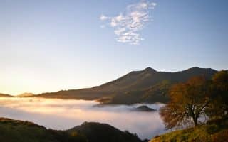
Three unbelievable runs. Marin Headlands/GG National Recreation area is challenging & hilly running just over the GG Bridge. Mt. Tam has a switchback fire road to the summit. And Point Reyes has spectacular trails and running options.
Share your feedback on this route and see that of other Great Runs users. Click on the image icon to upload a photo. And please let us know if there are notes or changes we should incorporate!
Subscribe
0 Comments
Oldest
Newest
Inline Feedbacks
View all comments
Essentials
Perimeter loop: 4.5 miles; Perimeter + Summit: 7 miles


Review or Comment on This Route/Share a Photo!
Share your feedback on this route and see that of other Great Runs users. Click on the image icon to upload a photo. And please let us know if there are notes or changes we should incorporate!