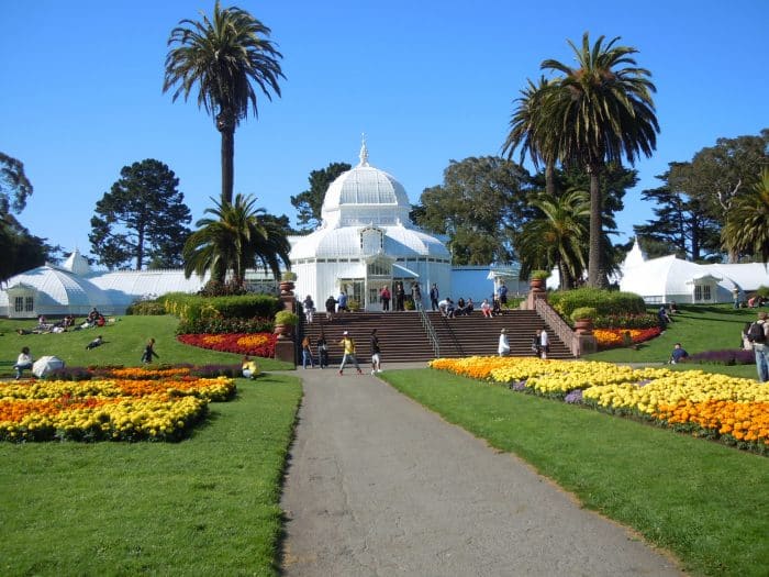
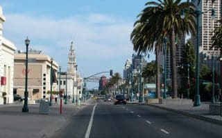
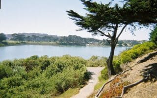
Golden Gate Park is the left coast version of New York’s Central Park. Yes, it’s a beautiful, green park, with wonderful paths, trails, ponds, fields, and other amenities. The 1,017 Park is also home to a Botanical Gardens, a Japanese Tea Garden, the De Young Museum of Asian Art, and a “Music Concourse”. The Park’s length is ~3.5 miles from Highway 1 at the ocean to the west, to the Haight-Ashbury area to the east., and its width is ~0.5 miles. PARK MAP
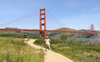
There are tons of options for running in Golden Gate Park, from the perimeter roads, to some terrific trails for running. Kezar Stadium at the southeast end of the park features a good running track. Here are some popular running routes in Golden Gate Park:
- Perimeter Loop: Running around the perimeter of the park is a 7.4 mile loop, or 8.8 miles including the Panhandle.
- Western Loop: A 4.5 mile loop around the perimeter at the western end of the park (West of Shoreline Dr.) is 4.5 miles. INFO
- Car-Free Roads. It’s now possible to run on wide, car-free roads for nearly the entire length of the park. NEW: The JFK Promenade is now permanently car-free, providing a wide, popular ~2-mile path for running in the park. MAP of car-free roads.
- NEW: Stow Lake Perimeter. This 1-mile trail around the lake has been improved.
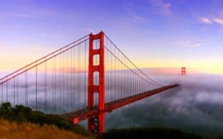
Add-Ons: At the western end of the park, Ocean Beach is great for running. Run on the beach or on the mult-use path alongside it.
Golden Gate Park is the left coast version of New York’s Central Park. Yes, it’s a beautiful, green park, with wonderful paths, trails, ponds, fields, and other amenities. The 1,017 Park is also home to a Botanical Gardens, a Japanese Tea Garden, the De Young Museum of Asian Art, and a “Music Concourse”. The Park’s length is ~3.5 miles from Highway 1 at the ocean to the west, to the Haight-Ashbury area to the east., and its width is ~0.5 miles. PARK MAP
There are tons of options for running in Golden Gate Park, from the perimeter roads, to some terrific trails for running. Kezar Stadium at the southeast end of the park features a good running track. Here are some popular running routes in Golden Gate Park:
- Perimeter Loop: Running around the perimeter of the park is a 7.4 mile loop, or 8.8 miles including the Panhandle.
- Western Loop: A 4.5 mile loop around the perimeter at the western end of the park (West of Shoreline Dr.) is 4.5 miles. INFO
- Car-Free Roads. It’s now possible to run on wide, car-free roads for nearly the entire length of the park. NEW: The JFK Promenade is now permanently car-free, providing a wide, popular ~2-mile path for running in the park. MAP of car-free roads.
- NEW: Stow Lake Perimeter. This 1-mile trail around the lake has been improved.
Add-Ons: At the western end of the park, Ocean Beach is great for running. Run on the beach or on the mult-use path alongside it.


Review or Comment on This Route/Share a Photo!
Share your feedback on this route and see that of other Great Runs users. Click on the image icon to upload a photo. And please let us know if there are notes or changes we should incorporate!