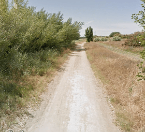
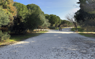
For a longer off-road run, there are some decent paths along the Guadalquivir River west of the city center. The most seamless stretch are the gravel paths starting on the western side of the river at the Puente de la Señorita (bridge), heading north for ~3.5 km to just past the SE-30. Note the paths are gravel, a bit dusty, and there are only occasional water views. One can continue even further north on a path that is less developed. There are also some quieter roads passing fields and farms once you’re north of the SE-30. It’s up to 7.4 k
River path, west side. Google Street View
We also like combining the river paths with the Vega de Triana Park, which has numerous paths along its nearly 2 km length. Unfortunately, there aren’t any particularly good crossings over the river. You can use Puente de la Señorita, but it takes a rather unpleasant 1 km loop around busy roads to access the bridge (see route map). There’s a path on the eastern side of the river as well, through Vega de Triana Park, and then continuing north.
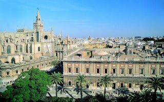
Seville's Old Town is the one of the largest in Europe, and we explore a good bit of it in this 8 km 'runseeing' tour. We've tried to design an easy-to-follow route while hitting the highlights. Good add-on options.
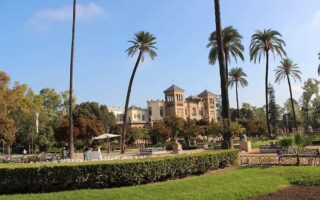
This is another lovely, centrally located run that combines the iconic María Luisa Park, Marillo Gardens, numerous important Seville sights, and a section of river path. Can be combined with other routes.
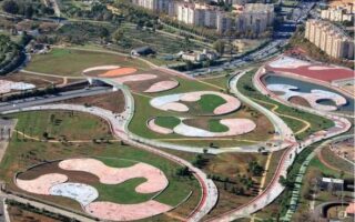
In the southern part of Seville, Parque Guadaíra and Parque de los Bermejales are two nice parks connected by multi-use paths that can be stitched together for a longer off-road run.
This scenic run has three distinct elements for variety: a loop through the iconic Guadalquivir Garden, the paths of Alamillo Park, and riverside paths.
The 90-hectare Parque Miraflores is Seville's largest park, and is a treat for running. A large network of paths pass through gardens, fields, lawns, and some water spots. One can easily put together a 6-7 km non-overlapping path run.
Lovely green oasis located in the Sevilla Este area a few km east of Seville Center. One can do a loop of 5-6 km on wide, tree-shaded paths. Good shade option in summer. Two fitness centers in the area.
Share your feedback on this route and see that of other Great Runs users. Click on the image icon to upload a photo. And please let us know if there are notes or changes we should incorporate!
Subscribe
0 Comments
Oldest
Newest
Inline Feedbacks
View all comments
Essentials
7.4 km (4.6 miles) one-way, with options for longer or shorter
Flat
Vega de Triana Park. Can also start at Puente de la Señorita bridge.


Review or Comment on This Route/Share a Photo!
Share your feedback on this route and see that of other Great Runs users. Click on the image icon to upload a photo. And please let us know if there are notes or changes we should incorporate!