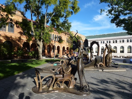
This is an interesting and scenic ‘runseeing’ tour of Springfield, highlighting the city’s history of innovation, its museum quadrangle, and several historic district neighborhoods, with their many Victorian homes. Use our mapped route as a guide — but create your own route in the residential areas.
Start in Court Square (McKinley Memorial, Symphony Hall) and run east (away from the river), past the (ugly) Mass Mutual Center, through Pynchon Park, to the Museum Quadrangle (Smith Museum, Springfield Museum, Dr. Seuss Museum, Central Library). Continue east, for a short jaunt around Armory Square, a National Historic Site.
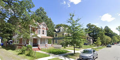
McKnight Historic District. Google Street View
The next section is an exploration of several of Springfield’s historical residential districts. Using State St. & Walnut St. as an anchor, enjoy running the leafy side streets of the Mason Square/McKnight (the nation’s first planned residential community, 900 Victorian homes), Old Hill, and Six Corners historic districts. Return using Maple St., which has grand older homes, in various states of repair.
Add-On: Add some miles by exploring the residential areas, continuing south into the Forest Park area. Or, connect from downtown to the River Walk, using State St. or Union St.
This is an interesting and scenic ‘runseeing’ tour of Springfield, highlighting the city’s history of innovation, its museum quadrangle, and several historic district neighborhoods, with their many Victorian homes. Use our mapped route as a guide — but create your own route in the residential areas.
Start in Court Square (McKinley Memorial, Symphony Hall) and run east (away from the river), past the (ugly) Mass Mutual Center, through Pynchon Park, to the Museum Quadrangle (Smith Museum, Springfield Museum, Dr. Seuss Museum, Central Library). Continue east, for a short jaunt around Armory Square, a National Historic Site.
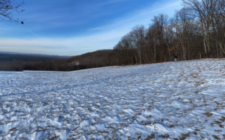
McKnight Historic District. Google Street View
The next section is an exploration of several of Springfield’s historical residential districts. Using State St. & Walnut St. as an anchor, enjoy running the leafy side streets of the Mason Square/McKnight (the nation’s first planned residential community, 900 Victorian homes), Old Hill, and Six Corners historic districts. Return using Maple St., which has grand older homes, in various states of repair.
Add-On: Add some miles by exploring the residential areas, continuing south into the Forest Park area. Or, connect from downtown to the River Walk, using State St. or Union St.
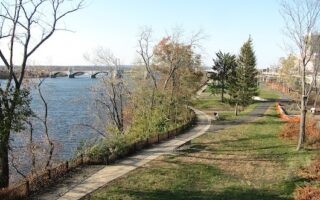
One of our favorite places to run in Springfield. Springfield section is up to 3.7 miles one-way, with some nice views of the Connecticut River, Springfield's skyline, area mountains. Agawam section paralleling River Rd. is 1.7 miles.
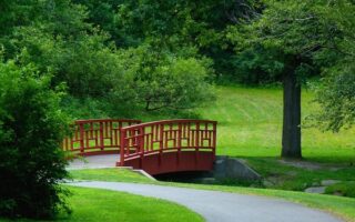
One of the country's largest and most historically important urban parks. Great running on paths and trails, past Victorian promenades, a formal rose garden, several ponds, and playing fields. And the Bright Lights 5k through 700,000 holiday lights!
Some nice trail running options in this easter suburb of Springfield. A favorite is Rice Preserve, which features 3.4 miles of trails around woods, farms, & fields. For a challenge, the Sunrise Peak Trailwalk, climbs 660 feet over 1.3 miles.
Share your feedback on this route and see that of other Great Runs users. Click on the image icon to upload a photo. And please let us know if there are notes or changes we should incorporate!

Review or Comment on This Route/Share a Photo!
Share your feedback on this route and see that of other Great Runs users. Click on the image icon to upload a photo. And please let us know if there are notes or changes we should incorporate!