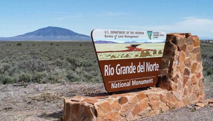
The RÍo Grande del Norte National Monument is comprised of rugged, wide open plains at an average elevation of 7,000 feet, dotted by volcanic cones, and cut by steep canyons with rivers tucked away in their depths. There are fantastic trail running options here with options for all abilities. Some of our recommendations:
West Rim Trail: This scenic spot is a favorite among Taos trail runners, provided they don’t have a fear of heights! The West Rim Trail traverses the west bank of Rio Grande del Norte, starting from the bridge on route 64. It’s about 10 miles one way, so runners can do a long or short out and back across the flat dirt rim of the canyon. It’s also possible to start at the south parking area (off Route 567). TRAIL MAP.
Rinconada Loop: The Rinconada Loop, in the Wild Rivers Recreation area, is another great easy trail. At 5 miles round-trip, it’s long enough for a good workout, but the smooth wide surface makes it gentle enough for even novice trail runners. TRAIL MAP.
Red River Fault Loop: Nearby the Rinconada Loop, the Red River Fault Loop Trail is a slightly more challenging 4 mile route. There’s a little bit of hill work to keep things interesting, but nothing too intense. TRAIL MAP.
East Rim Trail: The East Rim Trail is not as famous as its western counterpart, but it’s still a good running option with nice river views. This flat, level double track is 7 miles out and back. TRAIL MAP.
La Vista Verde Trail: La Vista Verde is one of our favorite running options in the Taos Valley Overlook area of the park. It’s an easy 2.6 mile out and back, starting just north of the Taos Junction Bridge. TRAIL MAP.
Park Map and Info
.


Review or Comment on This Route/Share a Photo!
Share your feedback on this route and see that of other Great Runs users. Click on the image icon to upload a photo. And please let us know if there are notes or changes we should incorporate!