The Thermi Ecological Park, located about 20 km southeast of Thessalonoki, is the start point of a series of hiking areas, nature preserves, and mountain bike parks. The area features a massive network of roads, trails, and paths that are also great for trail running. There’s something for all abilities — some flatter, easier sections and some more rugged, hilly trails.
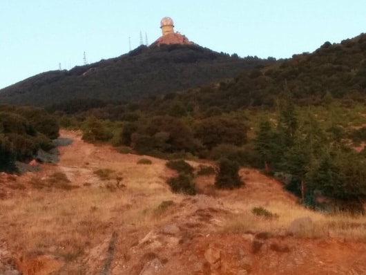
Mt. Chortiatis. Flickr: Alex Hughes
The closest point to Thessalonoki is the area around the Thermi Ecological Park (Περιβαλλοντικό Πάρκο Θέρμης). The terrain becomes increasingly rugged and hilly east of there, toward Mount Chortiatis (Xortiatis).
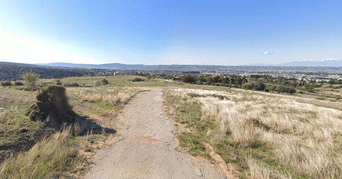
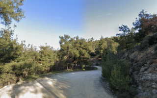
The Thermi Ecological Park, located about 20 km southeast of Thessalonoki, is the start point of a series of hiking areas, nature preserves, and mountain bike parks. The area features a massive network of roads, trails, and paths that are also great for trail running. There’s something for all abilities — some flatter, easier sections and some more rugged, hilly trails.
Mt. Chortiatis. Flickr: Alex Hughes
The closest point to Thessalonoki is the area around the Thermi Ecological Park (Περιβαλλοντικό Πάρκο Θέρμης). The terrain becomes increasingly rugged and hilly east of there, toward Mount Chortiatis (Xortiatis).
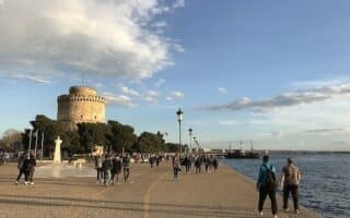
The iconic run in Thessaloniki. Wide, festive waterfront boardwalk runs for 4.4 km along the Thermaic Gulf, with water views key sites, and lovely gardens. Possible to extend for another 1 km at southern end.
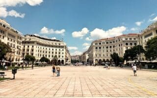
A 7.5 km 'runseeing' tour of Thessaloniki, which covers important archaeological and cultural highlights. It's a mix of roads, paths, and stairs. Includes Aristotelus Square, Roman Forum, Byzantine Walls, Arch of Galerius, White Tower. Hilly!
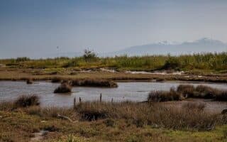
Located 8 km of Thessaloniki, Kalochori Lagoon is a major wetland area, popular for birding, walking, and running! There are many km of easy trails along the water and around the wetlands, with some great views. Additional trails in Axios Delta National Park.
This green oasis located only 15 minutes from the city center is a popular spot for walking, hiking, biking, & running. Large network of paths and trails, some easy & flat, others hilly & rugged. Mix of open and shaded through pine forest & other lovely trees.
Share your feedback on this route and see that of other Great Runs users. Click on the image icon to upload a photo. And please let us know if there are notes or changes we should incorporate!

Review or Comment on This Route/Share a Photo!
Share your feedback on this route and see that of other Great Runs users. Click on the image icon to upload a photo. And please let us know if there are notes or changes we should incorporate!