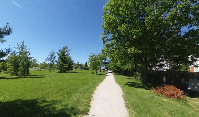
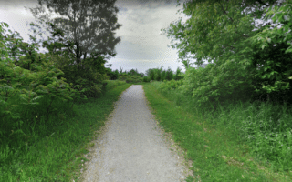
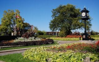
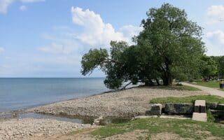
Oakville features a particularly nice collection of lovely parks for running. There are multi-use trails and some trail running options. The 3 km Crosstown Trail, which runs east-west between Nipegon Trail and the Heritage Trail in Lions Valley Park is a good connector, as is the Indian Ridge Trail in western Oakville. See also our guide to waterfront running options in Oakville & nearby.
Linear Park Loop. This is a great 9 km loop in central Oakville on paths connecting several parks. Starting near Town Hall, run on the gravel path headed north through several parks in Morrison Valley. It’s 3.6 km to the north end, mainly wooded and gradual uphill. Then use Kestell Blvd. & Grosvenor St. to head back south, joining paths through Iroquois Shoreline Park and Sheridian Valley Park. Then head west on the multi-use path for 2 km along the Morrison Wedgewood Diversion Channel. ROUTE MAP
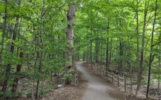
McCraney Valley Trail & Nipigon Trail. 4 km one-way. This route is also located in central Oakville and can be combined/mixed with the linear park loop above. The McCraney Valley Trail starts in McCraney Valley Park in central Oakville and runs for 2 km north through Oakville Park. It’s a gravel path, mainly wooded. Cross Upper Middle Rd., onto the Nipigon Trail, for 2 km to Oak Park. ROUTE MAP
- Add-Ons: Use the Crosstown Trail off the Nipegon Trail to connect to additional trails just west in Oakridge Park & River Glen Park. And just west of there is the Heritage Trail in Lions Valley Park and additional trails along Sixteen Mile Creek.
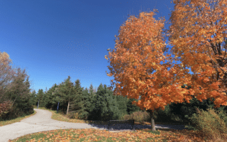
Indian Ridge Trail & Additional Parks. Even more parks and trails in the western part of Oakville! The Indian Ridge Trail is a paved multi-use path that runs for 3 km from the mall just north of Highway 403 to Third Line Rd. It’s a narrow strip of green in a more commercial part of Oakville. Use the Indian Ridge Trail to connect to numerous additional parks on paths headed north: Nottinghill Gate Park, McCraney Creek trails, & the Glen Abbey trails. Just west of Third Line, there are additional trails headed north in the Fourteen Mile Creek area, connecting to the West Oak Park trails & Valleyridge trails, north of Upper Middle Rd. ROUTE MAP: Indian Ridge
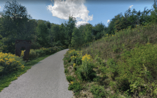
Bronte Creek Provincial Park. A good option for some trail running in this park on the Oakville/Burlington border. Several km of hiking trails in this park featuring woods, a ravine, and a large outdoor pool in season. Easiest for running are the Maiden’s Blush, Trillium, and Ravine trails. PARK INFORMATION TRAIL MAP
Oakville features a particularly nice collection of lovely parks for running. There are multi-use trails and some trail running options. The 3 km Crosstown Trail, which runs east-west between Nipegon Trail and the Heritage Trail in Lions Valley Park is a good connector, as is the Indian Ridge Trail in western Oakville. See also our guide to waterfront running options in Oakville & nearby.
Linear Park Loop. This is a great 9 km loop in central Oakville on paths connecting several parks. Starting near Town Hall, run on the gravel path headed north through several parks in Morrison Valley. It’s 3.6 km to the north end, mainly wooded and gradual uphill. Then use Kestell Blvd. & Grosvenor St. to head back south, joining paths through Iroquois Shoreline Park and Sheridian Valley Park. Then head west on the multi-use path for 2 km along the Morrison Wedgewood Diversion Channel. ROUTE MAP
McCraney Valley Trail & Nipigon Trail. 4 km one-way. This route is also located in central Oakville and can be combined/mixed with the linear park loop above. The McCraney Valley Trail starts in McCraney Valley Park in central Oakville and runs for 2 km north through Oakville Park. It’s a gravel path, mainly wooded. Cross Upper Middle Rd., onto the Nipigon Trail, for 2 km to Oak Park. ROUTE MAP
- Add-Ons: Use the Crosstown Trail off the Nipegon Trail to connect to additional trails just west in Oakridge Park & River Glen Park. And just west of there is the Heritage Trail in Lions Valley Park and additional trails along Sixteen Mile Creek.
Indian Ridge Trail & Additional Parks. Even more parks and trails in the western part of Oakville! The Indian Ridge Trail is a paved multi-use path that runs for 3 km from the mall just north of Highway 403 to Third Line Rd. It’s a narrow strip of green in a more commercial part of Oakville. Use the Indian Ridge Trail to connect to numerous additional parks on paths headed north: Nottinghill Gate Park, McCraney Creek trails, & the Glen Abbey trails. Just west of Third Line, there are additional trails headed north in the Fourteen Mile Creek area, connecting to the West Oak Park trails & Valleyridge trails, north of Upper Middle Rd. ROUTE MAP: Indian Ridge
Bronte Creek Provincial Park. A good option for some trail running in this park on the Oakville/Burlington border. Several km of hiking trails in this park featuring woods, a ravine, and a large outdoor pool in season. Easiest for running are the Maiden’s Blush, Trillium, and Ravine trails. PARK INFORMATION TRAIL MAP
Review or Comment on This Route/Share a Photo!
Share your feedback on this route and see that of other Great Runs users. Click on the image icon to upload a photo. And please let us know if there are notes or changes we should incorporate!