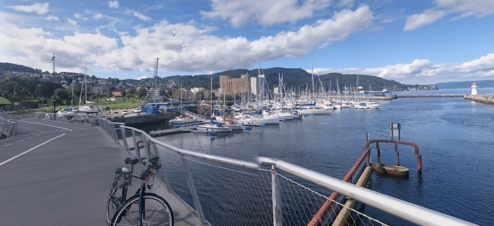
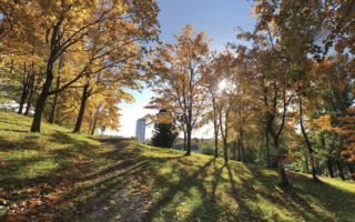
There aren’t many runs along fjords in the Great Runs catalog, so enjoy this one! There are two sections of the 3.6 km of paths along the Trondheim Fkord, connected by a short road section. There are great views of the fjord on one side and the city on the other.
The St. Olavs Path is located just across the channel/train tracks from downtown. The paved multi-use path runs west alongside a busy road for 1.3 km, between the Rockheim Heritage Museum and the Jernbanebru Bridge. Then there’s an 0.5 km road connection to another section of path that runs for another 1.8 km to Fagervika.
Add-Ons: Good options to combine with other routes in central Trondheim:
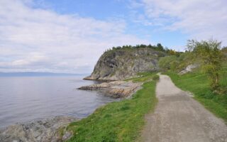
- Ladestien Walking Track (our favorite run in Trondheim) is 3 km east. Gorgeous run on a wide path around the Lade peninsula.
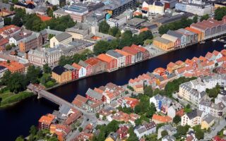
- Run through central Trondheim for 1.5 km to join our route along the Nidelva River
There aren’t many runs along fjords in the Great Runs catalog, so enjoy this one! There are two sections of the 3.6 km of paths along the Trondheim Fkord, connected by a short road section. There are great views of the fjord on one side and the city on the other.
The St. Olavs Path is located just across the channel/train tracks from downtown. The paved multi-use path runs west alongside a busy road for 1.3 km, between the Rockheim Heritage Museum and the Jernbanebru Bridge. Then there’s an 0.5 km road connection to another section of path that runs for another 1.8 km to Fagervika.
Add-Ons: Good options to combine with other routes in central Trondheim:
- Ladestien Walking Track (our favorite run in Trondheim) is 3 km east. Gorgeous run on a wide path around the Lade peninsula.
- Run through central Trondheim for 1.5 km to join our route along the Nidelva River

Review or Comment on This Route/Share a Photo!
Share your feedback on this route and see that of other Great Runs users. Click on the image icon to upload a photo. And please let us know if there are notes or changes we should incorporate!