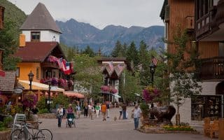
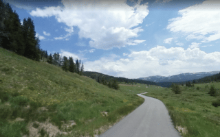
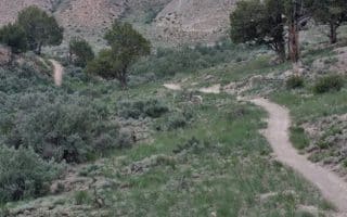
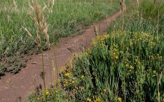
This route is a great tour of Beaver Creek, starting in Beaver Creek Village (on the east side of the mountain) and wrapping around west to Arrowhead Village. The trail is about 7.5 miles total one way. Most of the path is easy, with climbs up a few moderate sections.
Beaver Creek Mountain Summer Trail Map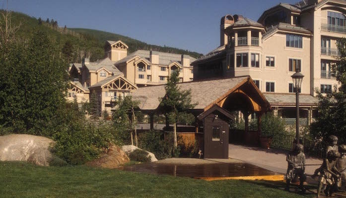
Features:
Scroll Down For Route Maps
Essentials
- 7.5 miles
- 585 feet
- Beaver Creek Village or Arrowhead Village
- Beaver Creek Village Bus
Current Weather & Forecast

Vail, US
4:39 am,
Jul 3, 2026
L: 19°
H: 24°
Daily ForecastHourly Forecast
Today
2:00 pm
19° / 24°°C
0 mm
0%
10 mph
79 %
1032 mb
0 mm/h
Tomorrow
2:00 pm
3° / 10°°C
0 mm
0%
13 mph
58 %
1027 mb
0 mm/h
Sunday
2:00 pm
3° / 13°°C
0 mm
0%
6 mph
71 %
1023 mb
0 mm/h
Monday
2:00 pm
5° / 17°°C
0 mm
0%
5 mph
68 %
1024 mb
0 mm/h
Tuesday
2:00 pm
8° / 23°°C
0 mm
0%
6 mph
43 %
1020 mb
0 mm/h
Today
5:00 am
2° / 4°°C
0 mm
0%
5 mph
79 %
1032 mb
0 mm/h
Today
8:00 am
4° / 6°°C
0 mm
0%
8 mph
65 %
1032 mb
0 mm/h
Today
11:00 am
6° / 7°°C
0 mm
0%
10 mph
53 %
1029 mb
0 mm/h
Today
2:00 pm
7° / 7°°C
0 mm
0%
10 mph
44 %
1026 mb
0 mm/h
Today
5:00 pm
4° / 4°°C
0 mm
0%
8 mph
47 %
1027 mb
0 mm/h
Today
8:00 pm
4° / 4°°C
0 mm
0%
7 mph
47 %
1027 mb
0 mm/h
Today
11:00 pm
3° / 3°°C
0 mm
0%
6 mph
52 %
1025 mb
0 mm/h
Other Routes in Vail, CO
12 mile path cuts through the center of Vail. Nicest section is right downtown, from West Meadow Drive to the Betty Ford Alpine Gardens.
One of the more memorable running experiences in the Vail/Summit County area. The paved multi-use trail runs between East Vail and Copper Mountain, up over Vail Pass. Mountain views, aspens, hills.

44 miles of segmented recreation path. One of the most central and popular sections is the stretch between Edwards and Avon.
Take the gondola part way up Vail Mountain to run the 4.4 mile Kinnikinnick and Sunlight Trail up and down the summit.
These popular running and mountain biking trails in the town of Eagle can be combined for a 6 mile loop. Note the elevation gain -- super challenging -- but not too technical.
This trail near Beaver Creek is a good intro to trail running at 4 miles round trip, skirting the edge of the Golf Club, Stone Creek, and the surrounding forest.
4 mile trail running loop in Edwards with good hill work and a fun downhill to finish.
User Ratings
Leave A Review or Comment
Review or Comment on This Route/Share a Photo!
Share your feedback on this route and see that of other Great Runs users. Click on the image icon to upload a photo. And please let us know if there are notes or changes we should incorporate!