Features:
Categories:
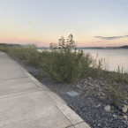
The Klickitat River Trail is another worth-it destination for those looking for a longer, scenic off-road run. The gravel multi-use path starts in Lyle, located 80 miles east of Vancouver on the Columbia River. The overall trail is 31 miles, and is in two distinct sections.
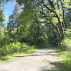
The first section, starting in Lyle, is a bit more for all types of runners, following an old railway line along the Klickitat River, paralleling SR 142. It’s mainly wooded, with some views of the river. It’s 13 miles from Lyle to Klickitat (it’s 10 miles to Pitt). Choose a section for an out and back, or leave an extra car! Note that it’s a gradual, ~700 foot climb headed west to east.
There’s a gap on the trail in Klickitat, due to a washed out bridge. The second section of the trail continues at the Swale Canyon Trailhead, located 3.5 miles east of Klickitat — that’s the only spot one can cross over the river. This section of trail is more rugged and remote, running for 16.5 miles along Swale Creek through Swale Canyon to the Centerville Valley. It’s also a steady climb the whole way, gaining 1,500 feet, with grades of 1-3%.
- Lyle to Klickitat: 13.1 miles (21 km);Klickitat to Centerville Valley 16.4 miles (26.4 km)
- Lyle to Klickitat: 679 feet (206m); Klickitat to Centerville Valley: 1,523 feet (464m) -- a steady climb the whole way!
- Lyle Trailhead
- Numerous trailheads and access points


Comment on this Route/Share a Photo!
Share your feedback on this route and see that of other Great Runs users. Click on the image icon to upload a photo. And please let us know if there are notes or changes we should incorporate!